
After Typhoon Lan, a day of perfect weather
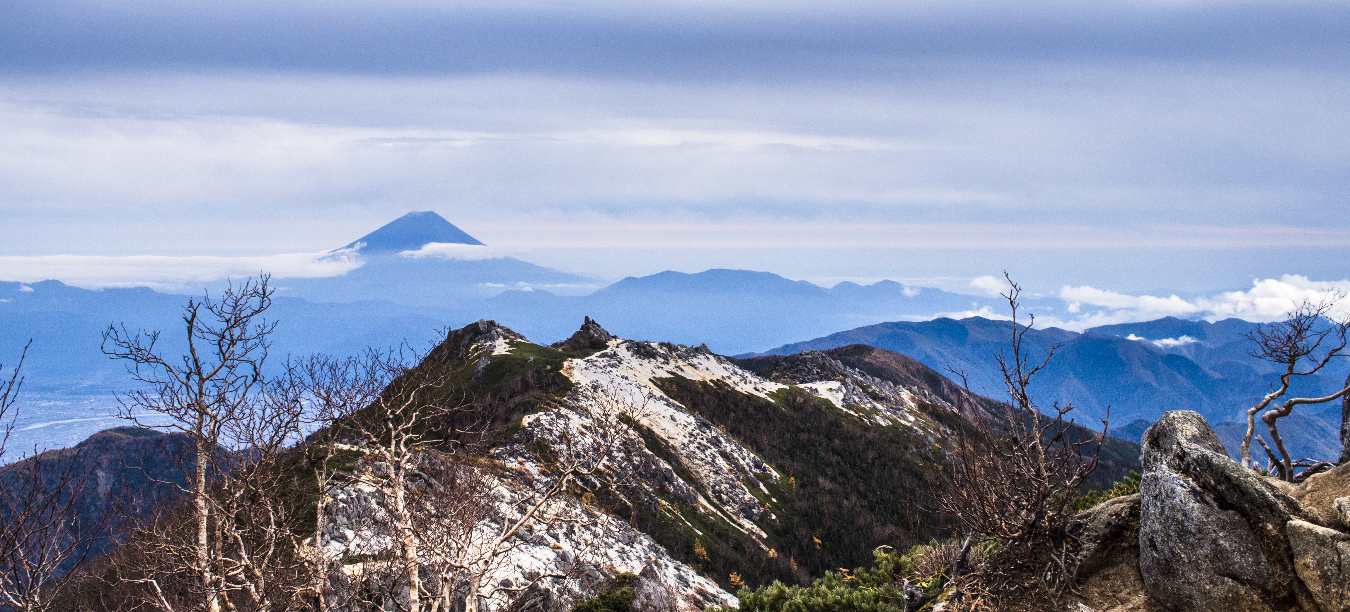
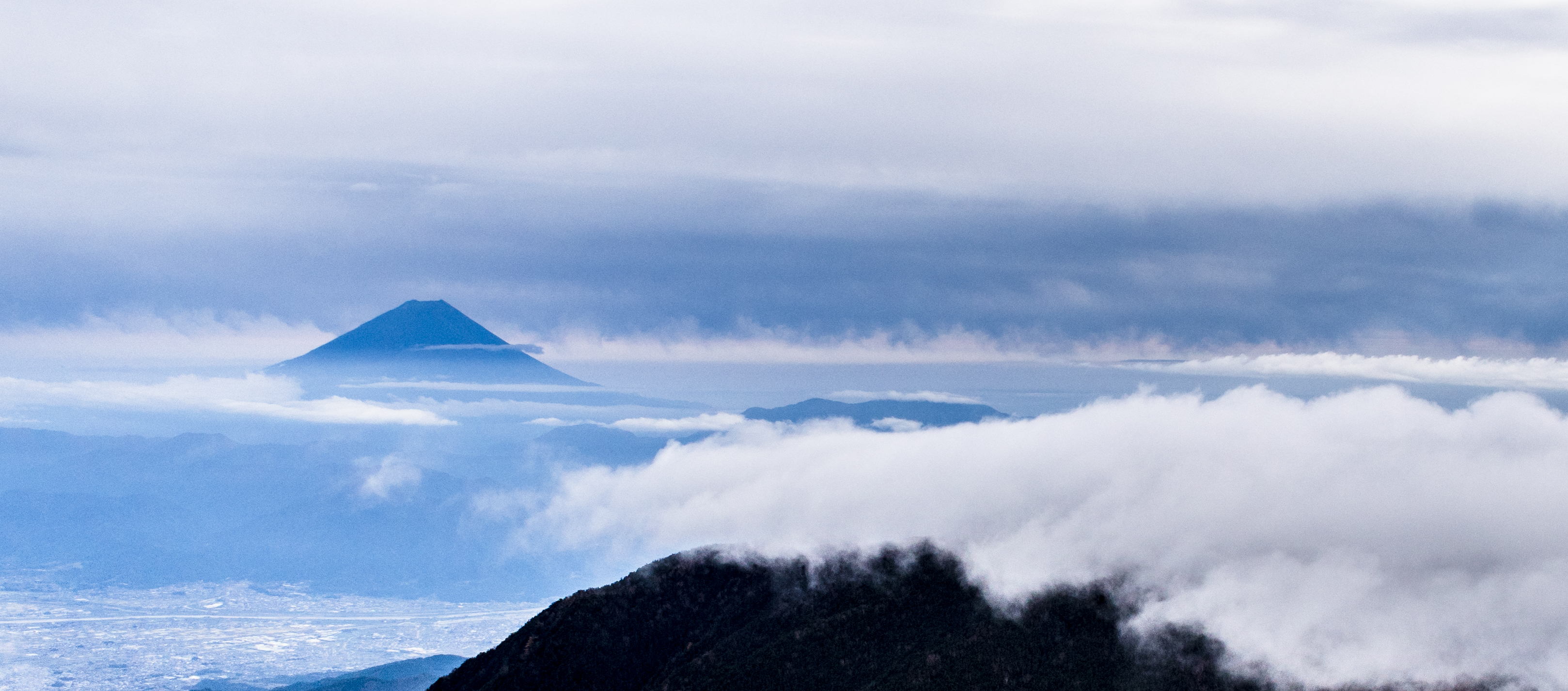
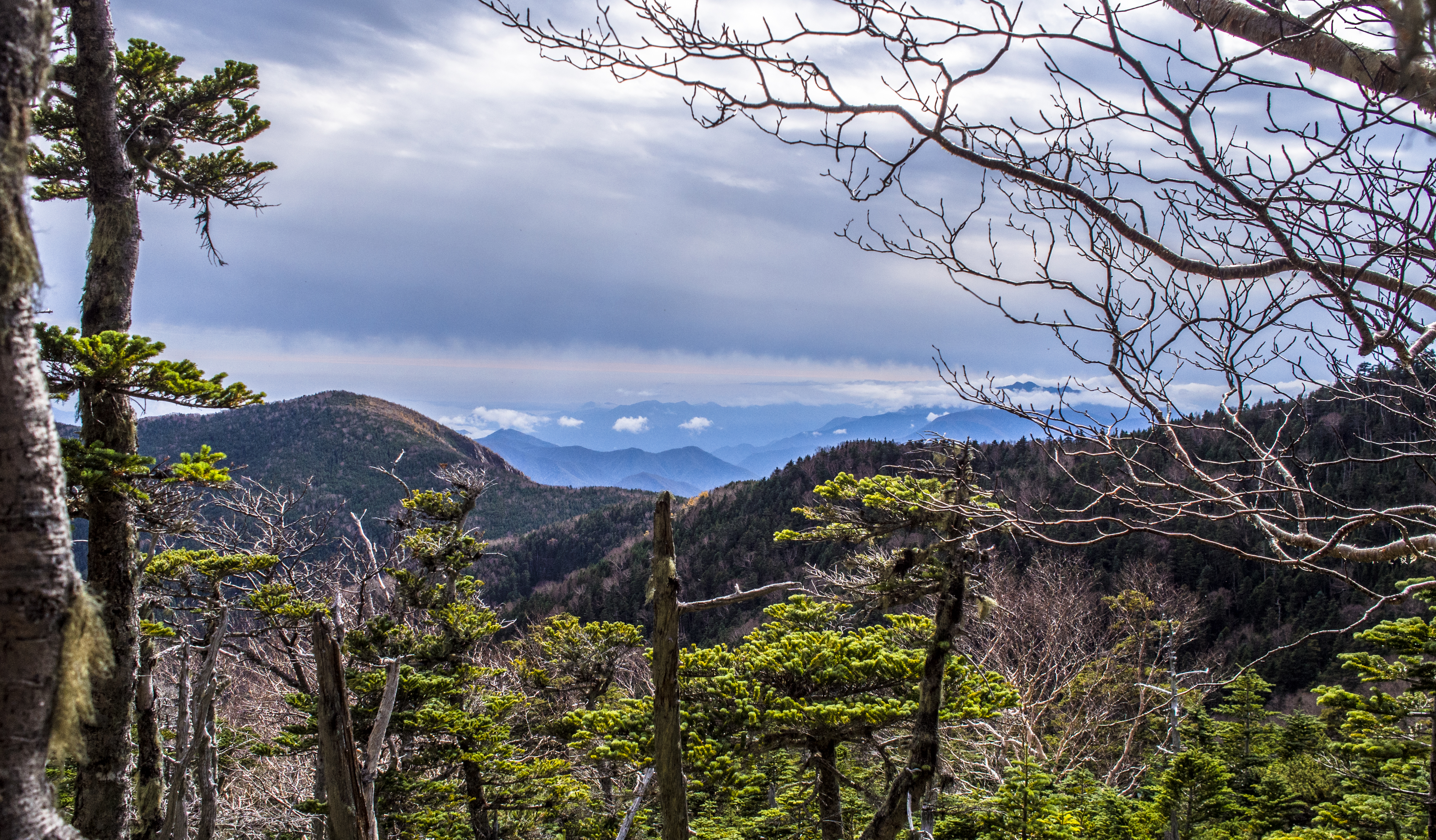
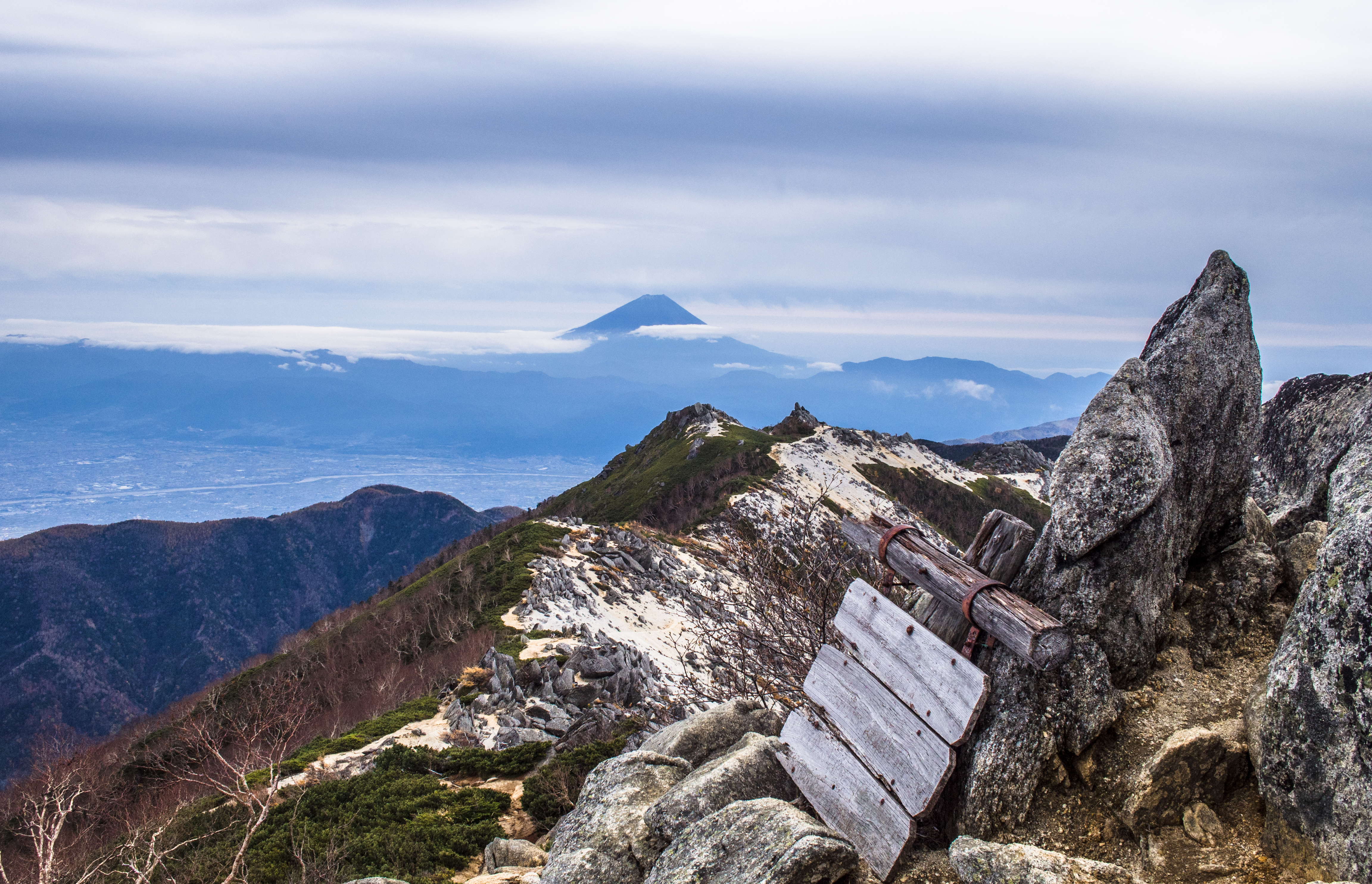
Regal Fuji – from Kannon peak
The gamble paid off. A day earlier, we queued for over an hour at the Kanazawa JR ticket office because some shinkansen lines were stalled due to Typhoon Lan. We were skeptical that the weather would really be fine like mountain-forecast.com predicted but went ahead as planned.
From Kōfu 甲府 station to Nirasaki 韮崎 (2 stops, 10 mins), in the taxi to Aokikousen 青木鉱泉 the hike was still under probation. Anytime the weather turned foul, we’d abort the climb.
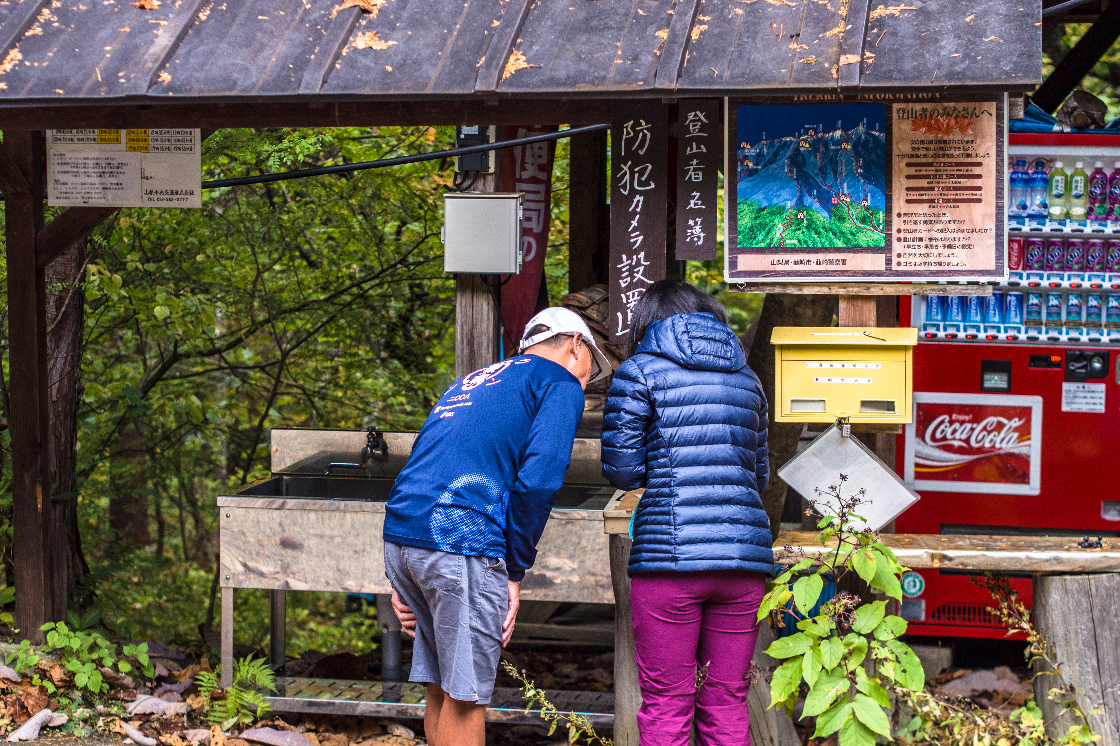
Writing our names on the form – in case of emergency
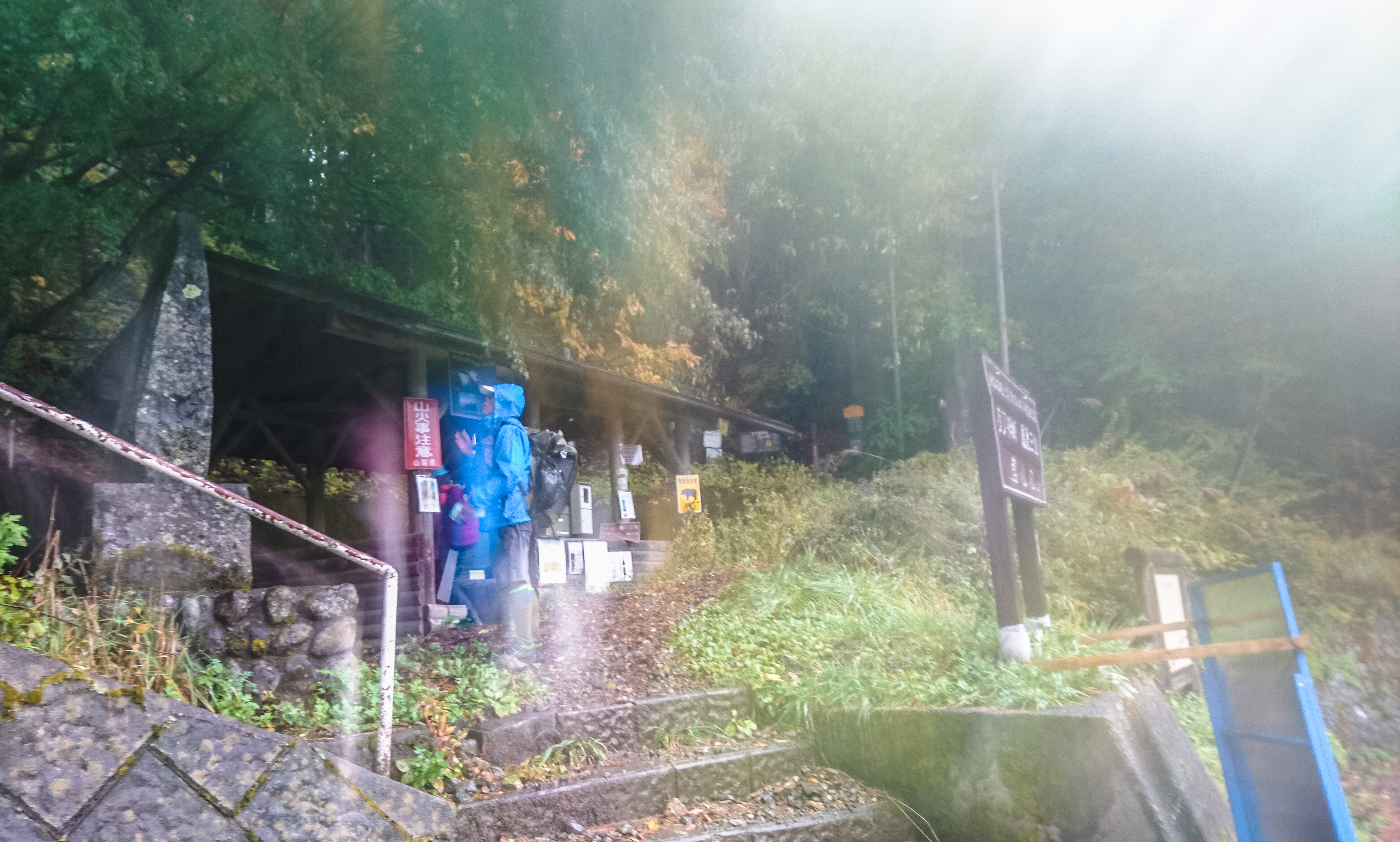
All was quiet when we reached Aokikousen at 7am. On the left there’s the mountain hut (seemed vacant); on the right there’s a wooden shed – toilets (with toilet paper!). We scratched our names on a registration form, dropped it into a box, then marched onto the Dondoko-sawa trail ドンドコ沢.
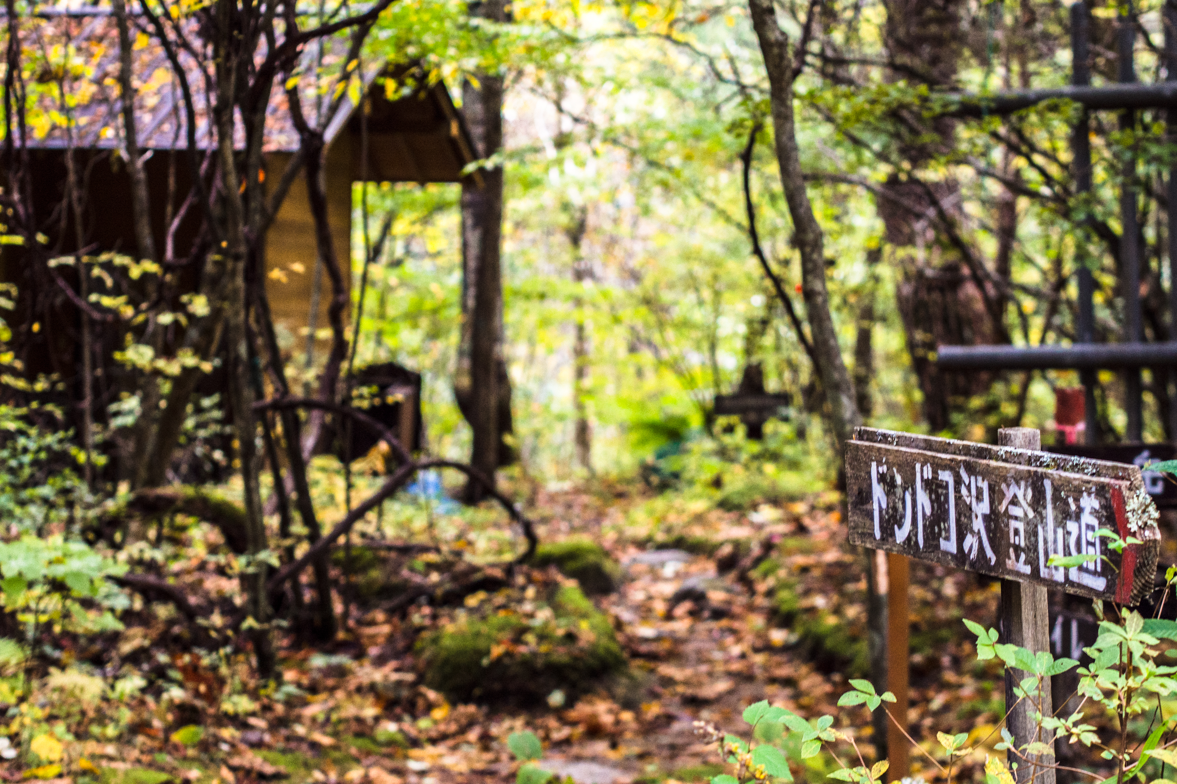
Dondoko-sawa Trail
10 minutes later, we were back – with another (Japanese) hiker, he who had turned back because of landslide. Dondoko-sawa was moot, so we followed the Yakushi-dake 薬師岳 trail towards the river. We only managed to leapt cross one rivulet then realised the river was too swollen. With waters gushing at dangerous speeds, it was impossible to cross. We headed back to the hut again, met an old man (maybe the hut caretaker) who directed us to the other Yakushi-dake trail – the one that wouldn’t need any river crossing.
We didn’t meet anyone else that day. When we got to our mountain hut (Minamiomurou-goya 南御室小屋), the caretaker exclaimed in english: you guys are crazy!
So we were the only 3 jokers who climbed that day. But you know what, we had perfect weather.
About Mt. Houou
Mt. Houou or Mt. Hōō 鳳凰山 (lit. mt pheonix) is part of the Minami (southern) Alps range in Yamanashi Prefecture 山梨県. Most of Minami Alps is comprised of the Akaishi mountains 赤石山脈 (lit. red stone mountains) but Houou 鳳凰 and Kaikoma 甲斐駒ヶ岳 are exceptions (both are granite mountains).
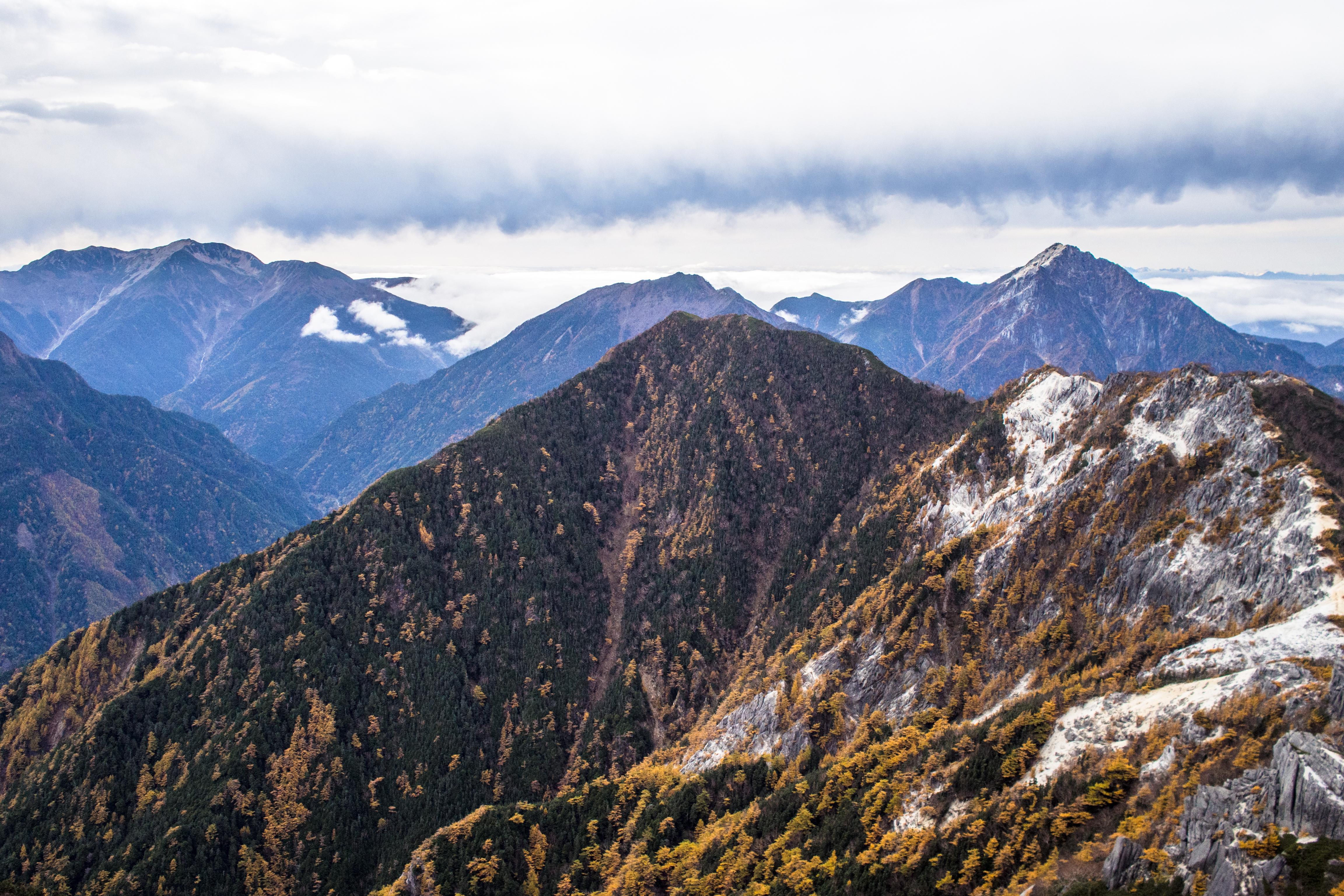
The Akaishi mountains as seen from Yakushi peak
There are 3 peaks on Houou though none is named Houou. Instead, they are named after Bodhisattvas ie Jizo 地蔵 guardian of children, Kannon 観音 goddess of mercy & compassion, Yakushi 薬師 buddha of healing. Thus, Houou is sometimes referred to as Houou Sanzan 鳳凰三山 (lit. pheonix 3 peaks).
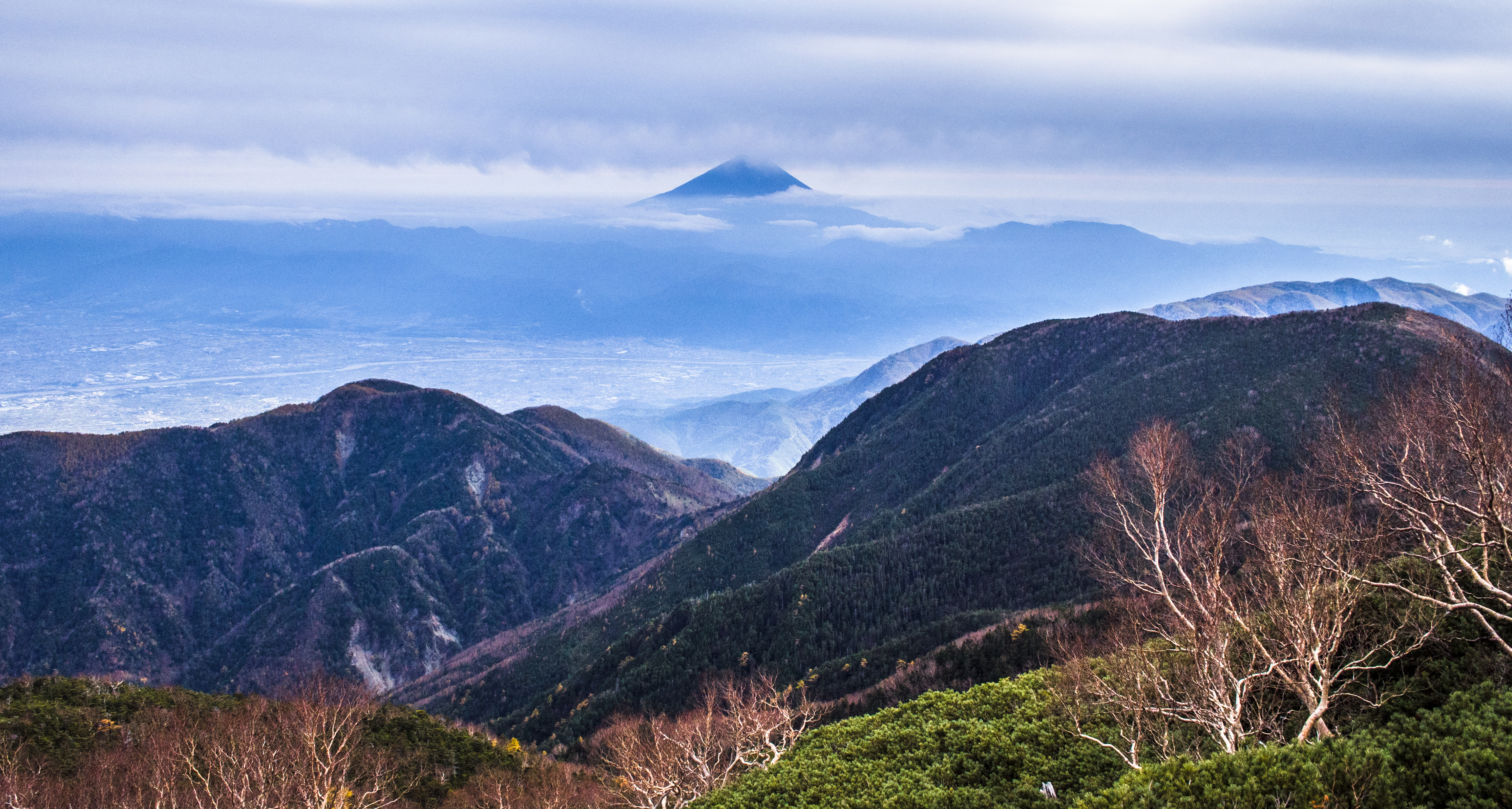
Mt. Fuji in the distance – taken near Yakushi-goya
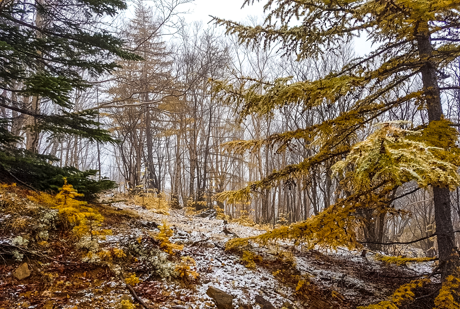
We chose Houou this time because it was one of the few remaining ones that was still open to hikers in autumn and we wanted to see red leaves. Unfortunately, the leaves were either blown off by the typhoon or have yet to turn red. But we got a clear view of Mt. Fuji in the distance. It seemed there were some who climbed Houou just to shoot Fuji.
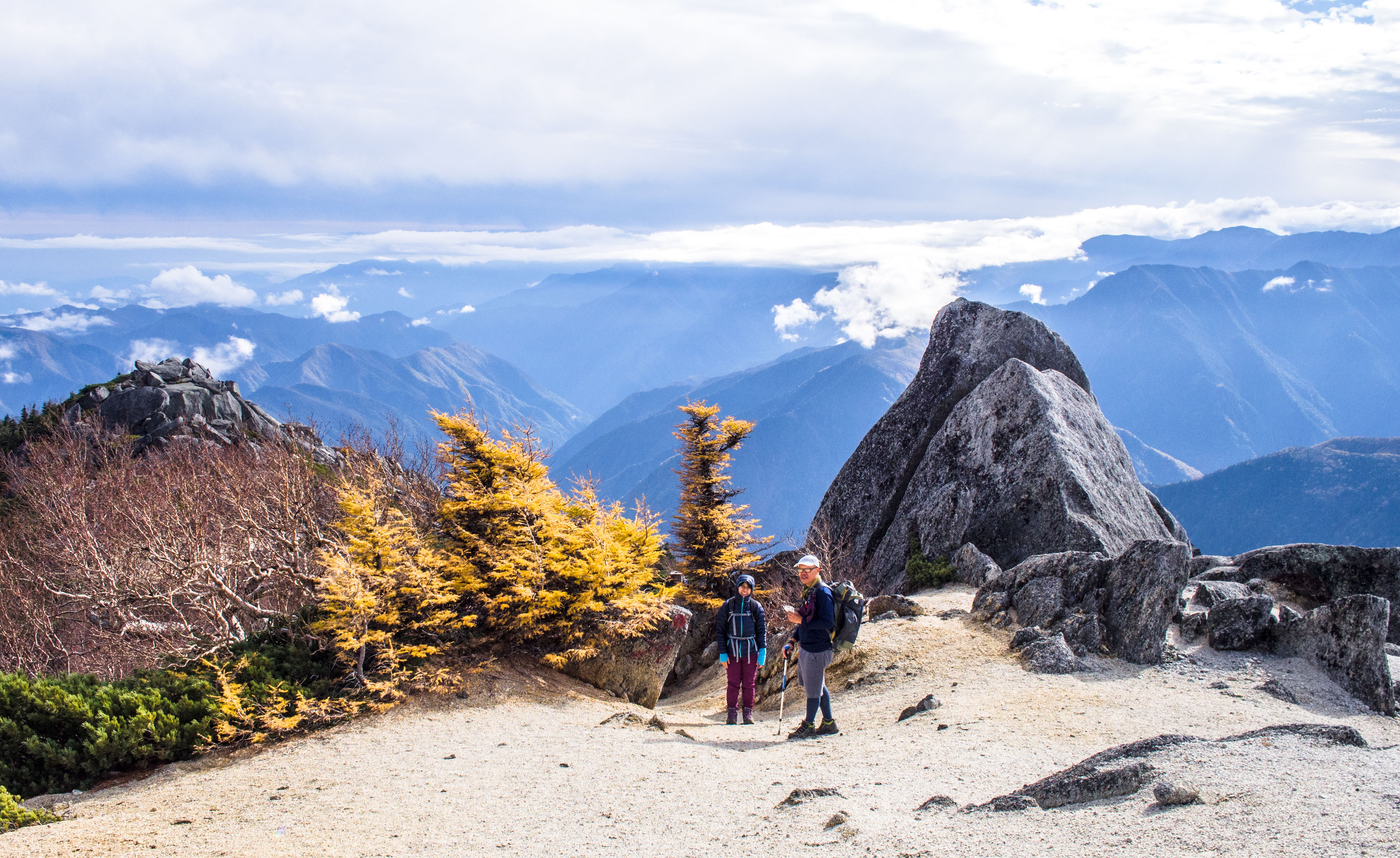
Not flaming red yet but still bright and cheerful
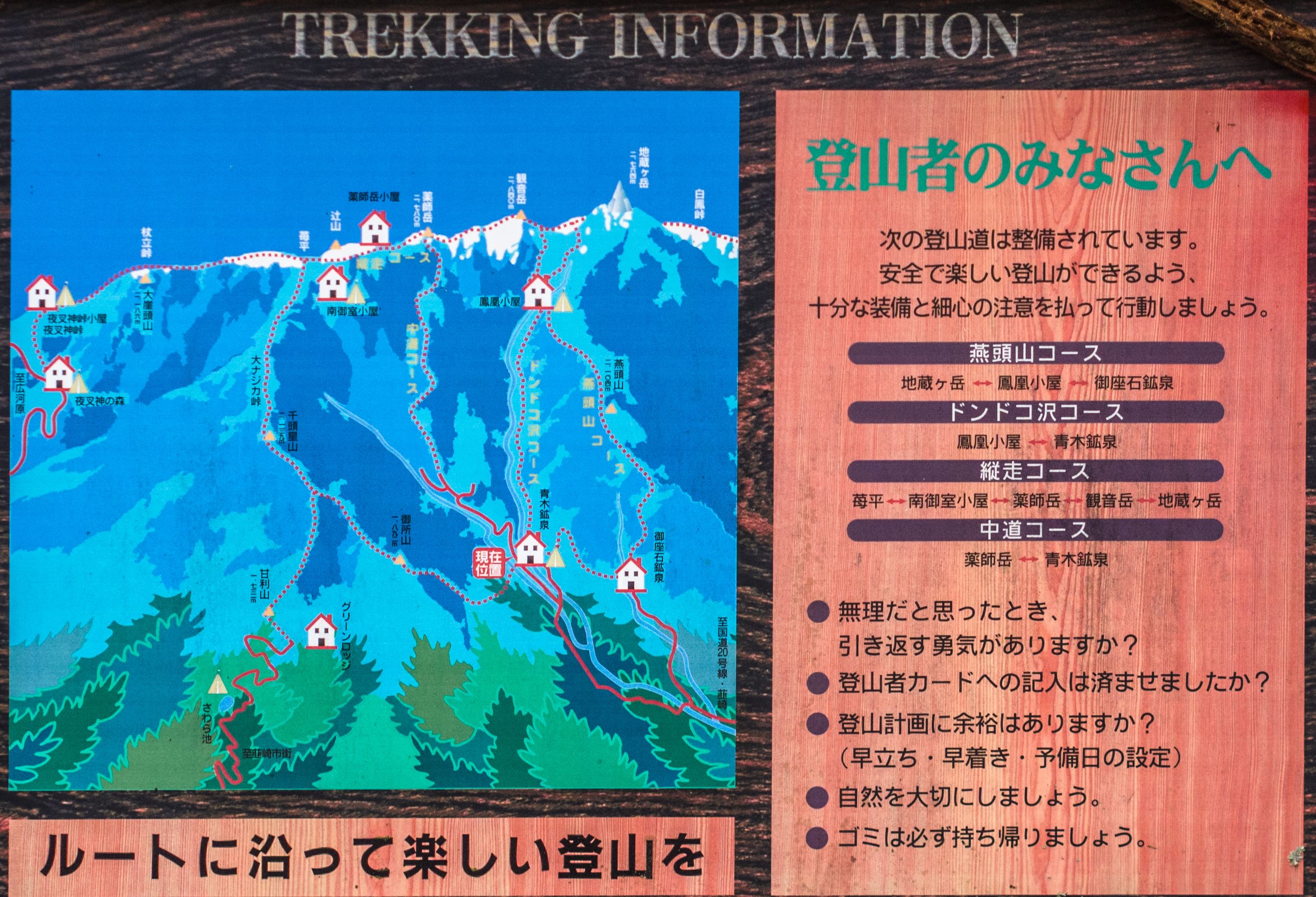
The routes
There are 4 ways to hike up Houou.
How the different trails come together
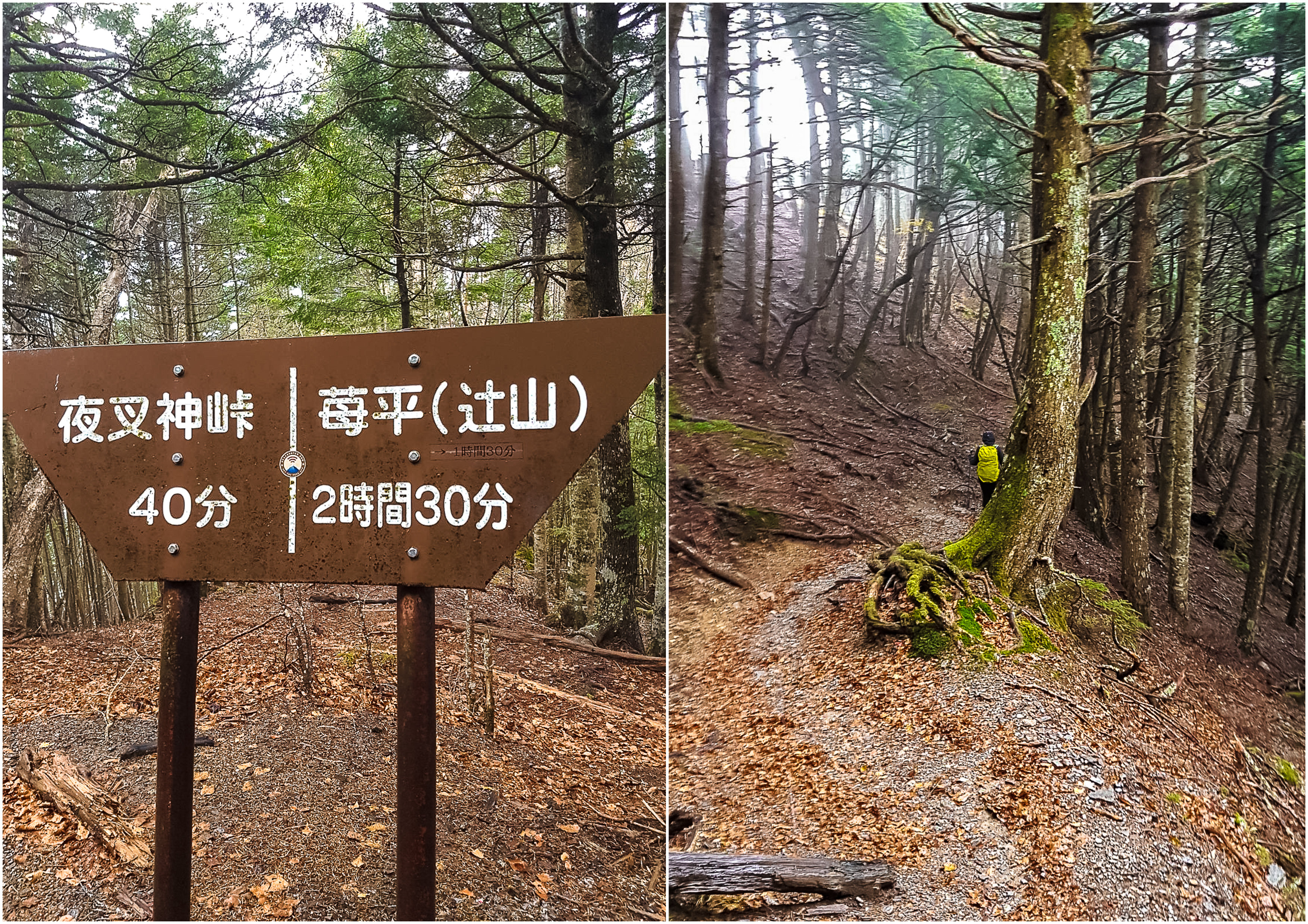
The most popular ascent is from Yashashintouge 夜叉神峠登山. A bus from Koufu drops trekkers right next to the trailhead (1420 yen). The climb is more gradual, typically ending with a night’s stay at Yakushi-goya 薬師小屋. The next day, wake up early for sunrise (and Fuji), trek to Kannon-dake then Jizo-dake, staying another night at Houou-goya 鳳凰小屋. On day 3, walk down to Aokikousen 青木鉱泉.
Trails from Aokikousen area
The reverse of the popular option ie starting from Aokikousen 青木鉱泉 taking the Dondoko-sawa route is also quite well-starred.
Besides, instead of 3 days, this route can be compressed into 2 days. On day 1, the trail will showcase some big and small (and beautiful) waterfalls, before hitting first base at Houou-goya. Then it will be followed by Jizo-dake, Kannon-dake, and Yakushi-dake. This will take 7-8 hours if the night’s stay is at Yakushi-goya (10 mins from Yakushi-dake). If descending to Minamiomurou-goya (another 90 mins), that will take 8-9 hours. On day 2, descend to Yashashintouge. During summer, a bus from Nirasaki station brings hikers to the mountain hut at Aokikousen.
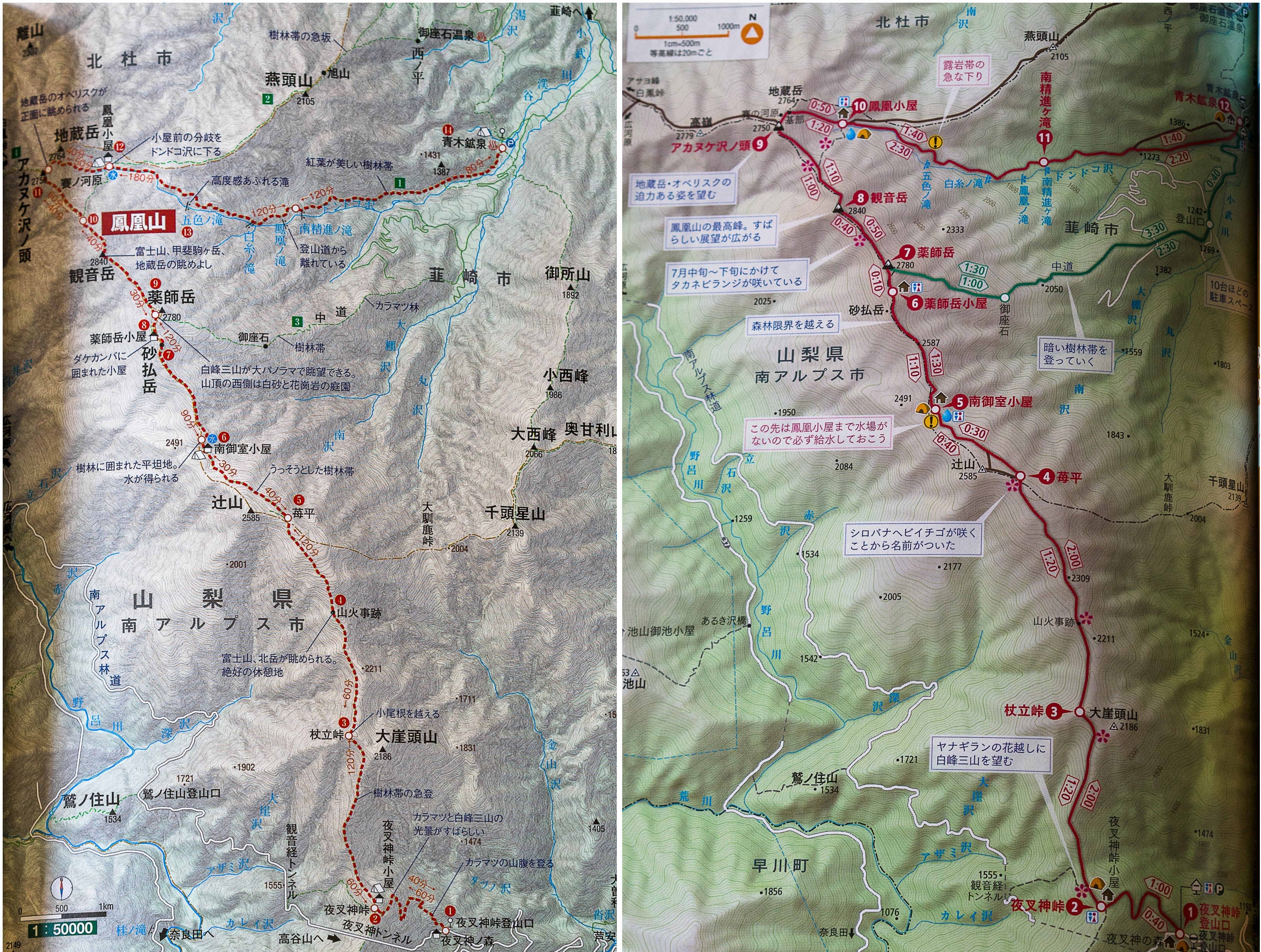
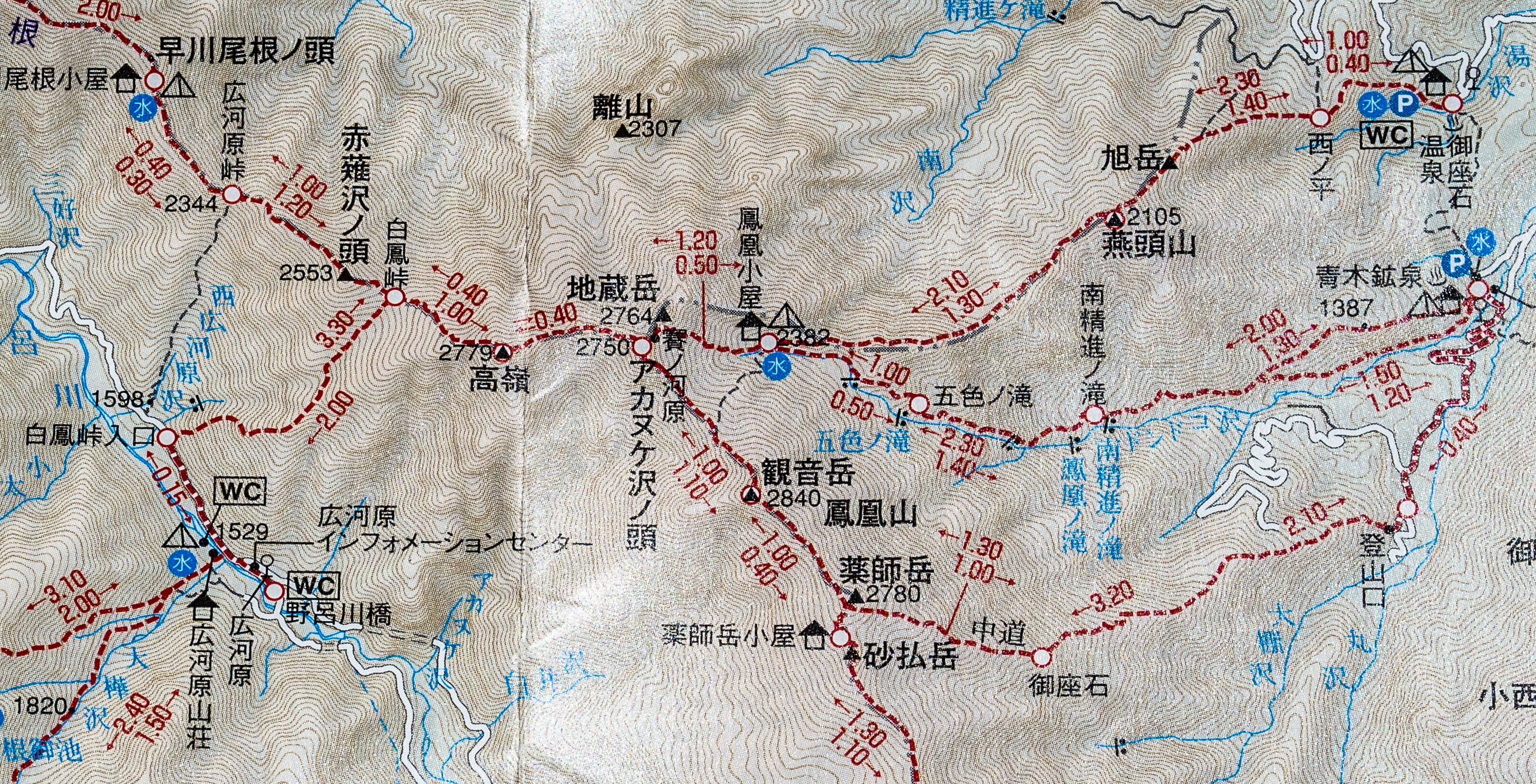
2 maps for comparison
If for some reason, you only want to get to Yakushi-dake, you can take the Yakushi-dake trails like we did. The ‘wet’ trail requires river fording; the ‘dry’ trail follows a wide path (enough for a 4-wheel drive) that skirts the river. Both trails will eventually coverge at the base of the climb.
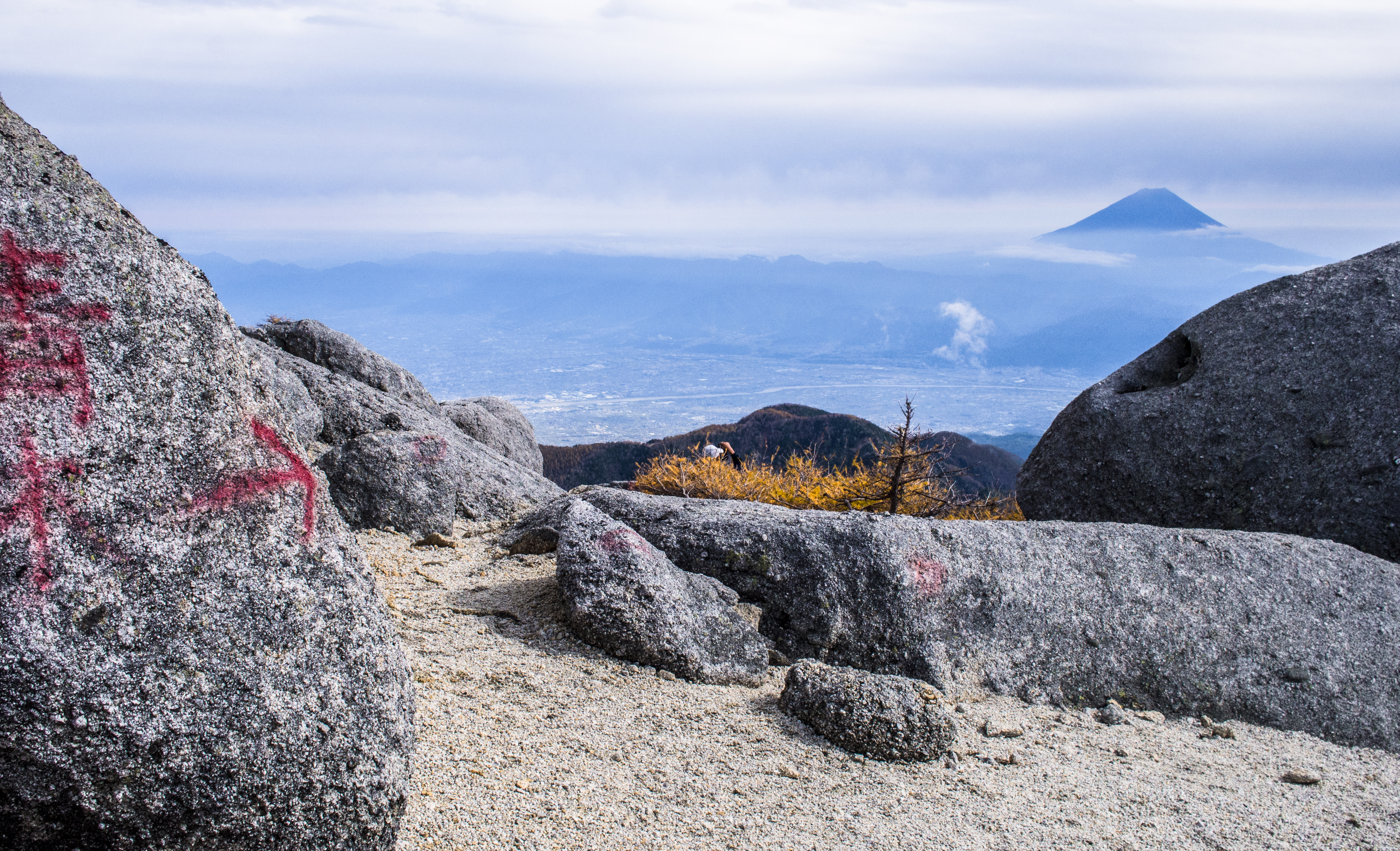
The last trail available – no wavering allowed
The ‘dry’ path – not that dry after typhoon
You can also make the ascent from Gozaishi-onsen 御座石温泉. This trail meets the Dondoko-sawa trail at Houou-goya. Gozaishi-onsen is nearer to Nirasaki station but has a longer section of trail to cover.
The final option is to go by way of Hirogawara 広河原 (accessible by the same bus that goes to Yashashin-touge), passing Hakuhou-touge 白鳳峠. Instead of going down to Aokikousen, some will take this route down but it looks like another steep descent.
The guidebooks recommend spacing out the hike into 3 days. I understood why when I struggled with some form of AMS while making the 1800+ m ascent in 5.5 hours (from an elevation of 1000m so that’s 2800m in half a day). It was a mixture of breathlessness, pounding heart-thumps, brain-body disconnect sluggishness. But, if you are a frequent climber or runner, doing the hike in 2 days should be perfectly fine.
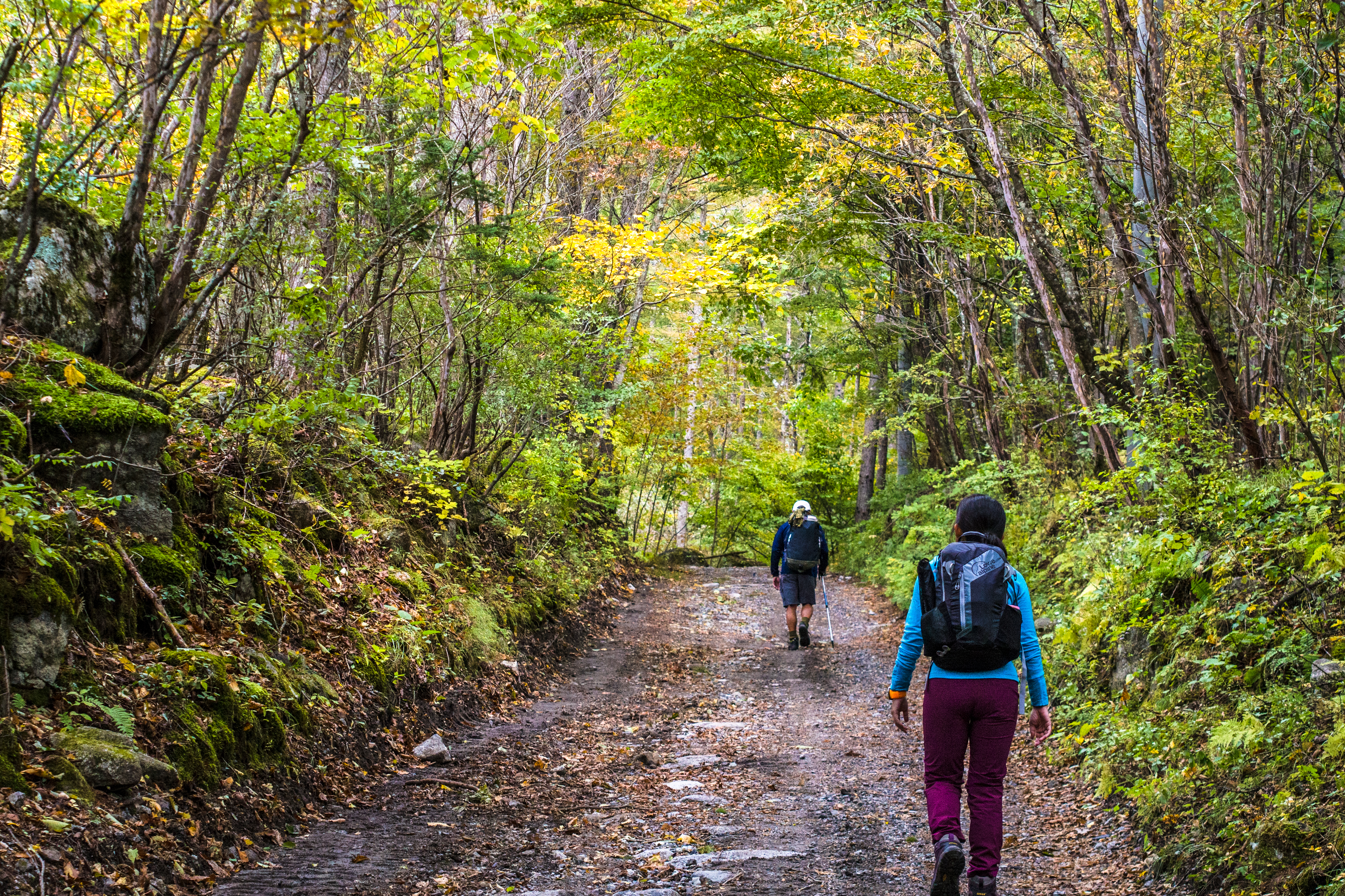
The climb
The climb was strenuous but not technical, steep at various parts and only needed to use hands but infrequently. We chose to start from Aokikousen because it’s easier to return to civilisation from Yashashintouge.
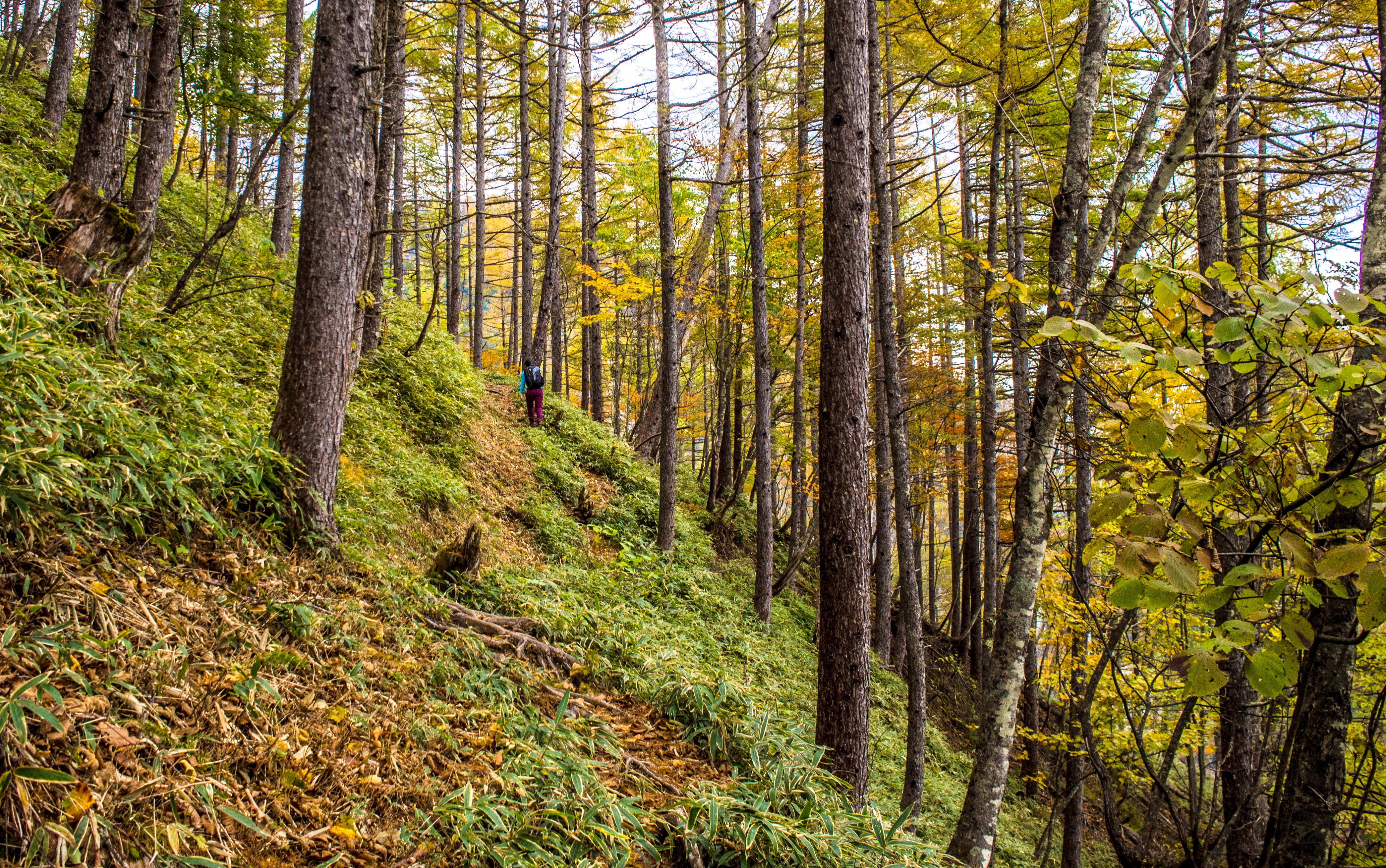
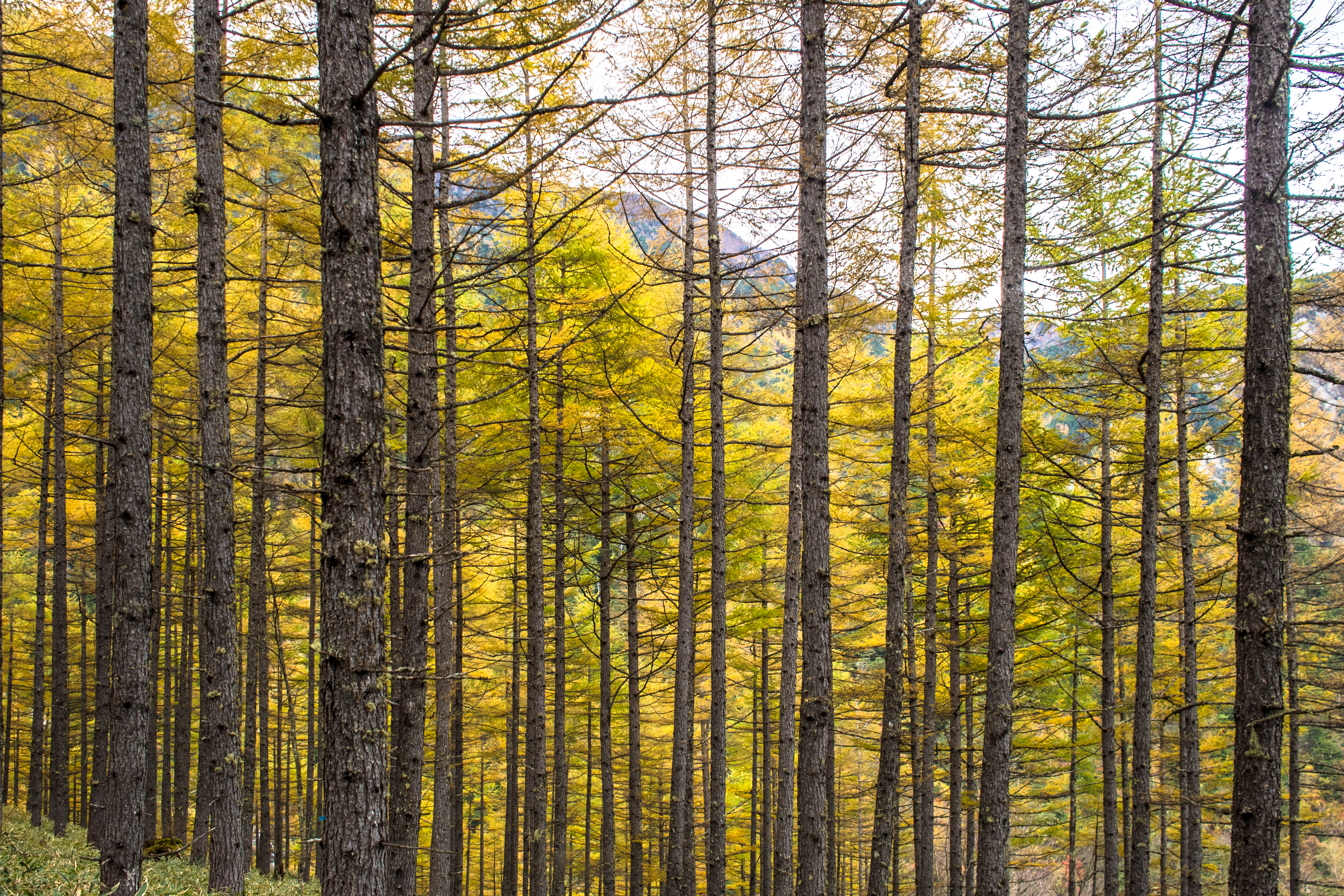
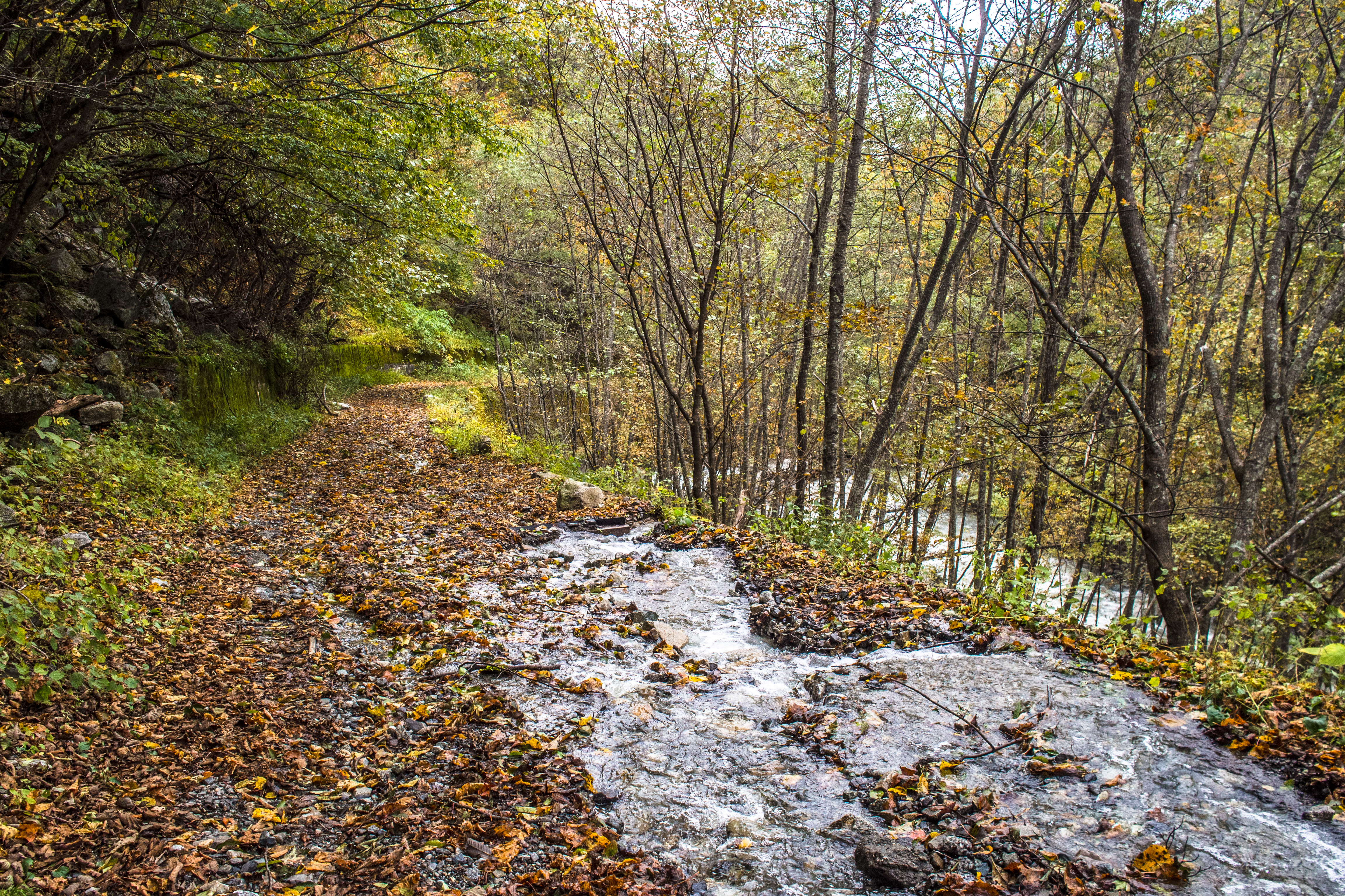
For most part of the trail, we climbed among trees
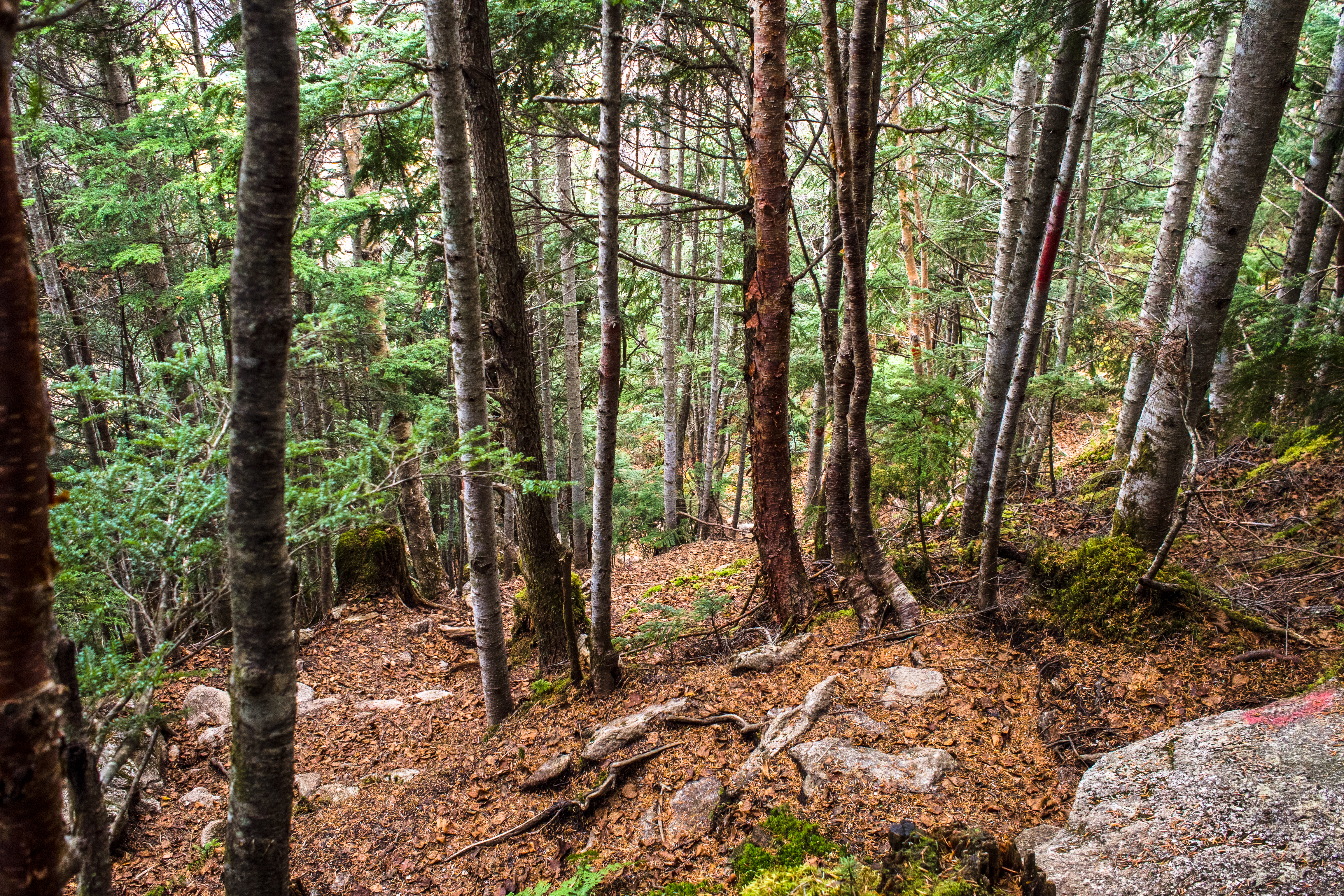
How the forest trail looked like
View from higher ground
The walking sticks helped but the camera and lenses were a hindrance so I was wishing I’d left them in Koufu. Until I turned back and saw Mt. Fuji staring back at me. Nixed that thought immediately.
What it looked like when I turned around
Because of the false starts in the beginning, we only properly started on the 3rd trail close to 8am. The early part of the trail was quite flat. By 830am we’d reached the base of the climb. The signboard said 6.5 hrs to Yakushi peak. Originally it read 4.5 hrs but someone scratched the 4 out and wrote ‘6’ above it. Not a good sign.
Almost reaching Yakushi peak
The typhoon blew a lot of leaves onto the trail, obscuring a good part of it so we kept a vigilant lookout for marks on the trees. We reached Yakushi peak (2780m) at 1pm with no problems.
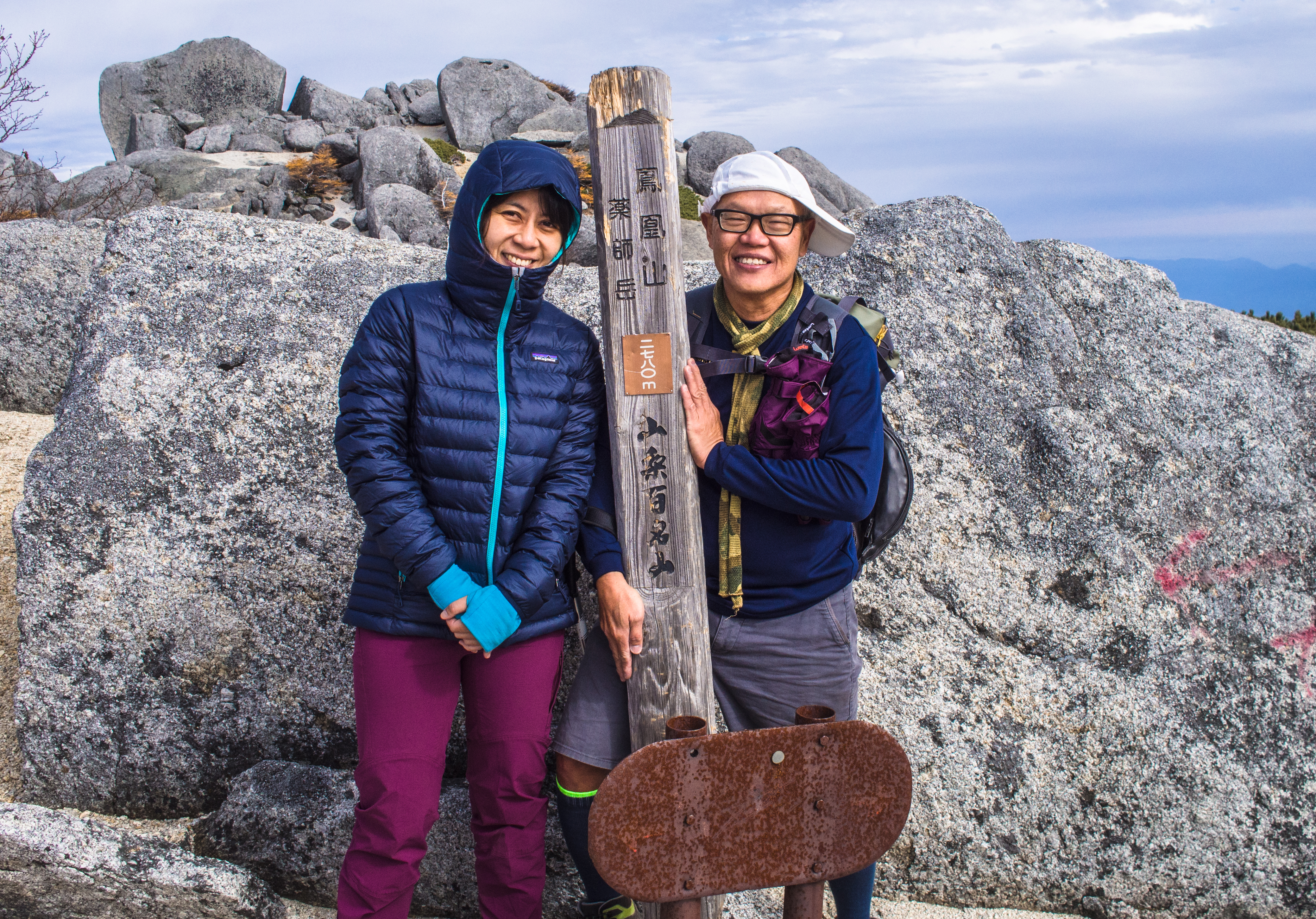
Wefie at Yakushi peak
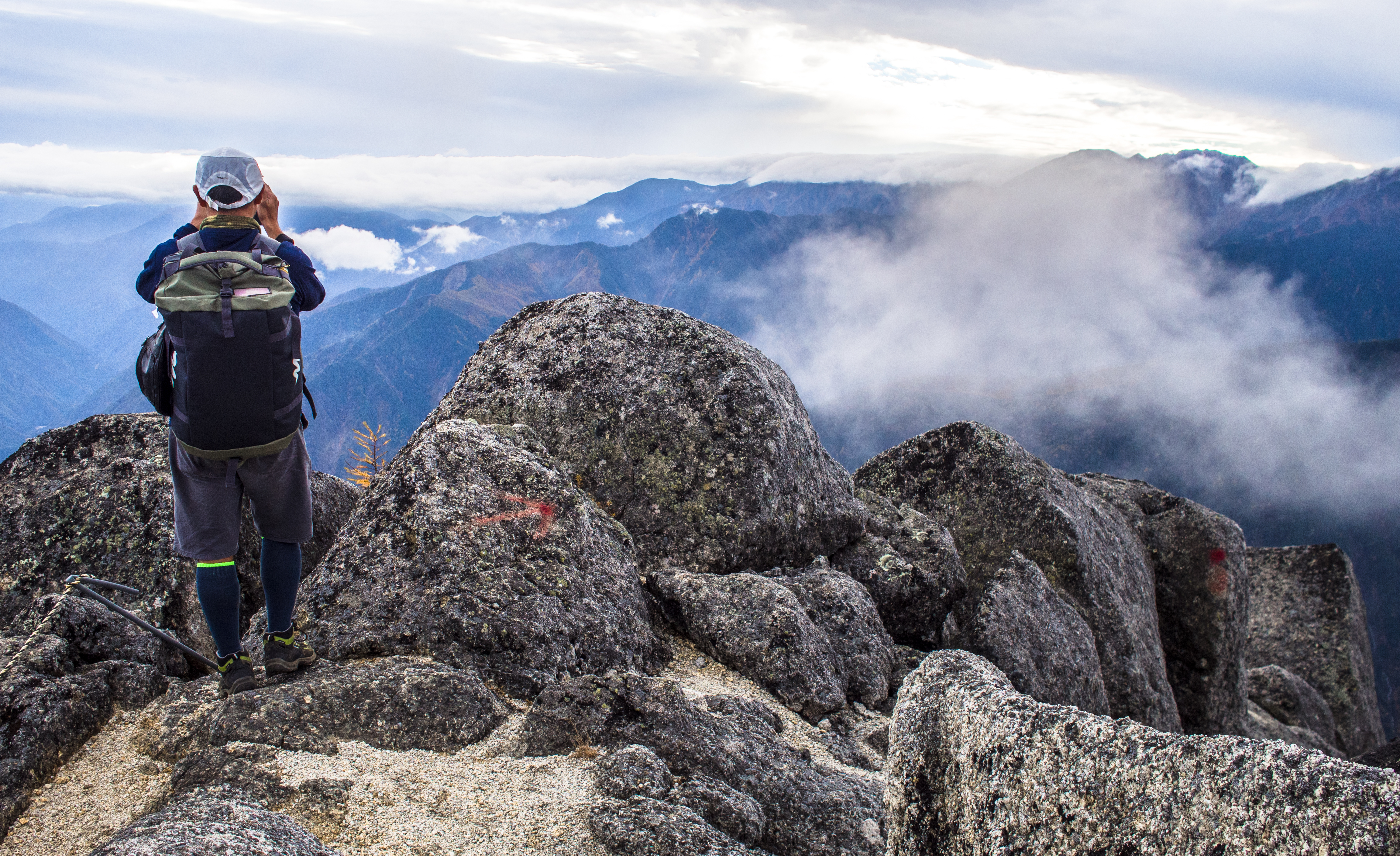
My mates were still energetic and seeing there’s time to kill, wanted to walk to Kannon peak. I was broke but I thought I wouldn’t hear the end of it if I didn’t let them. So we dropped our bags at Yakushi peak, then walked over to Kannon peak (2840m) and were back by 2pm. Specks of snow began swirling around as we started towards Yakushi but soon retreated (sun was high and bright).
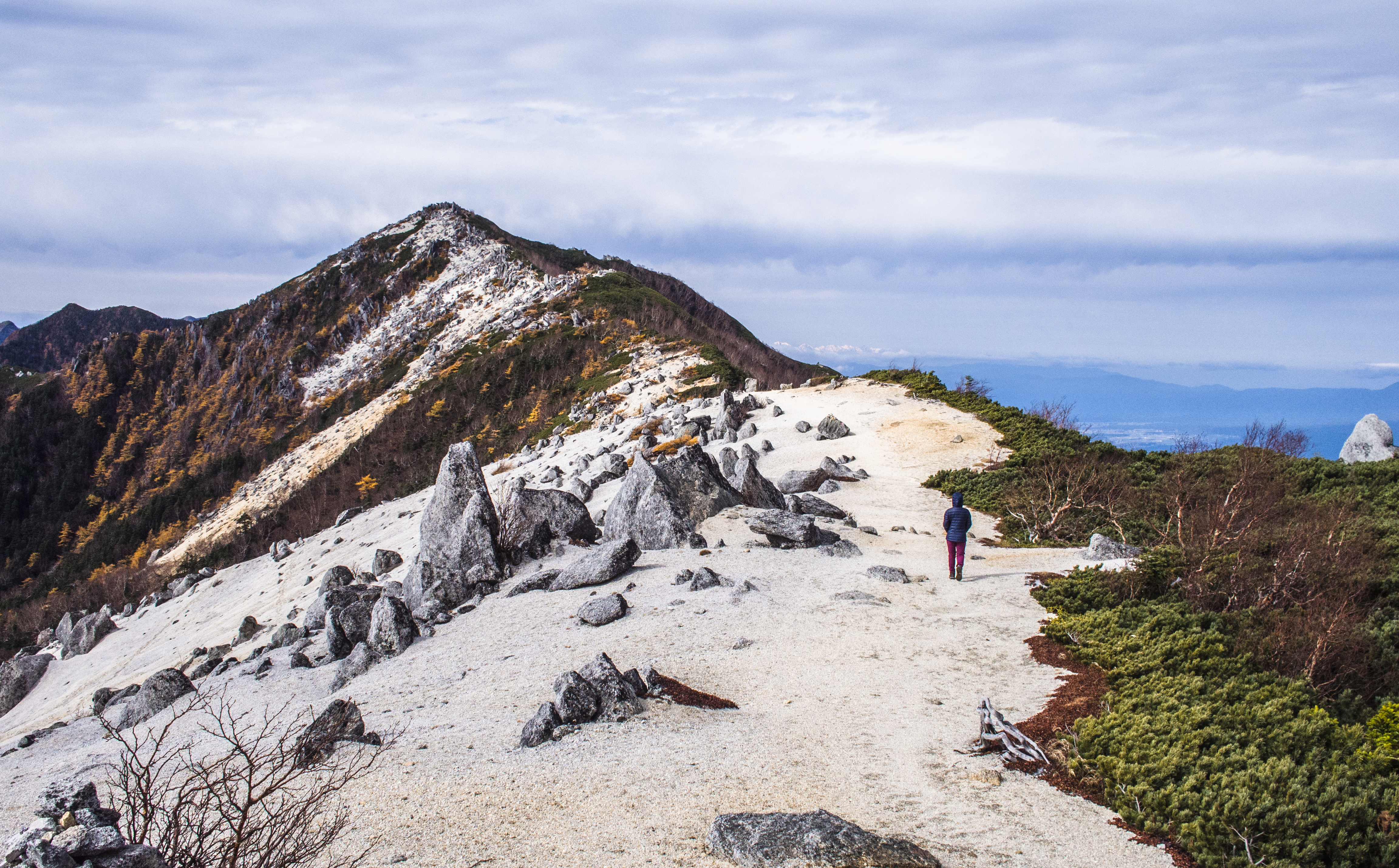
Trail to Kannon – highest peak on Houou
Mt Fuji – from Kannon peak
From Yakushi peak, it was an estimated 1.5hr trek down to our mountain hut. Just pass Yakushi-goya, we had a scale another small peak and the view from it was fantastic.
Heading down from Yakushi
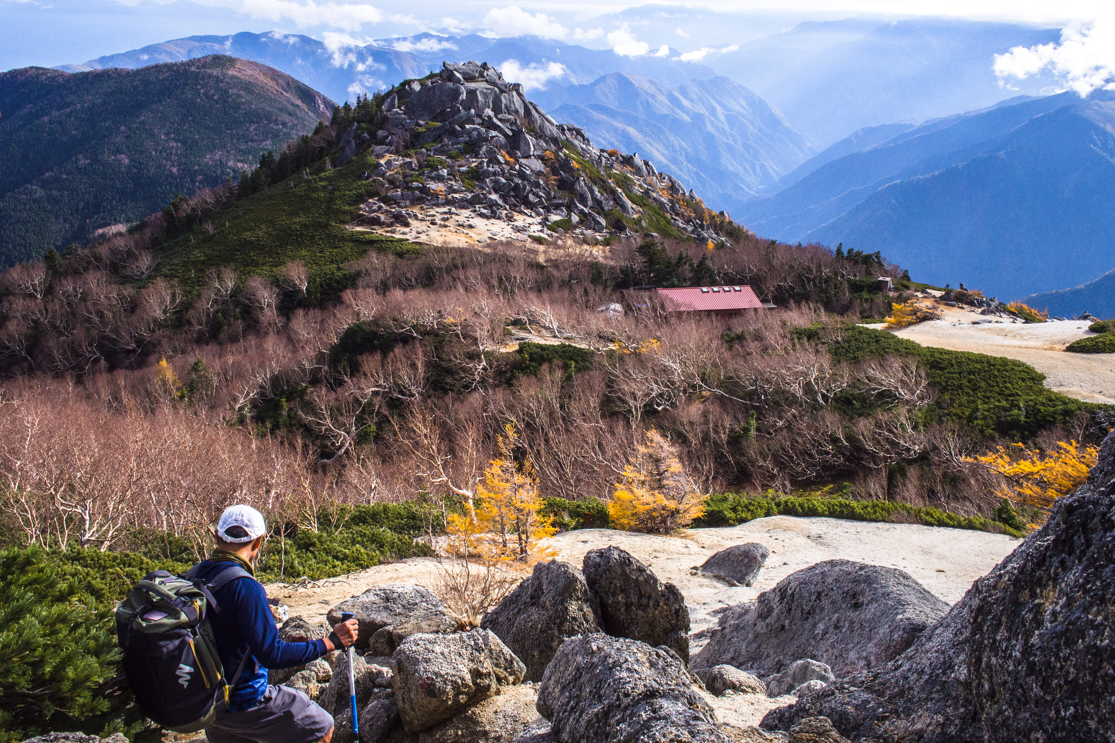
That’s Yakushi-goya and the small hill we had to climb after it
Mesmerised by the panoramic view from the top
We were usually slower going down but by 330pm we still hadn’t seen the roof of the mountain hut so we called a halt to consult our maps again. It was already 2500m and we’d only 1 hour of daylight left (in case we really missed a turn). Satisfied that there’s only 1 trail down, we pressed on and 15 mins later, we reached the hut (wonderful camouflage job by the trees even though the hut had red roofs).
The caretaker was waiting for us (to tell us we were crazy, but he’d actually also laid our beds out). He said that everyone else had cancelled but us.
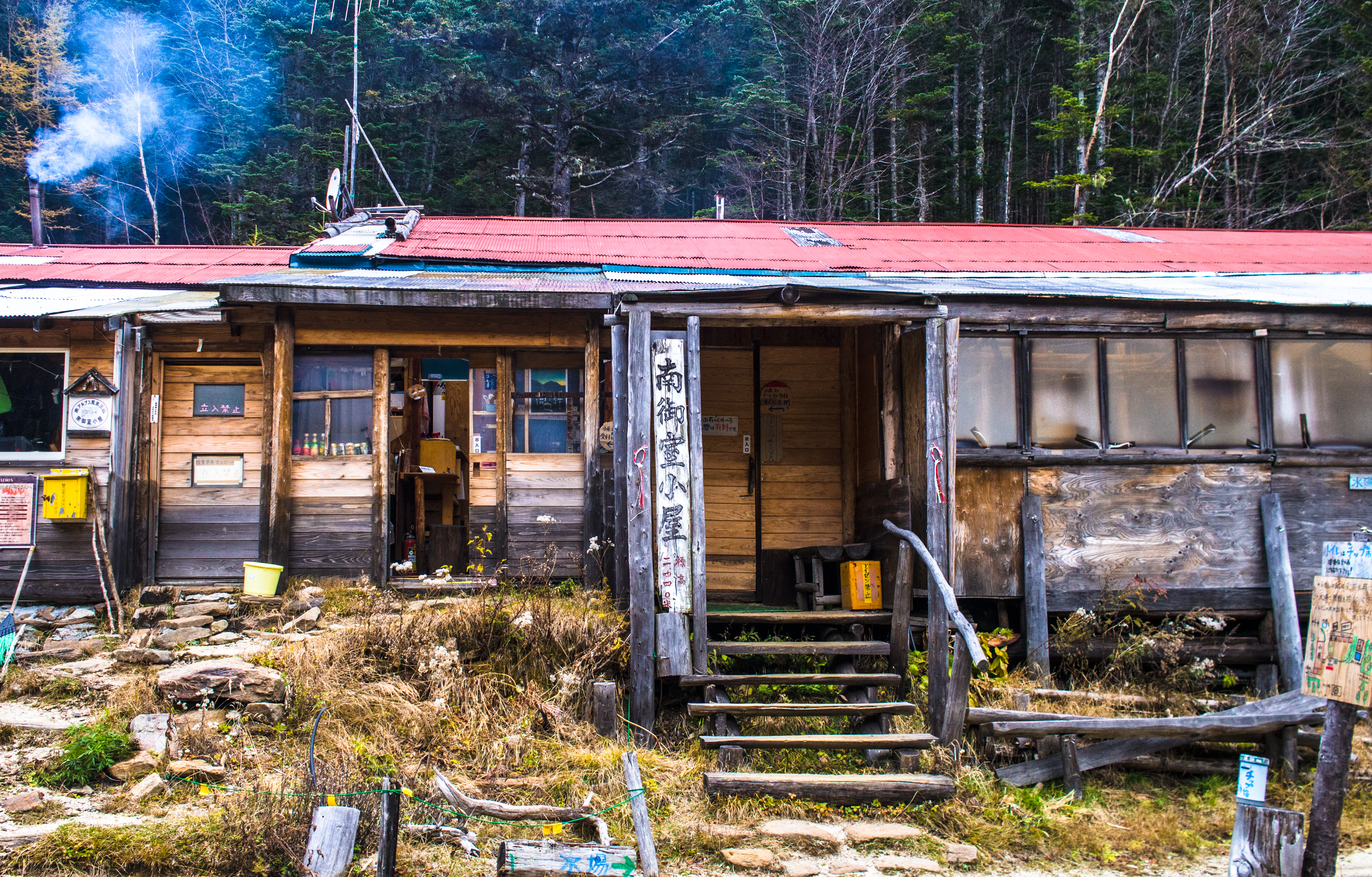
Minamiomurou-goya
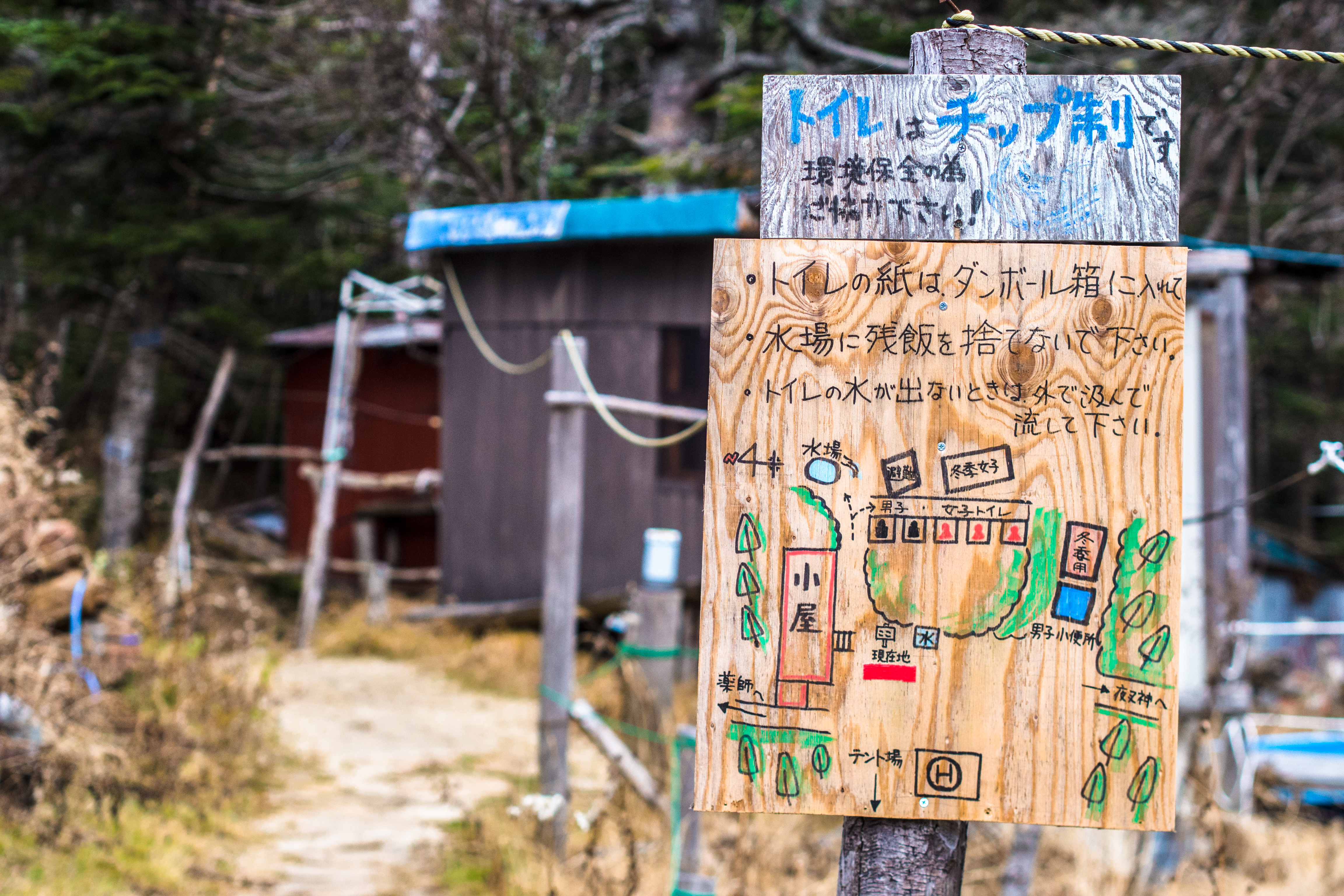
Signboard – directions and instructions
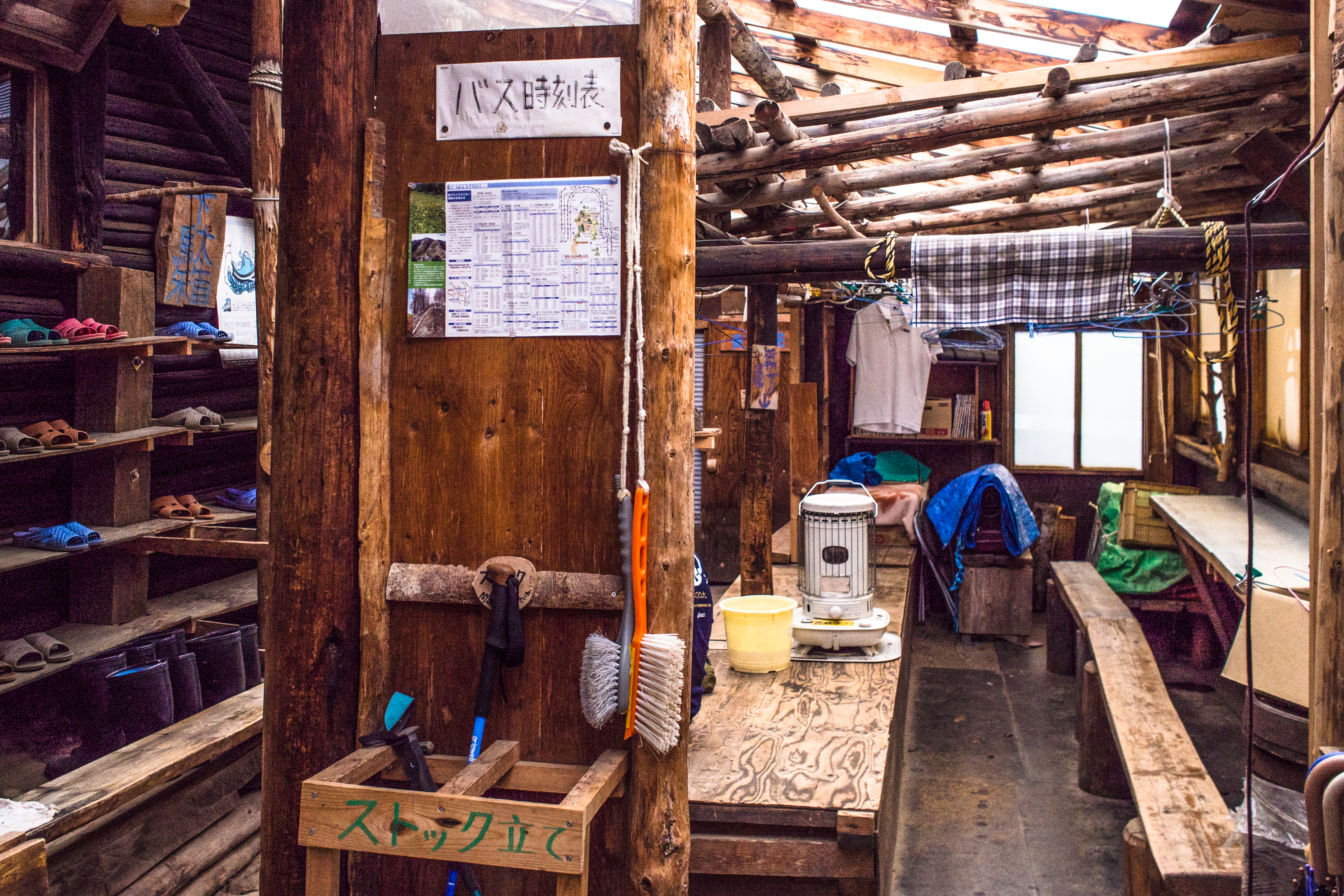
Reception area – take off trekking boots here!
It was great to have the hut all to ourselves but it was really really cold. Maybe because it started to snow outside.
We stuck heat pads to our bodies, huddled around the heater (not the kotatsu which was only lukewarm) and waited. The sky turned dark by 430pm, dinner was served at 5pm, the heater was off by 7pm and all lights were out by 8pm. There’s a kind of tranquillity with such a precise schedule.
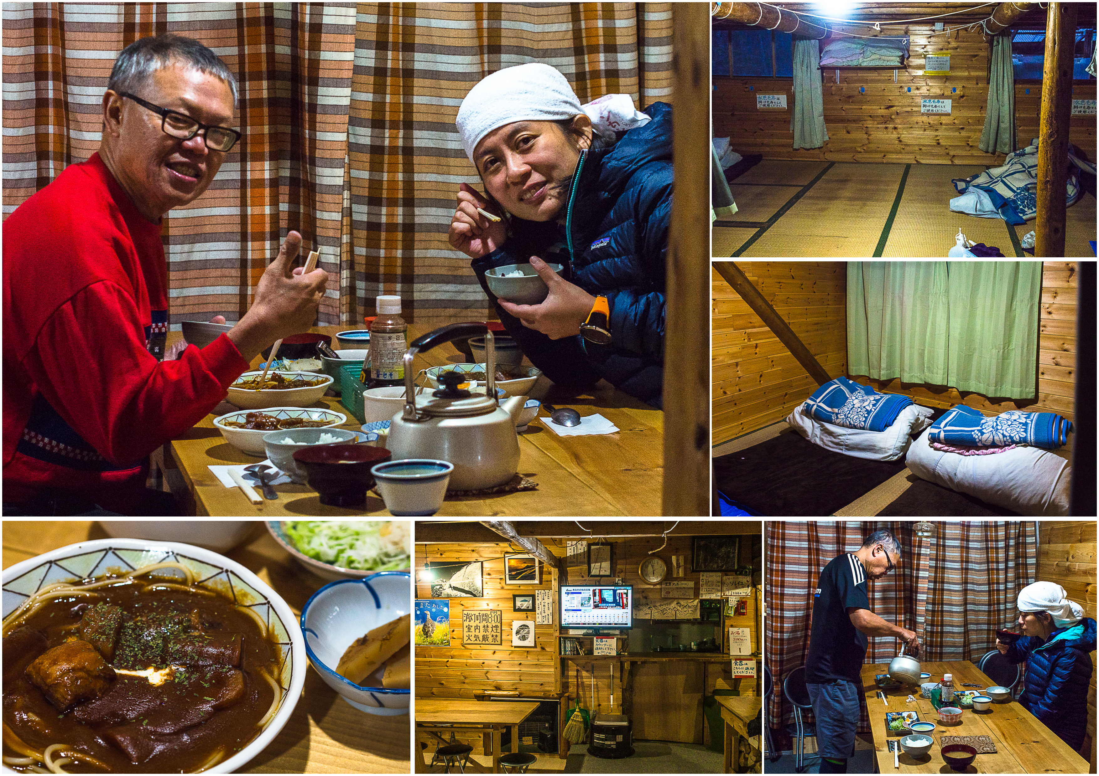
Inside the goya and dinner, breakfast
Stay + 2 meals was 8800 yen per pax. Boiling water was 200 yen/bottle.
559am: Koufu -> Nirasaki (train)
7am: arrived to Aokikousen by taxi (7000yen)
Distance: 12.6km
Starting elevation:1065m
Ascent: 1887m
Descent: 573m
Highest point: 2842m
Total time taken: 8hrs 28min (actual walking time 7hrs 45mins)
The descent
Morning, as we prepared to set out
Breakfast was officially served at 6am but we were up by 530am, started eating at 550am and almost ready to go by 610am. From the window, the snowfall looked pretty thick so we conferred with the caretaker. He said it was better to leave early because he expected the snowfall to get heavier and anyway the forest would provide some cover. He was right. We left at around 630am and by then, the trail was already completely blanketed under a thin layer of snow, but still obvious so there’s almost zero chance of getting lost. It was a gradual descent, interspersed with a little climb at some parts, much easier than what we went through the preceding day.
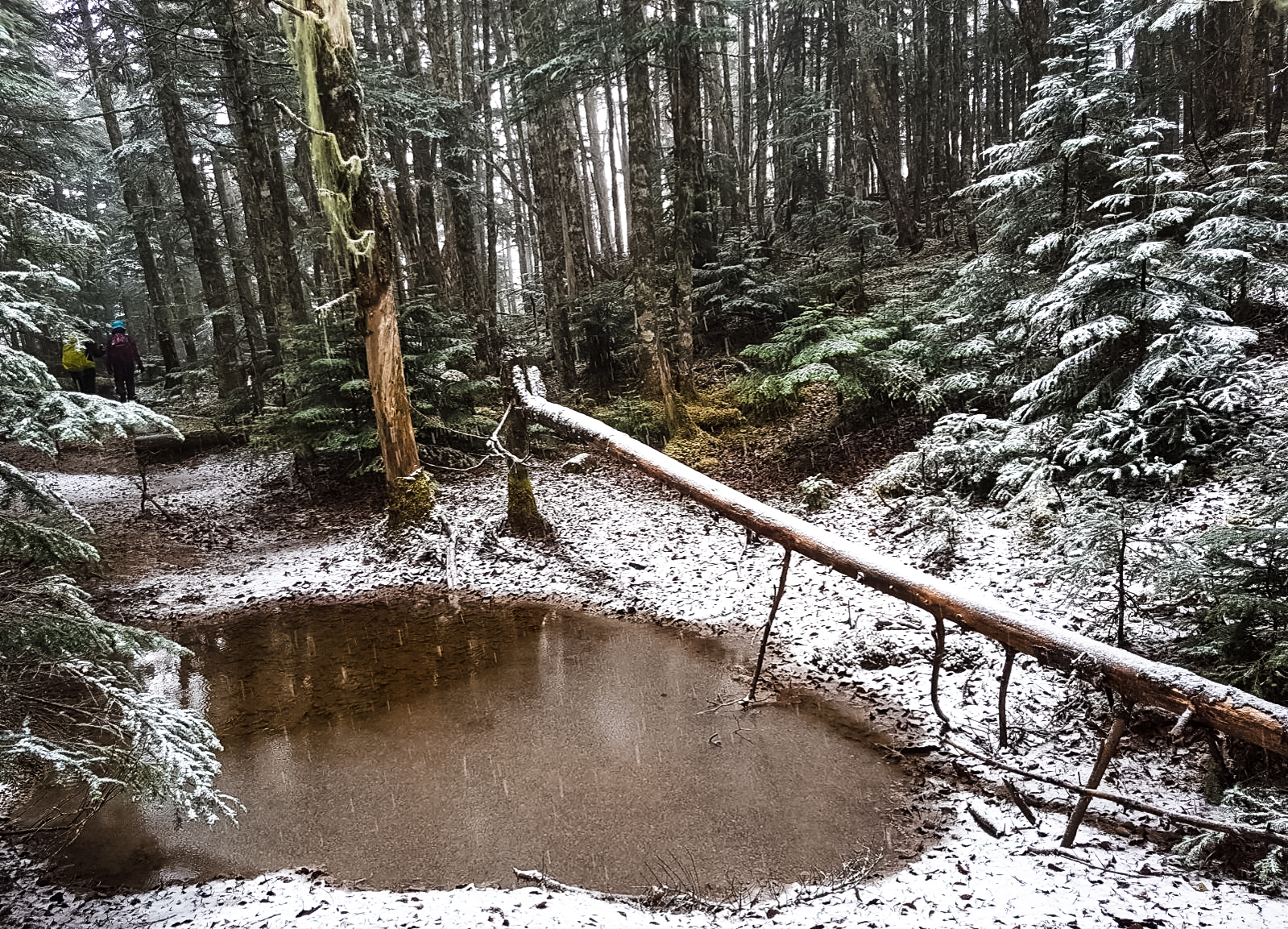
A snow-covered puddle (credit: SK)
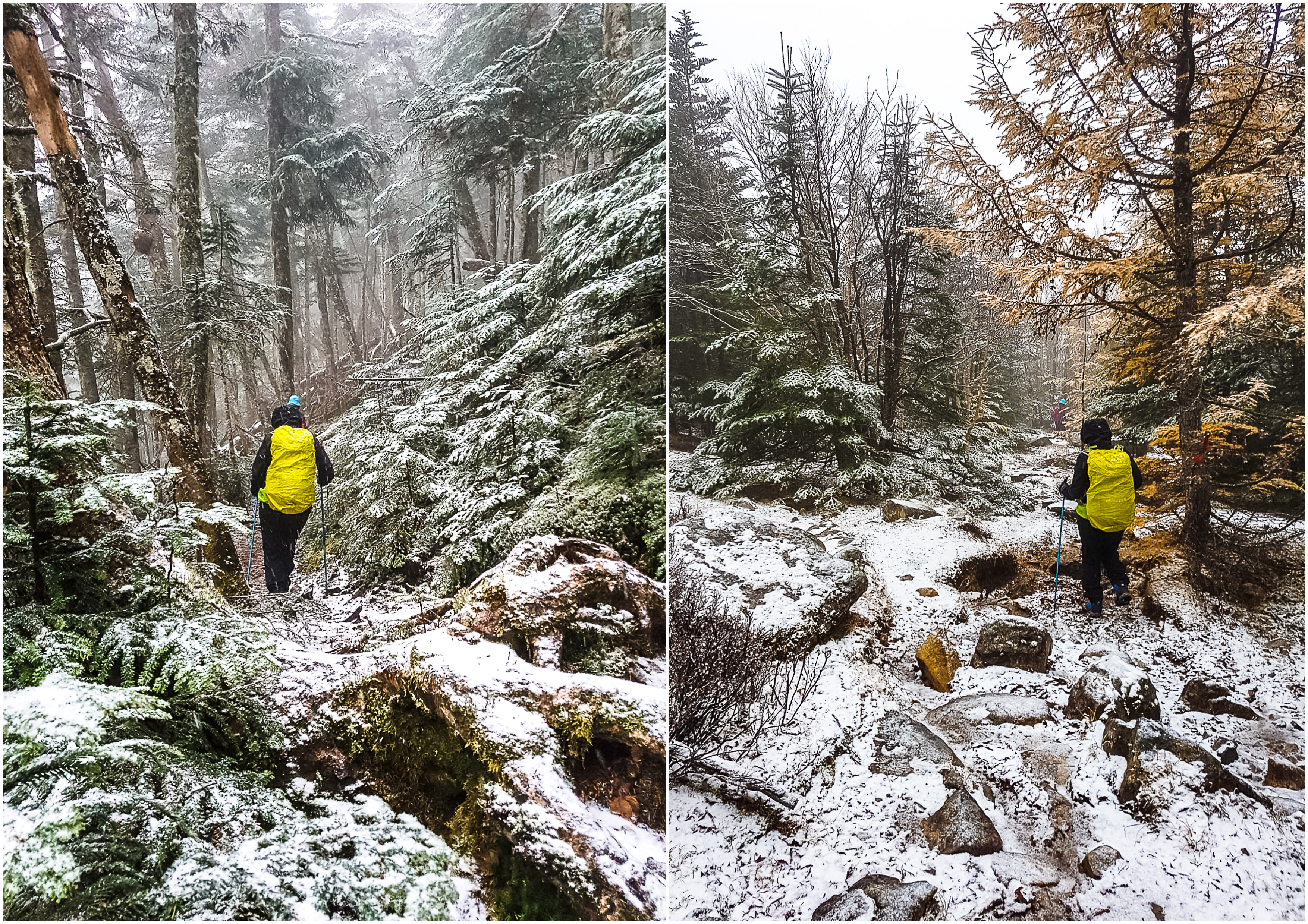
On the snow trail (credit: SK)
Finally, autumn (credit: SK)
All was good until we crossed the snow line – that’s where the snow turned into huge rain drops. It became colder and wetter, though not as cold as what we endured at Shirouma last year since the forest shielded us from wind.
When snow turned into rain (credit: SK)
With less than one-third of the trail to go, we started to meet other hikers. A couple of solo hikers, groups of 2-3 etc. All in, we counted 16 hikers that morning (all Japanese). That’s 16 hikers crazier than us!
End of trek – a final blurry farewell shot with the handphone
We reached the Yashashintouge trailhead (1380m) at about 1010am and got on the 1041am bus back to Koufu (1 hour 10 mins). Then we were off on the earliest train to Iida 飯田, Hirugami Onsen 昼神温泉 and a much needed bath.
Distance: 8.33km
Starting point: 2517m
Ascent: 163m
Descent: 1217m
Lowest point: 1396m
Total time taken: 3hr 40min
visited 24-25 october 17
References: Japanhike; Southern Alps Alpine Guide; Japan 100 Mountains Guide

WOW!!! Thank for the nice pictures!!!