

hakuba oike
We’d heard there is snow to be seen, even in the throes of summer. The Daisekkei 大雪渓 beckons, a 3.5 km snow & ice corridor stretching from the belly of the mountain to the summit (with a vertical span of 600m). It is the main reason why many hikers are drawn to Mt Shirouma (or Shirouma Dake).
Part of the mountain range collectively known as the Japan Alps, Mt Shirouma’s namesake 白馬 comes about because come spring when the snow melts, the rock face that gets exposed takes on the shape of a horse.
the route from hakuba sanso to yari onsen
We too, felt compelled to pay homage to the Daisekkei.
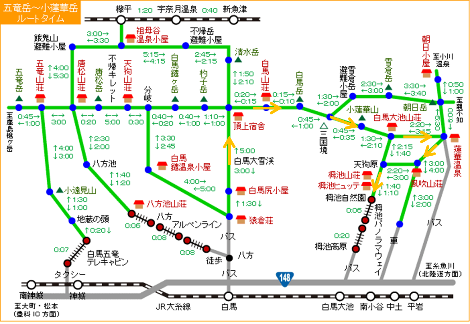
We had planned to start the trek from Sarukura 猿倉, hike up Daisekkei, come down via Hakuba Oike 白馬大池 to Renge Onsen 蓮華温泉 (a secret onsen) and finish off at Tsugaike Shizenen 栂池自然園. Quite perfect, we thought.
the original route
The map can be found here; it also features other recommended walking courses (in Japanese).
To book a sleeping berth in the mountain huts, go to the Hakuba Sanso website. click on the tab indicating “English information” and you will get to see the sanso descriptions and an email address at the bottom. Or, check out the Hakuba Kousha website or the Yama-goya website (which features mountain accommodation options across japan) but these are in Japanese only.
The Perfect Plan got thrown out
One week before we were due to go, the Daisekkei route became off-limits – closed due to the snow melting and numerous crevasses appearing. After some contemplation, we decided to turn the route around ie start from Tsugaike shizenen, come down via Yari Onsen 白馬鑓温泉小屋 and end at Sarukura. Here’s the route we eventually took.
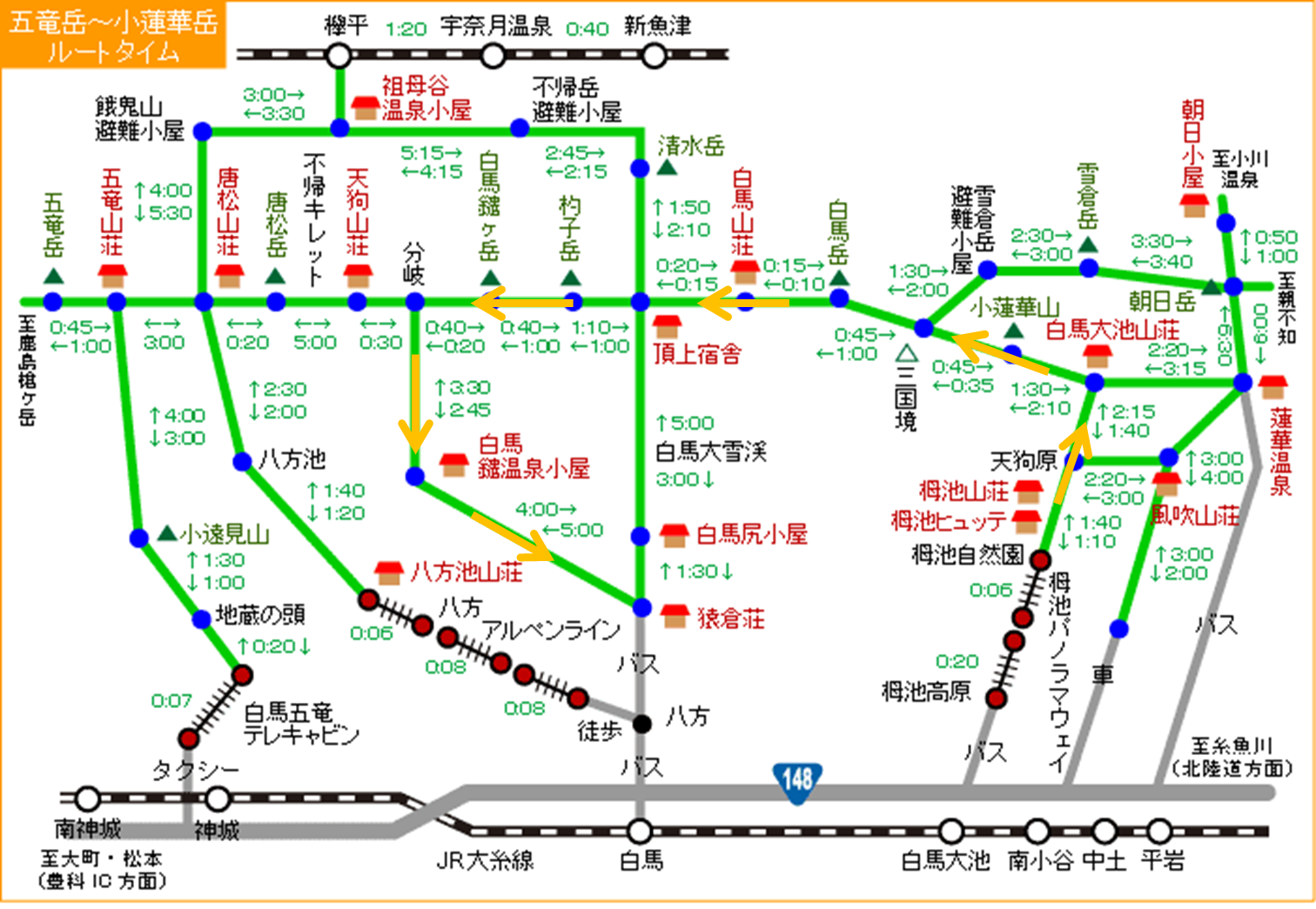
final route
Did we regret we couldn’t admire the splendour of Daisekkei? If we did, it must have been a very short-lived one. We were, in fact, rather relieved that those crampons (courtesy of a friend) could stay put in our stowaway luggage.
For a lighter load, pack some small snacks to eat along the way; the mountain huts serve up delicious full meals so ditch those instant noodles. Leave the toilet rolls behind as well because the well-equipped, ultra civilised mountain huts in japan provides almost everything – including slippers.
sanso dinner
Avoid climbing over the weekend because that’s when the locals ascend. The flip side is, during low seasons, buses don’t run on weekdays. Anyway, here’s the bus schedules to Sarukura and Tusgaike.
Taxis are another way to commute to the start and from the end of trek; they are actually a better deal than taking buses if you have a group of 3-4 to share costs.
Day 1: A beautiful lake and a not so beautiful storm
(Happo One -> Tsugaike -> Hakuba Oike -> Hakuba Sanso)
From hotel Mominoki 白馬樅の木ホテル at Happo-one 白馬八方尾根, we took a taxi (3180 yen) to the TsugaikeKogen 栂池高原 ‘eve’ gondola station (1829m) for the 20-minute, 4km gondola ride. Then we transferred to a ropeway to Tsugaike Shizenen (1900m, 6 minutes).
We followed the granite trail extending from the ropeway station and soon reached the Tsugaike Nature Park entrance. The trailhead is behind the toilet at the right hand side. We readied our getup, submitted the hikers’ data form and then we were off!
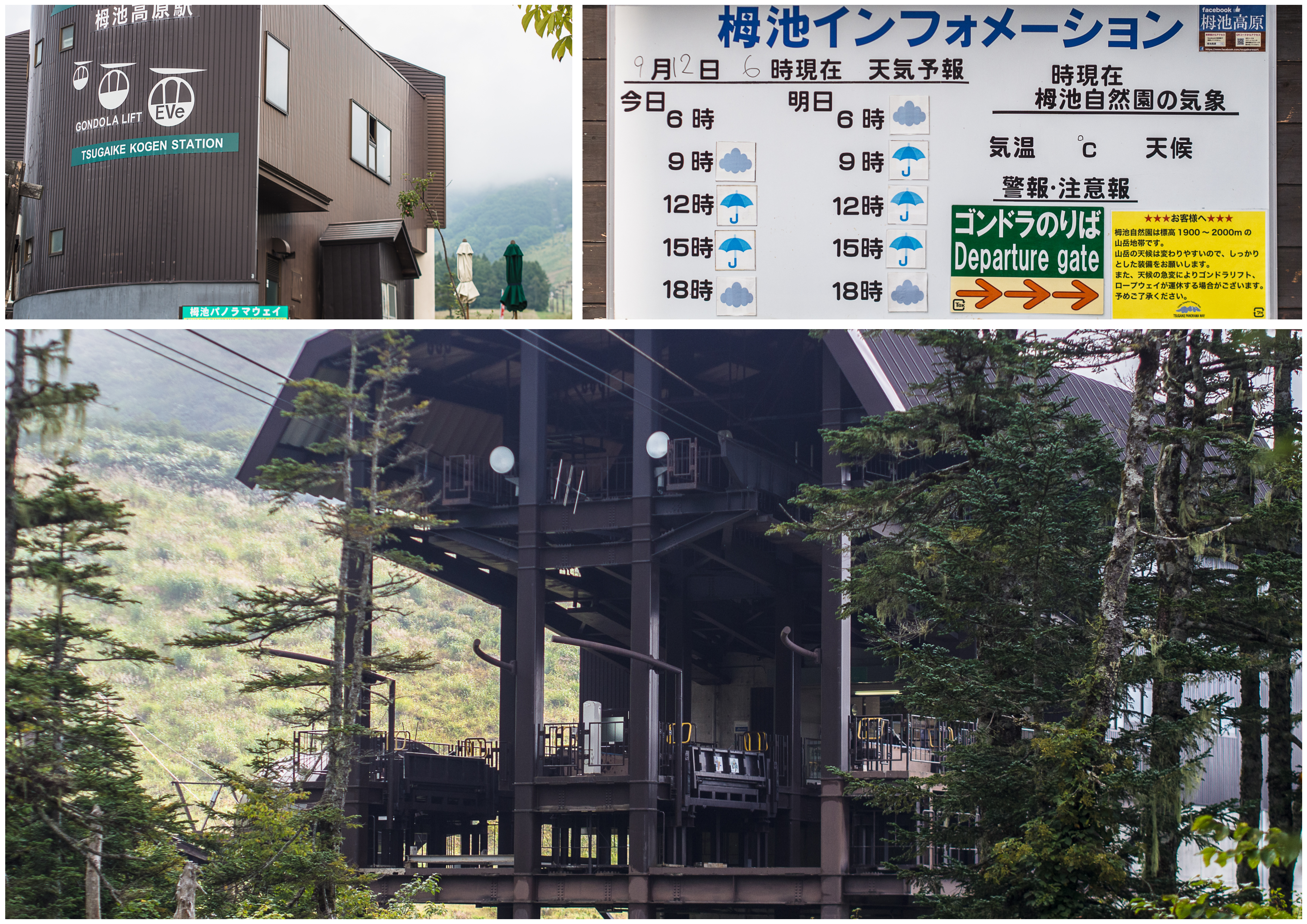
tsugaike gondola and ropeway – the weather forecast is ‘wet’
Tsugaike Nature Park looked beautiful that day – we told ourselves we’d have to come back and do it another day. Let that group of grannies and gramps from our hotel have the park to themselves for the day.
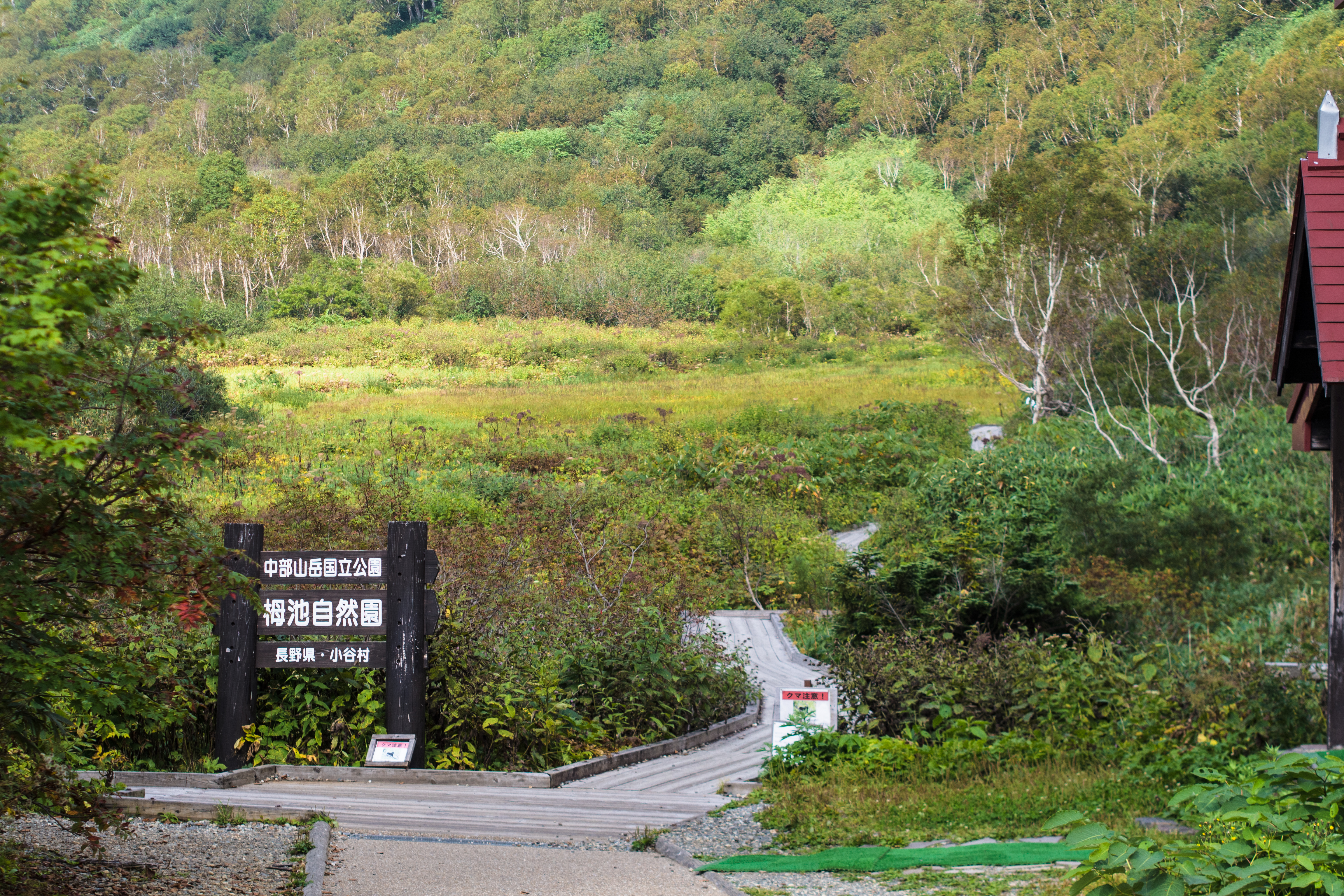
tsugaike shizenen (tsugaike nature park)
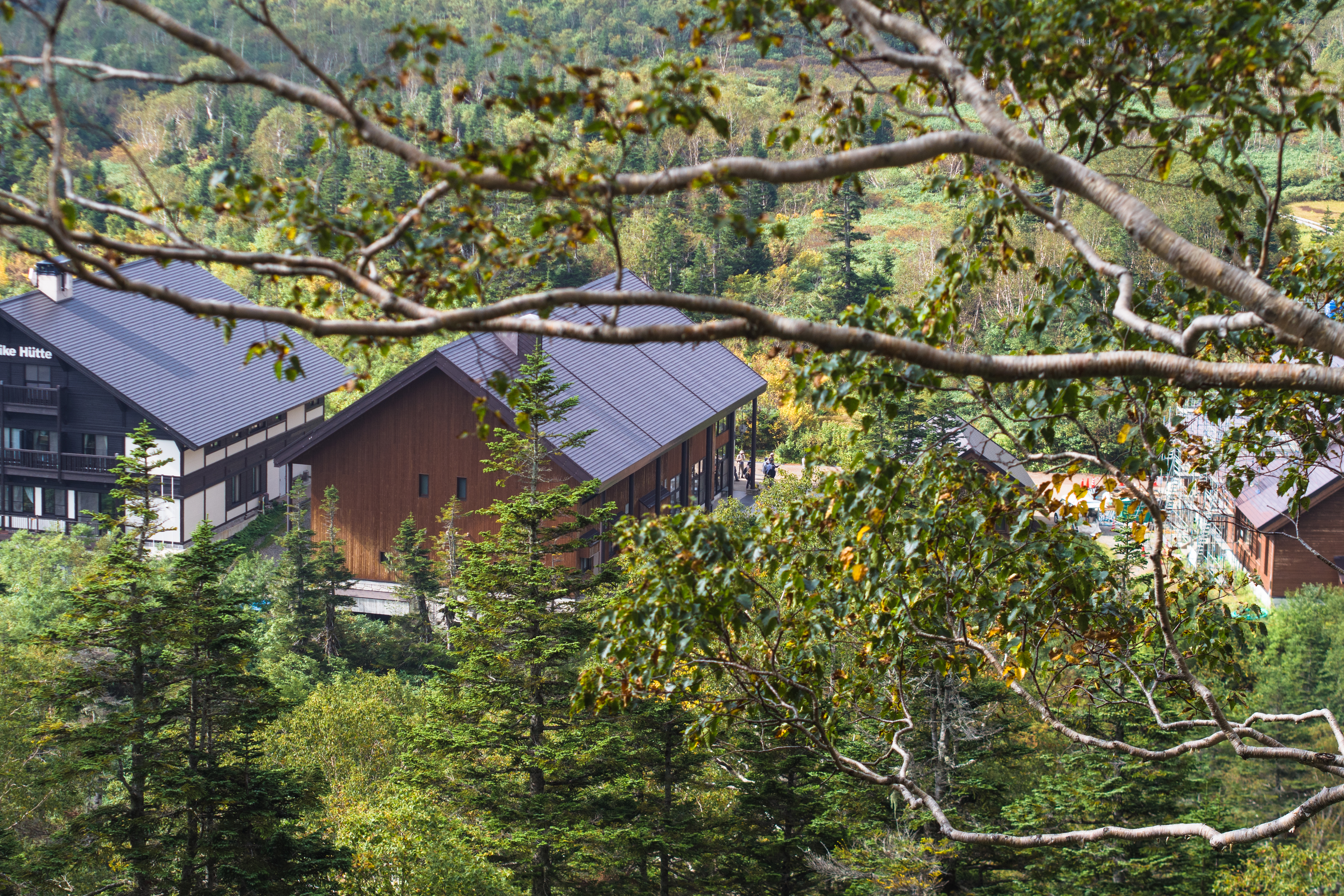
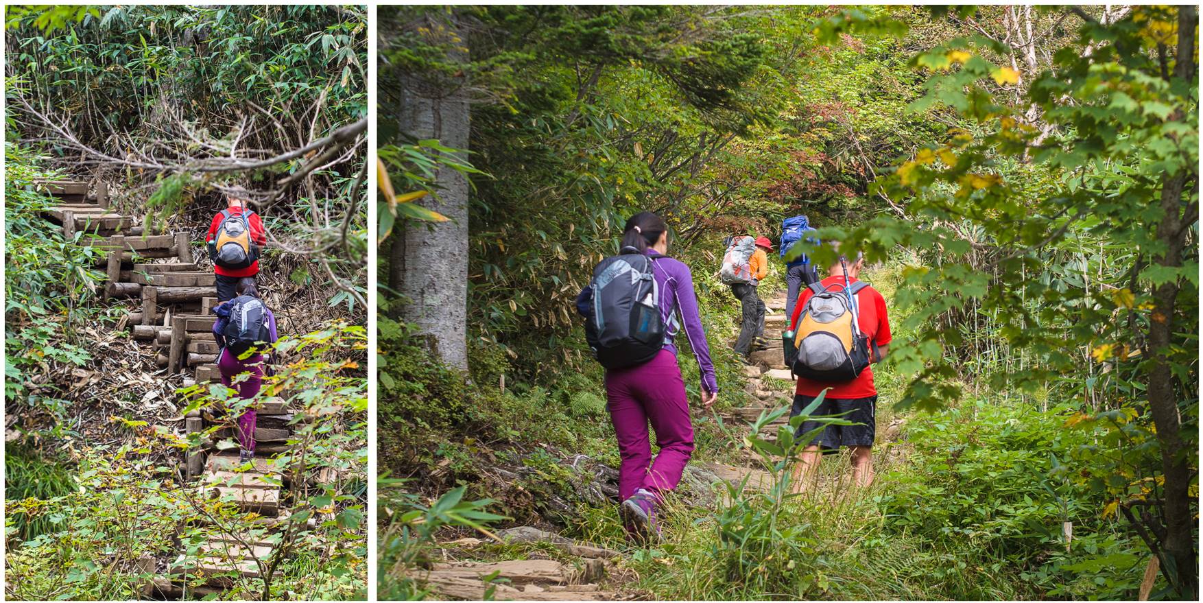
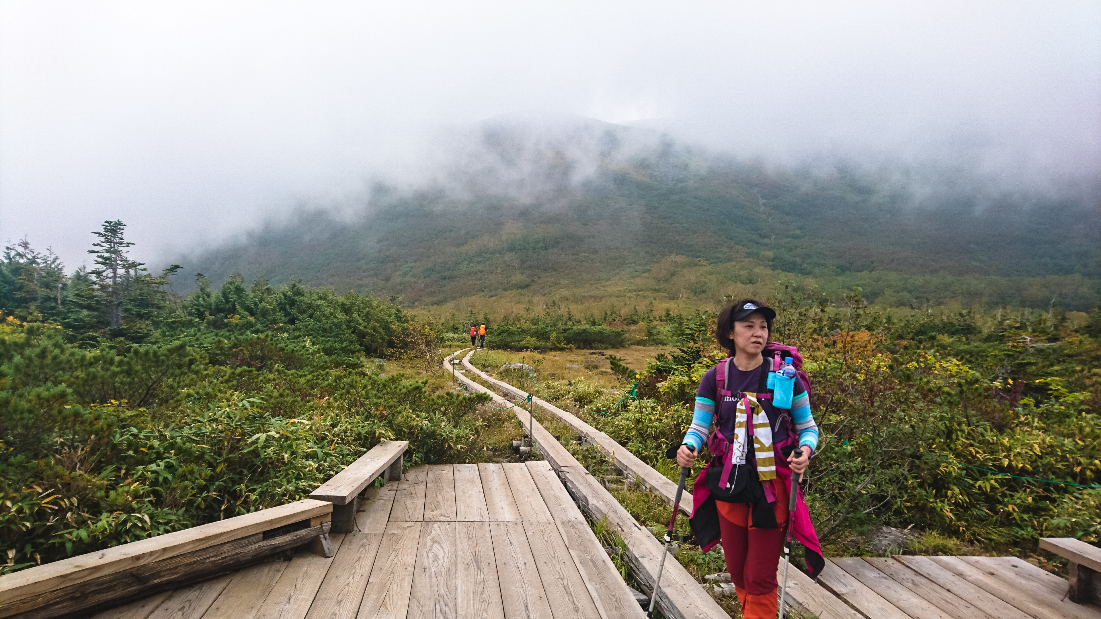
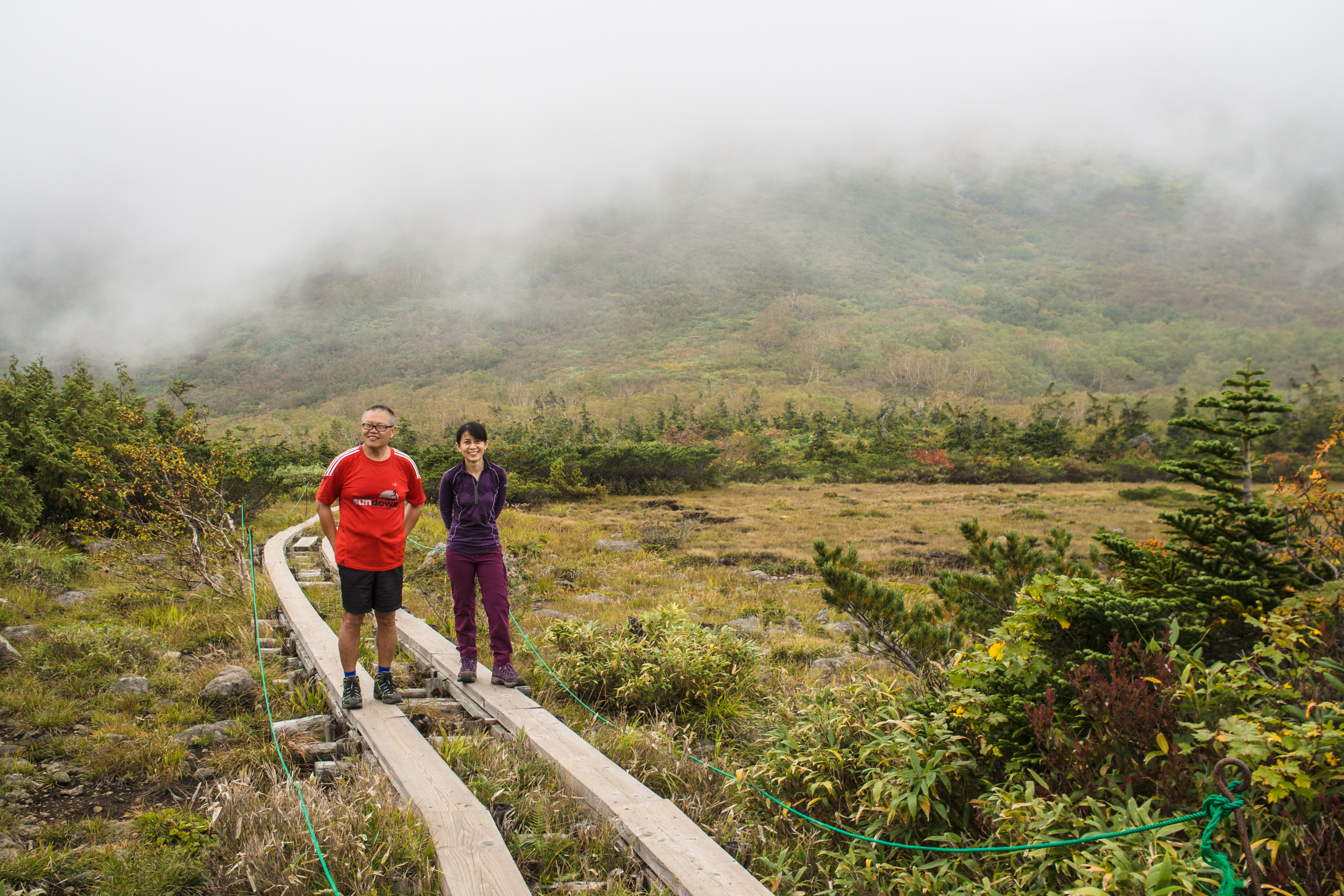
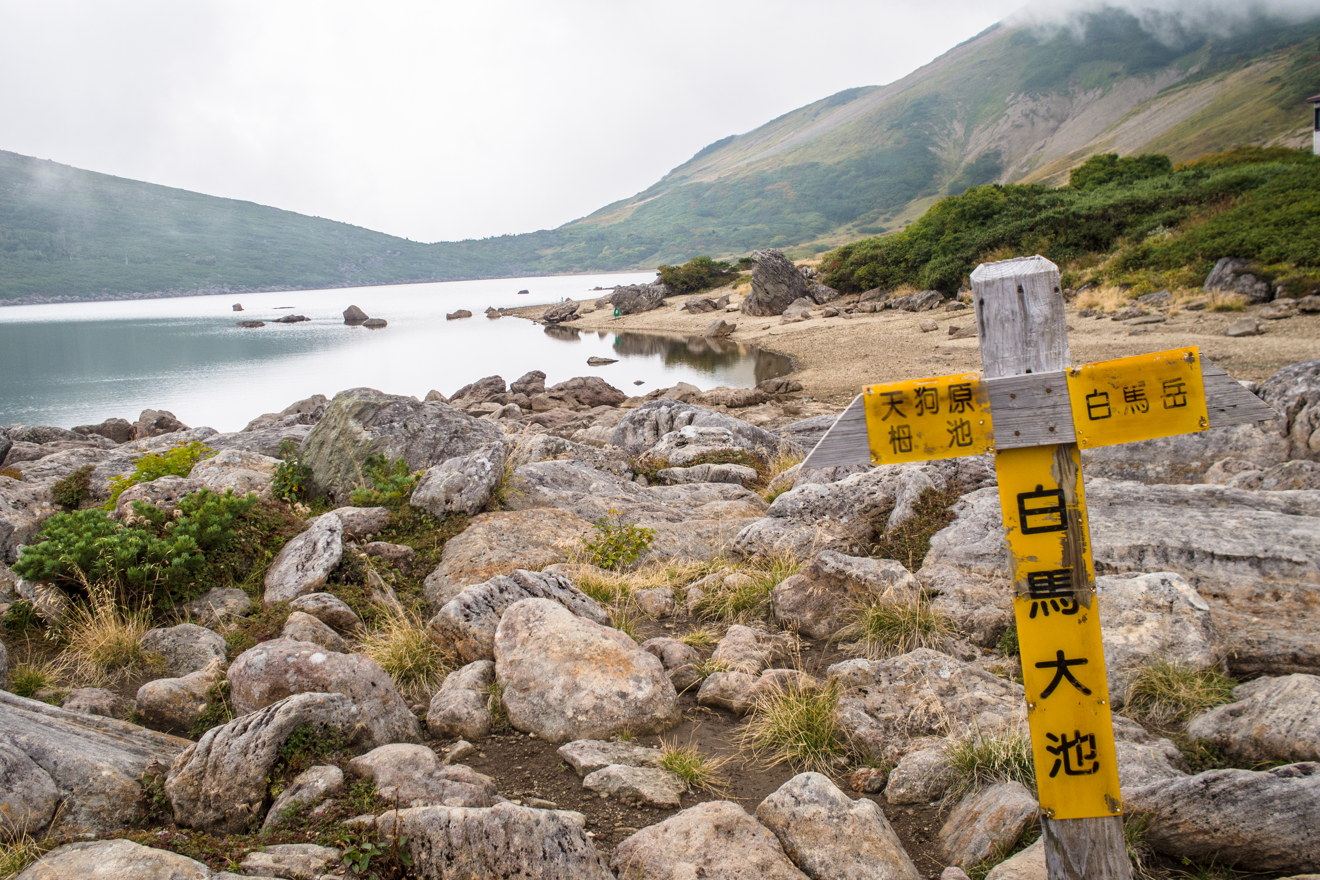
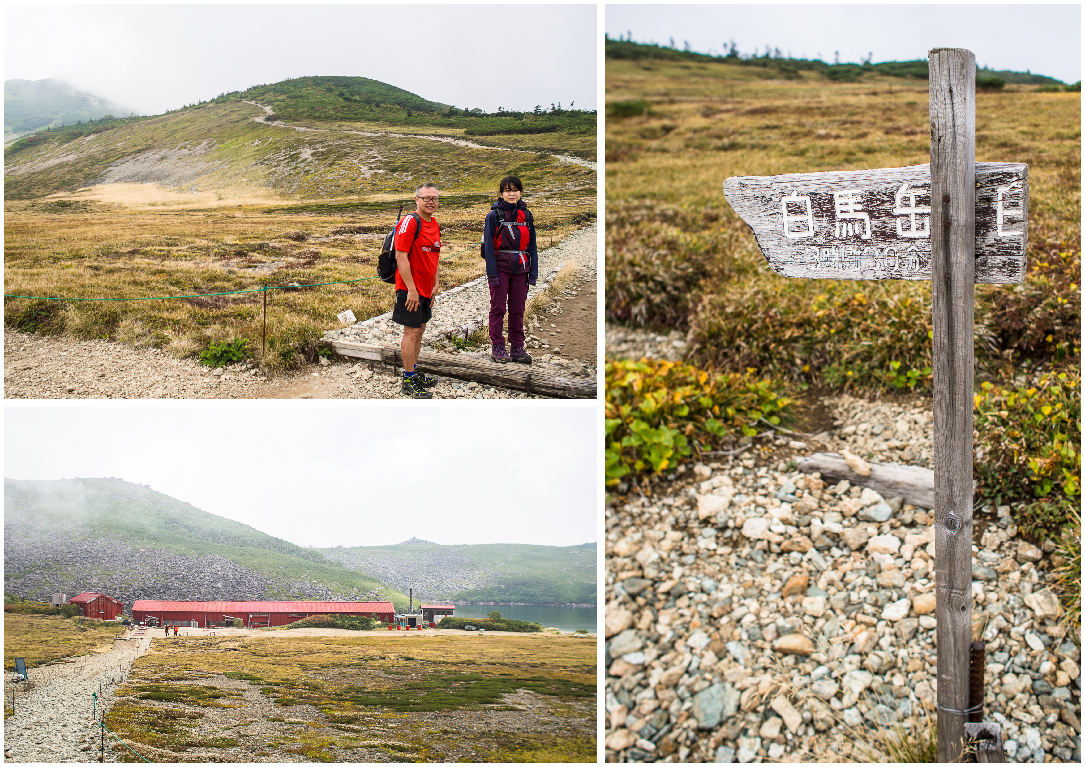
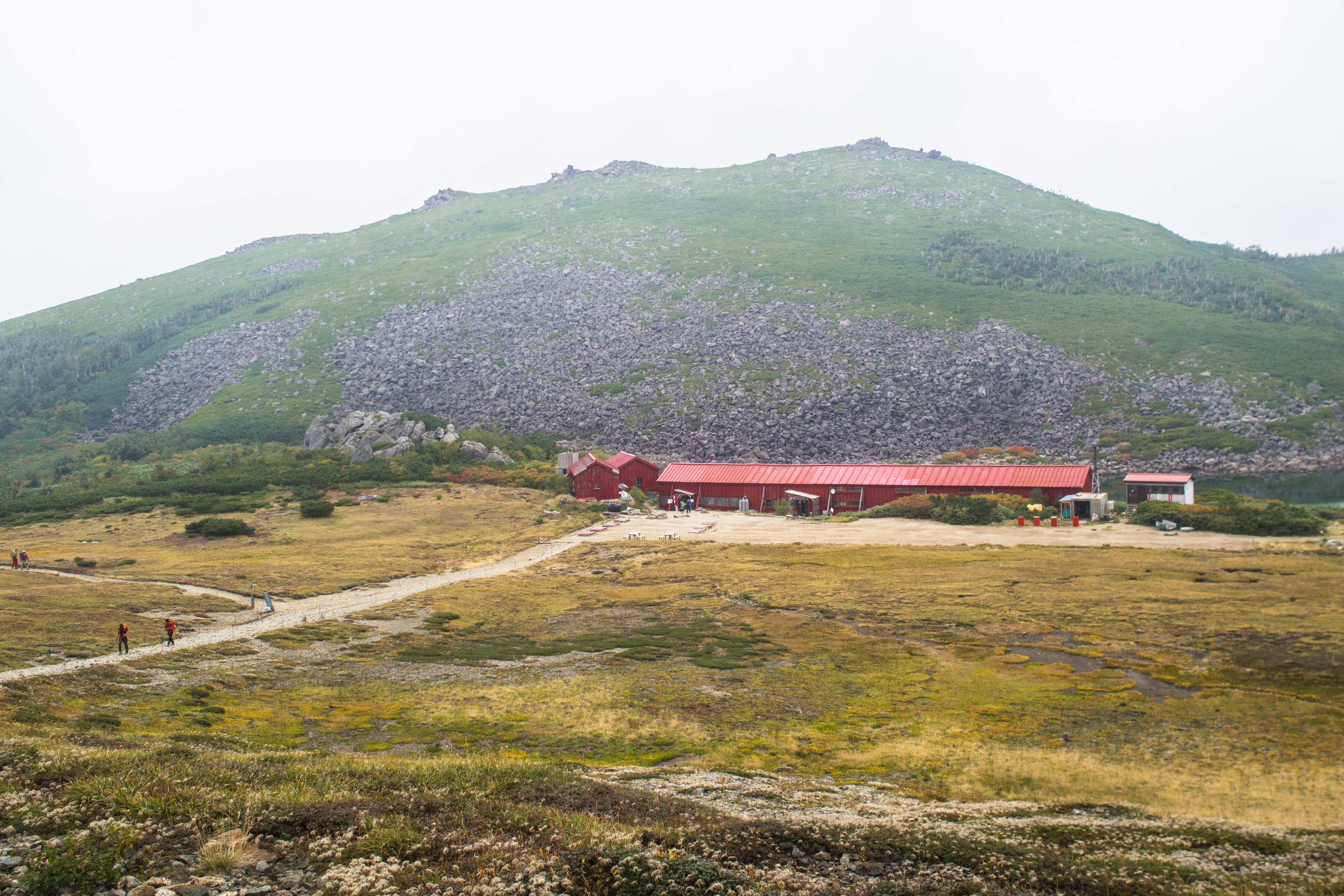
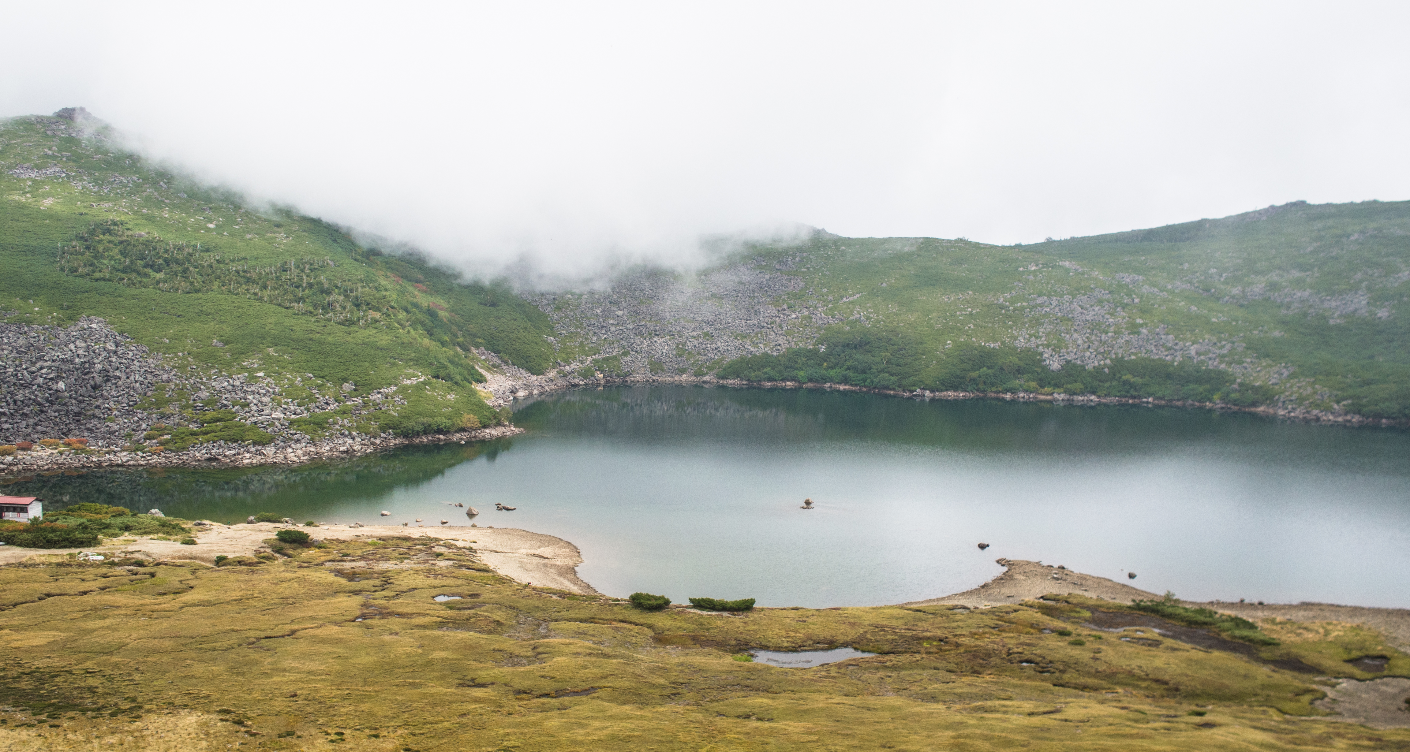
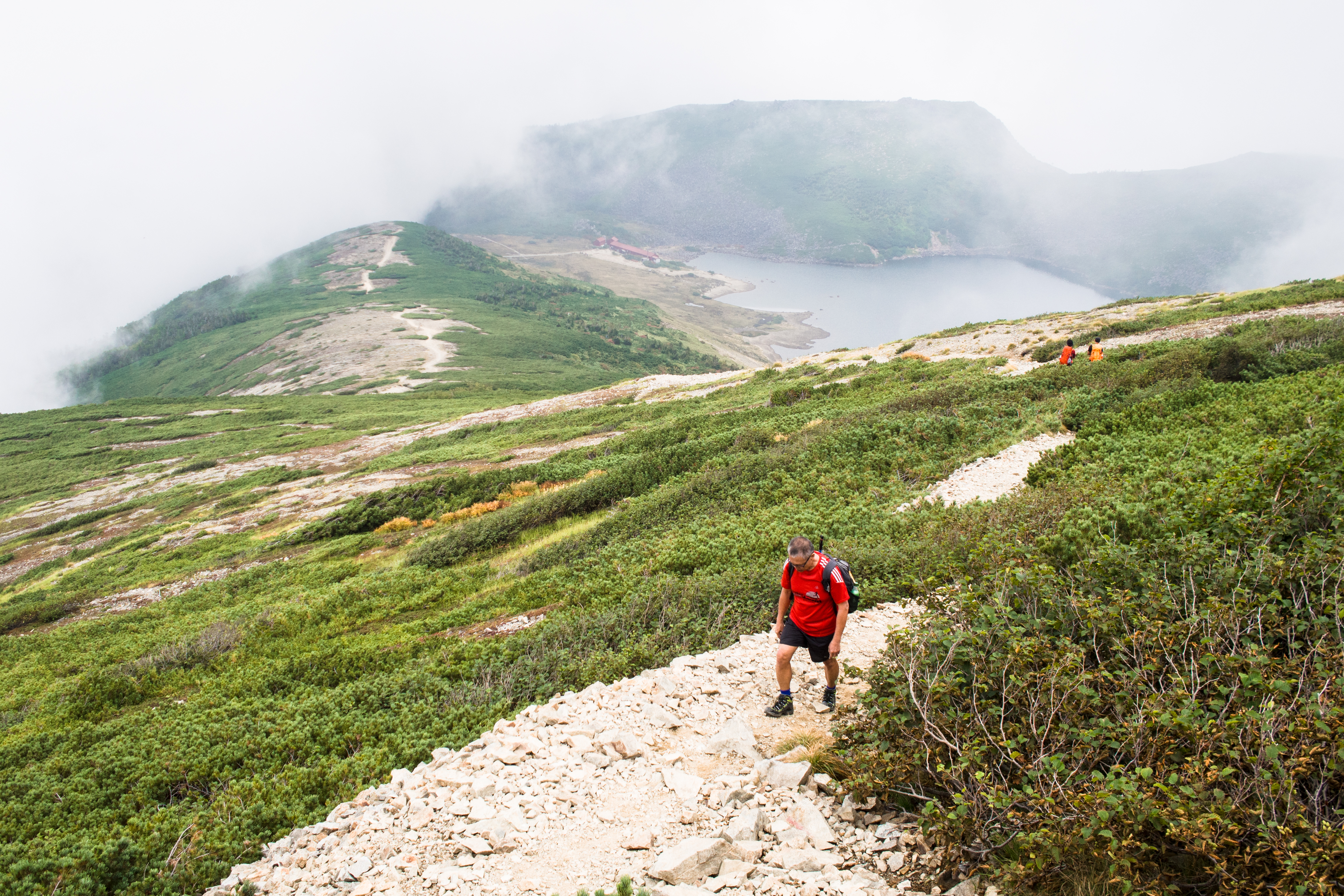
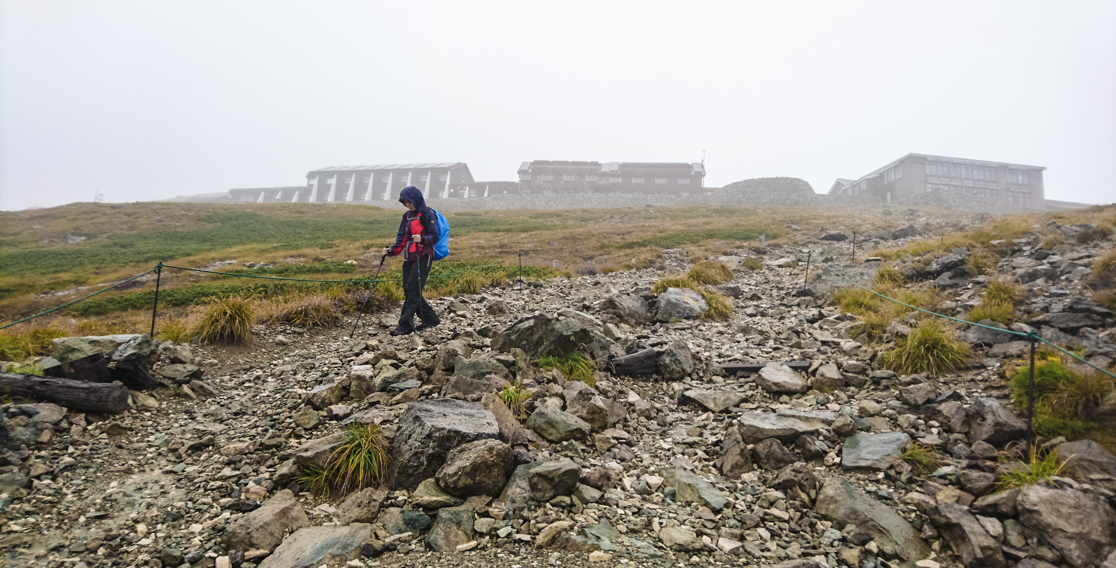
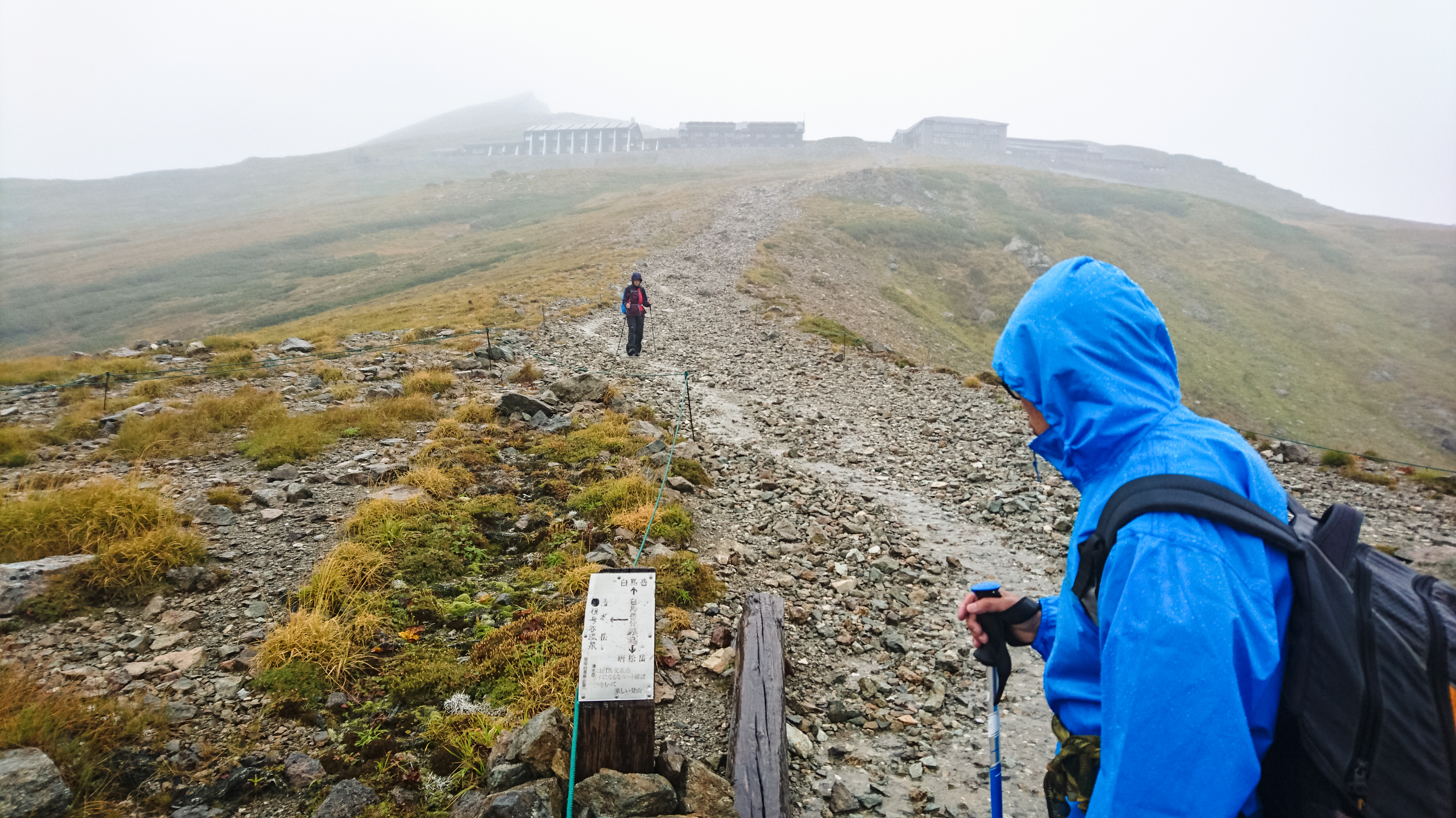
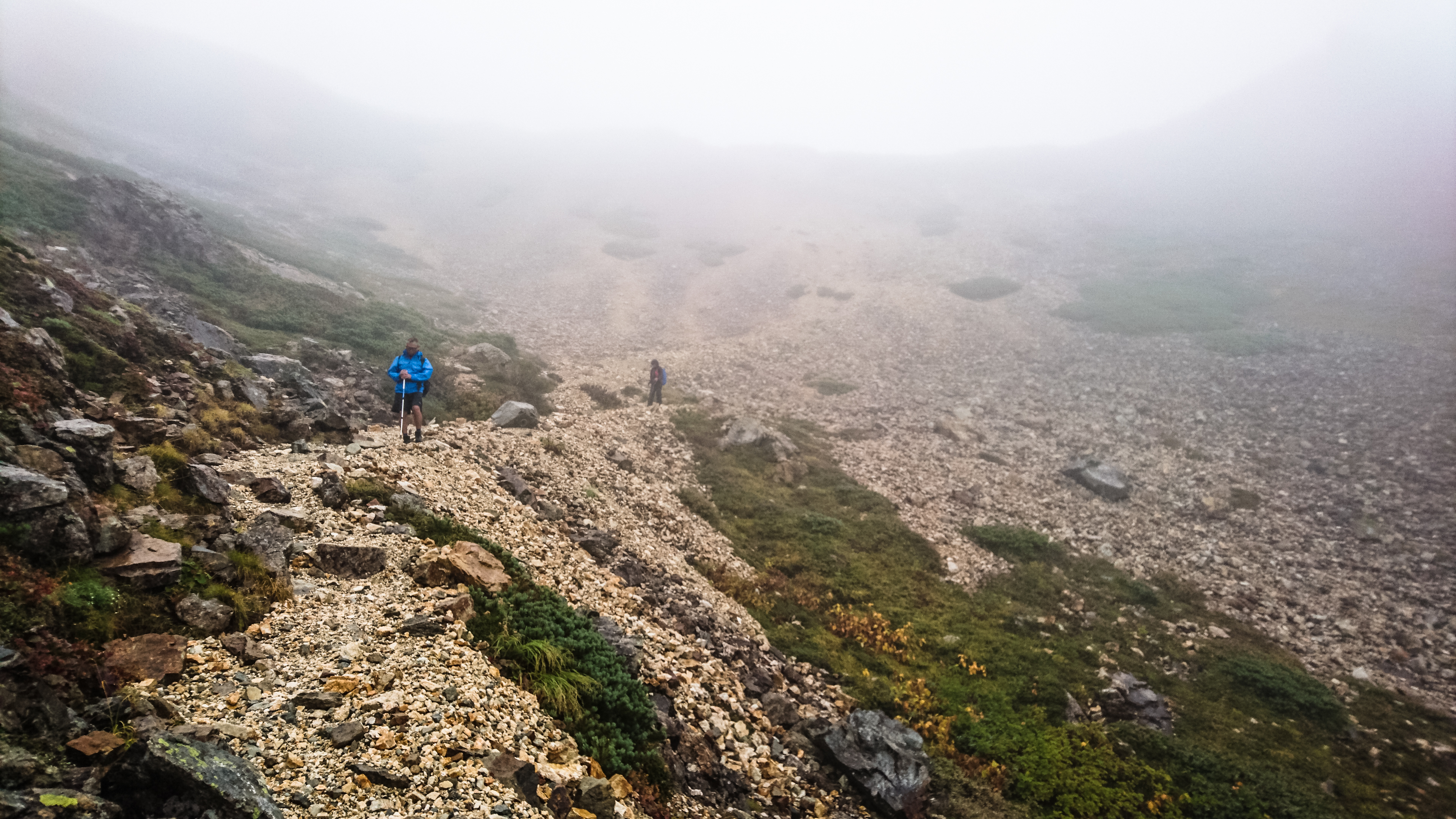
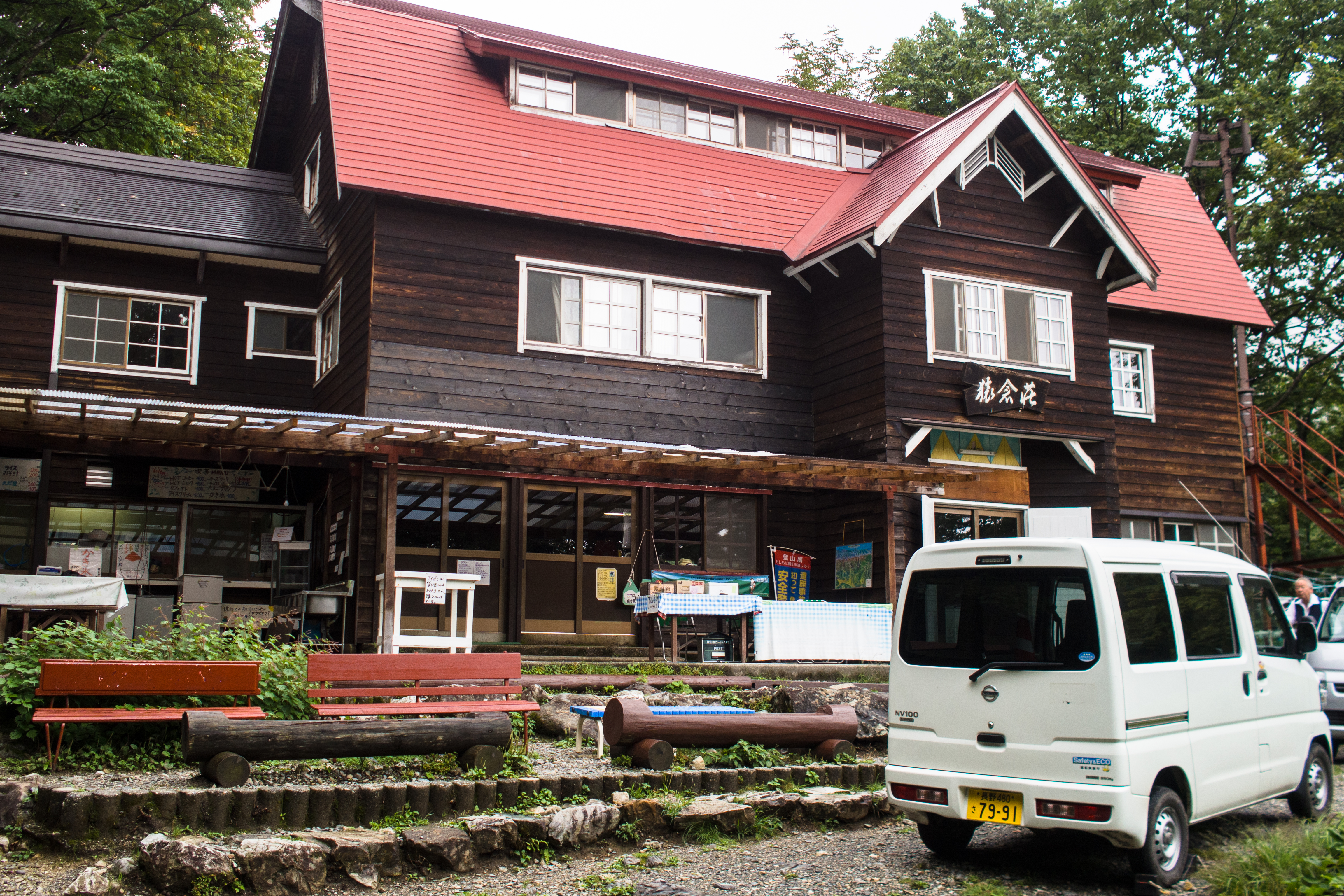
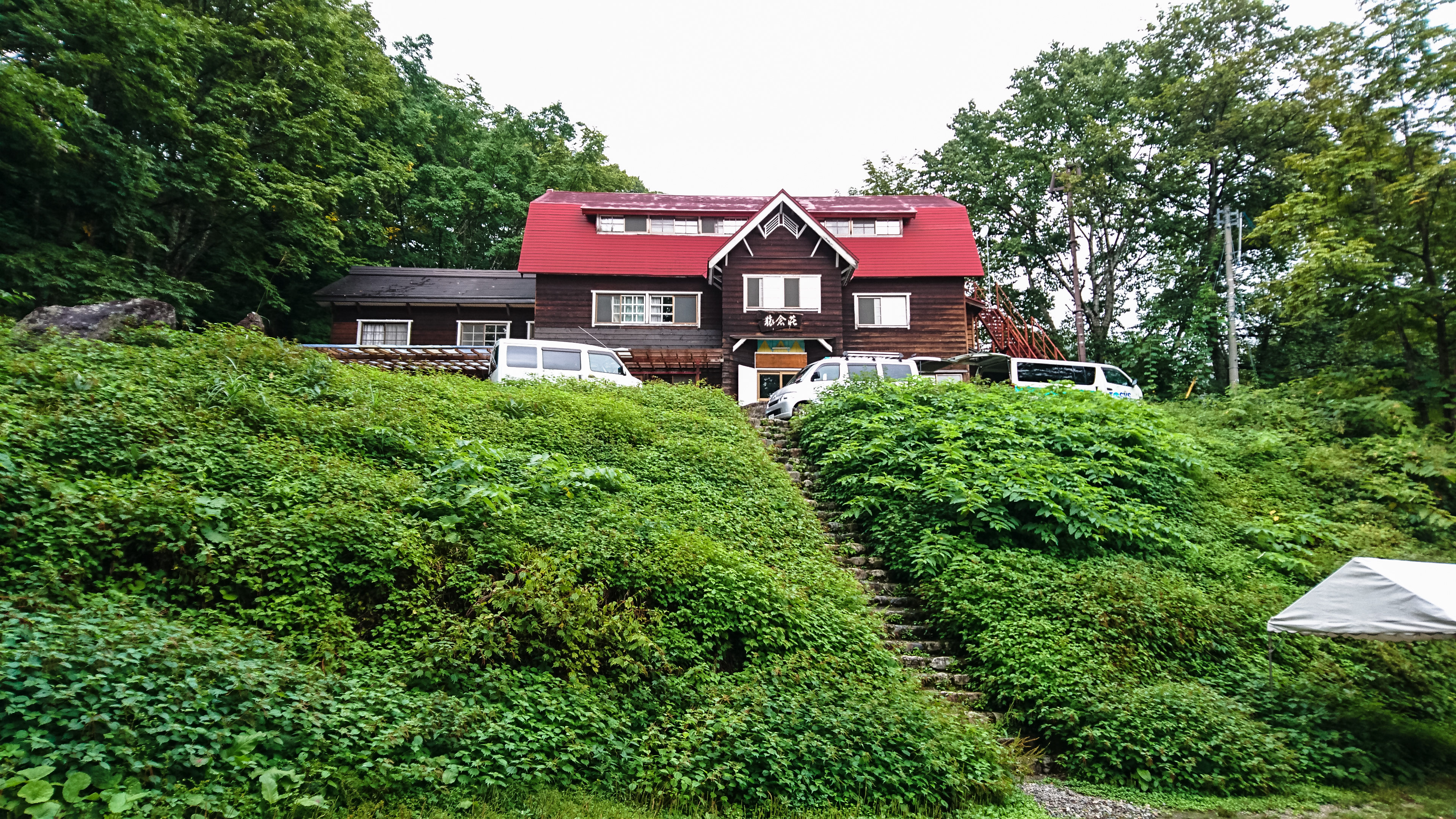
Our immediate destination was Tenguhara 天狗原 (2200m), a beautiful marshland that could be reached after a moderately-paced 2-hour amble over stone steps. After Tenguhara, we had to scale some big boulders before we came to a plateau from where we got a good view of the Hakuba Oike before following the stone-lined trail down to it (another hour). We took a quick lunch at Hakuba Oike Sanso 白馬大池山荘 (2380m) then got ready to tackle the tougher part of the day’s hike.
leaving those huts behind
start of the trail
it’s a little steep but no sweat
tenguhara
a short photo break before heading up

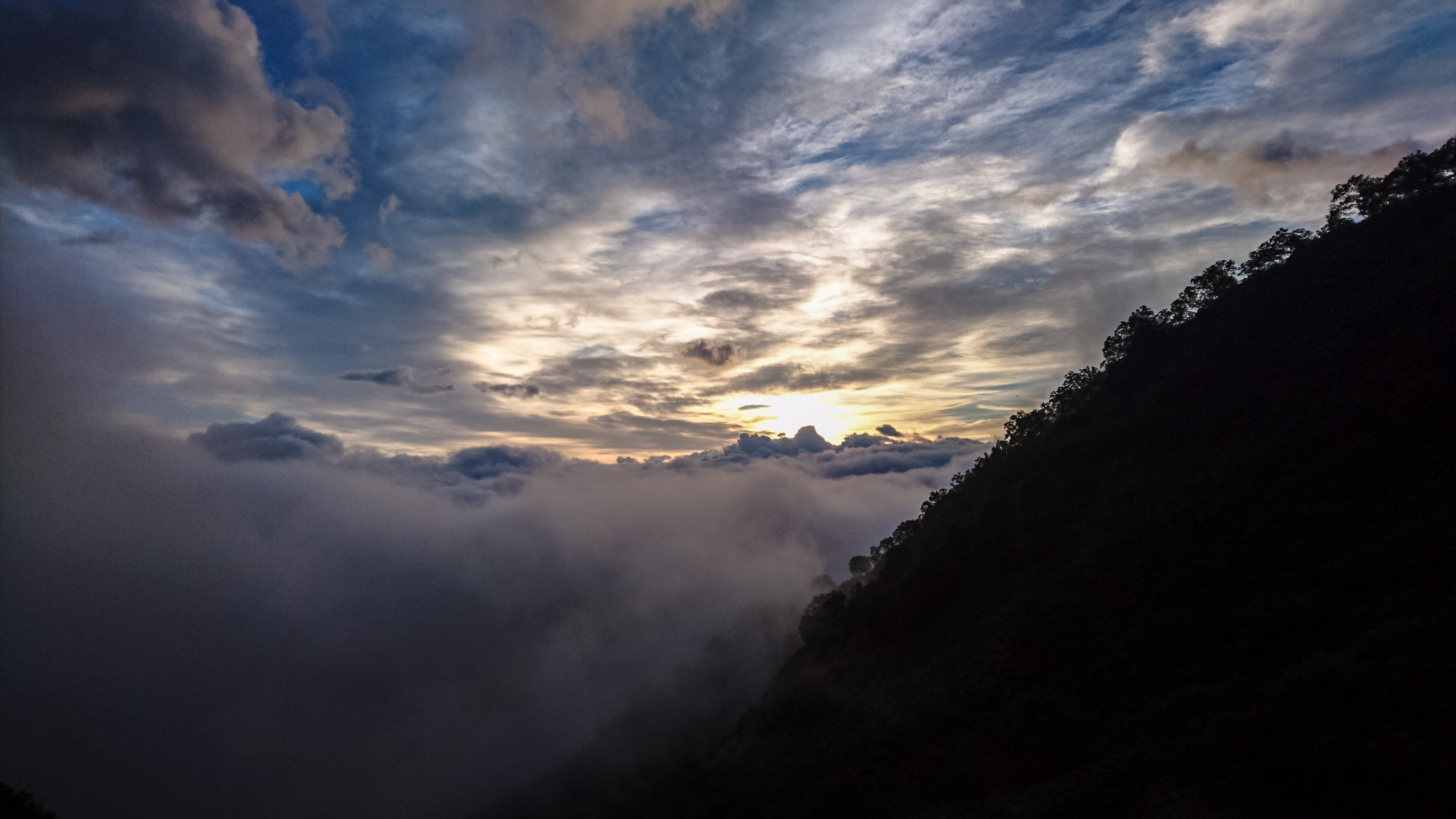
hakuba oike or kazefuki oike?
hikers coming down
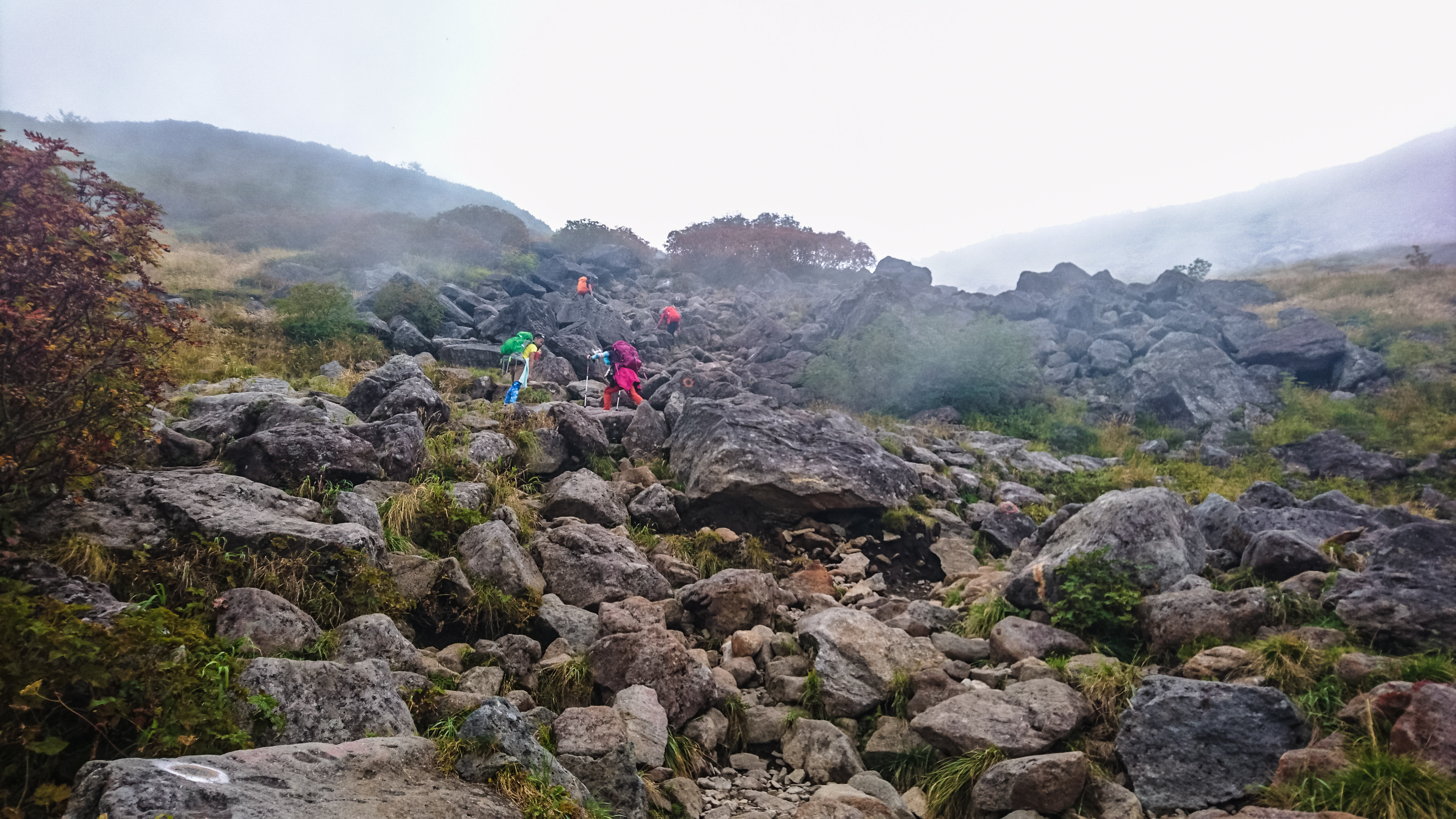
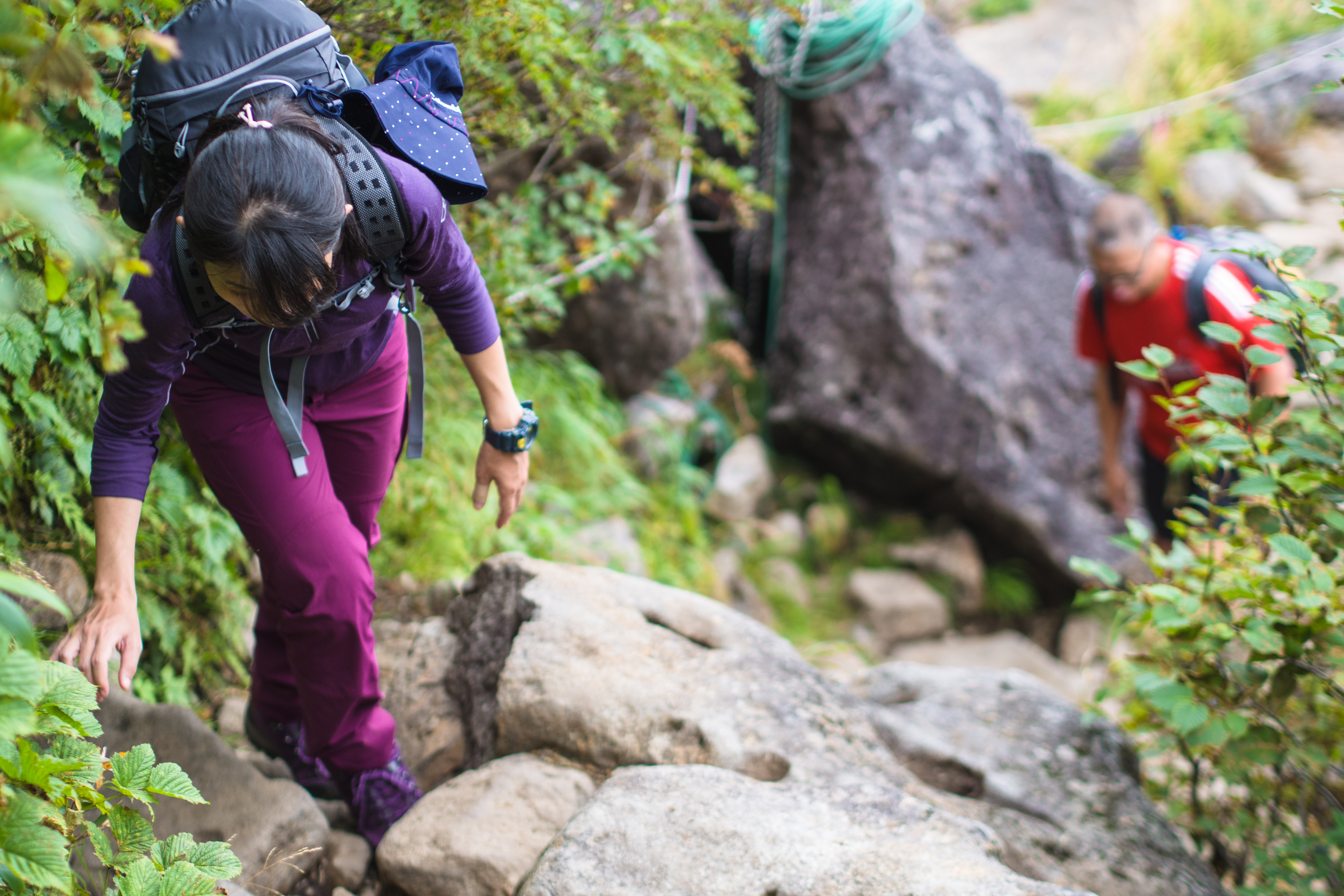
up the ragged rocks
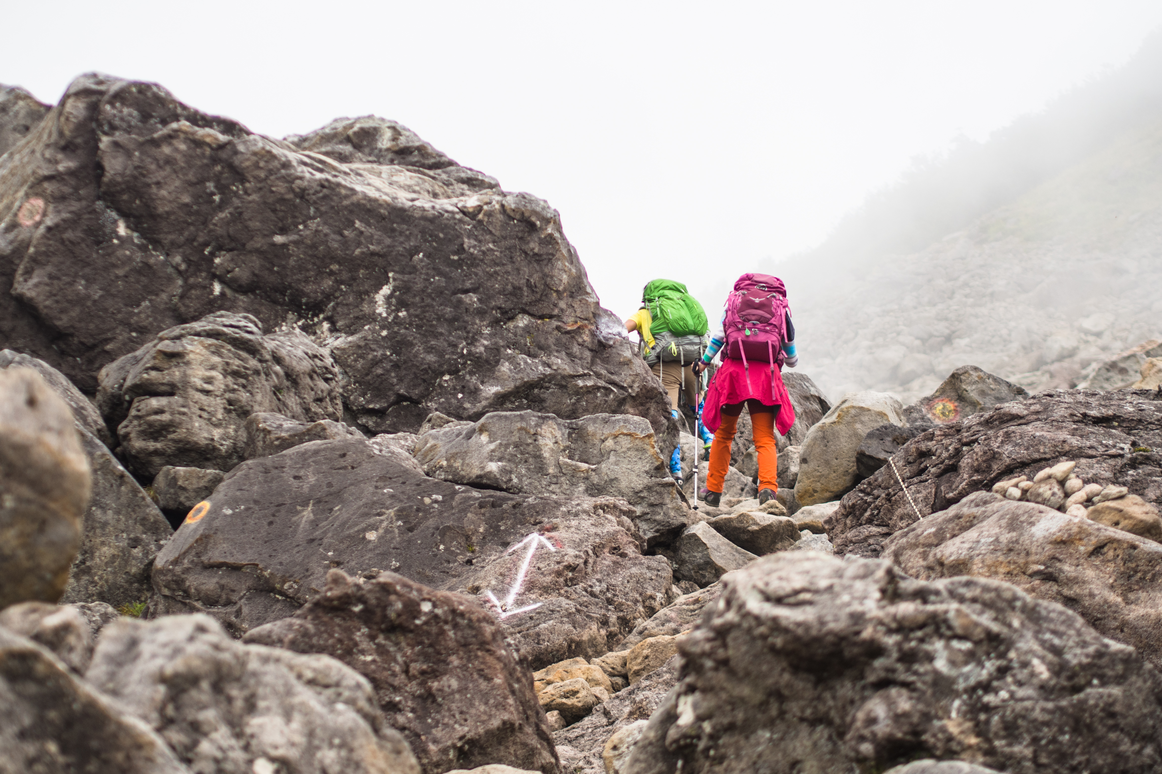
and a few boulders

the right way to admire a lake – channelling mindfulness
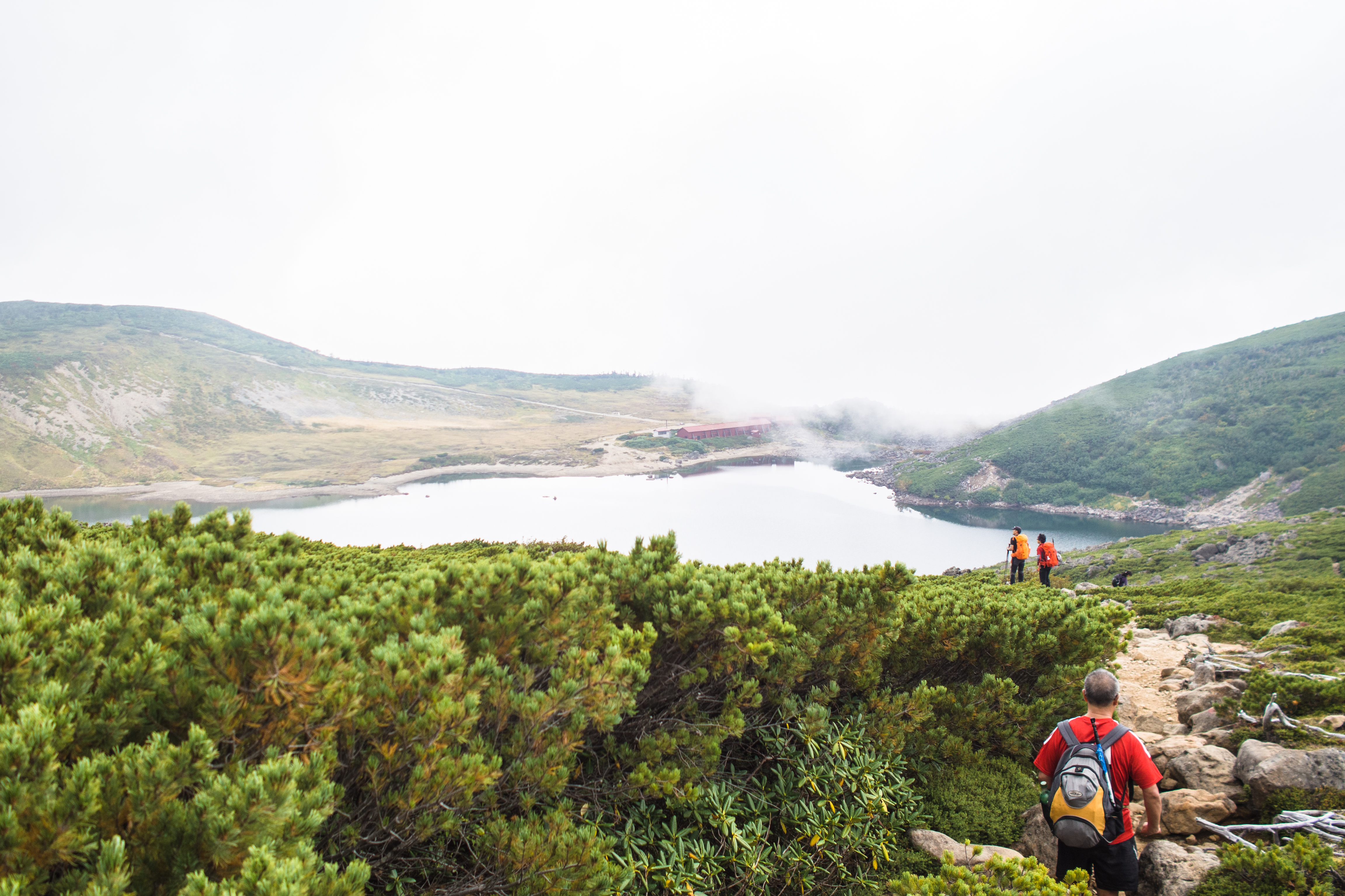
heading down to the lake

reflections – of the hill and trail that we’re gonna have to climb in a while
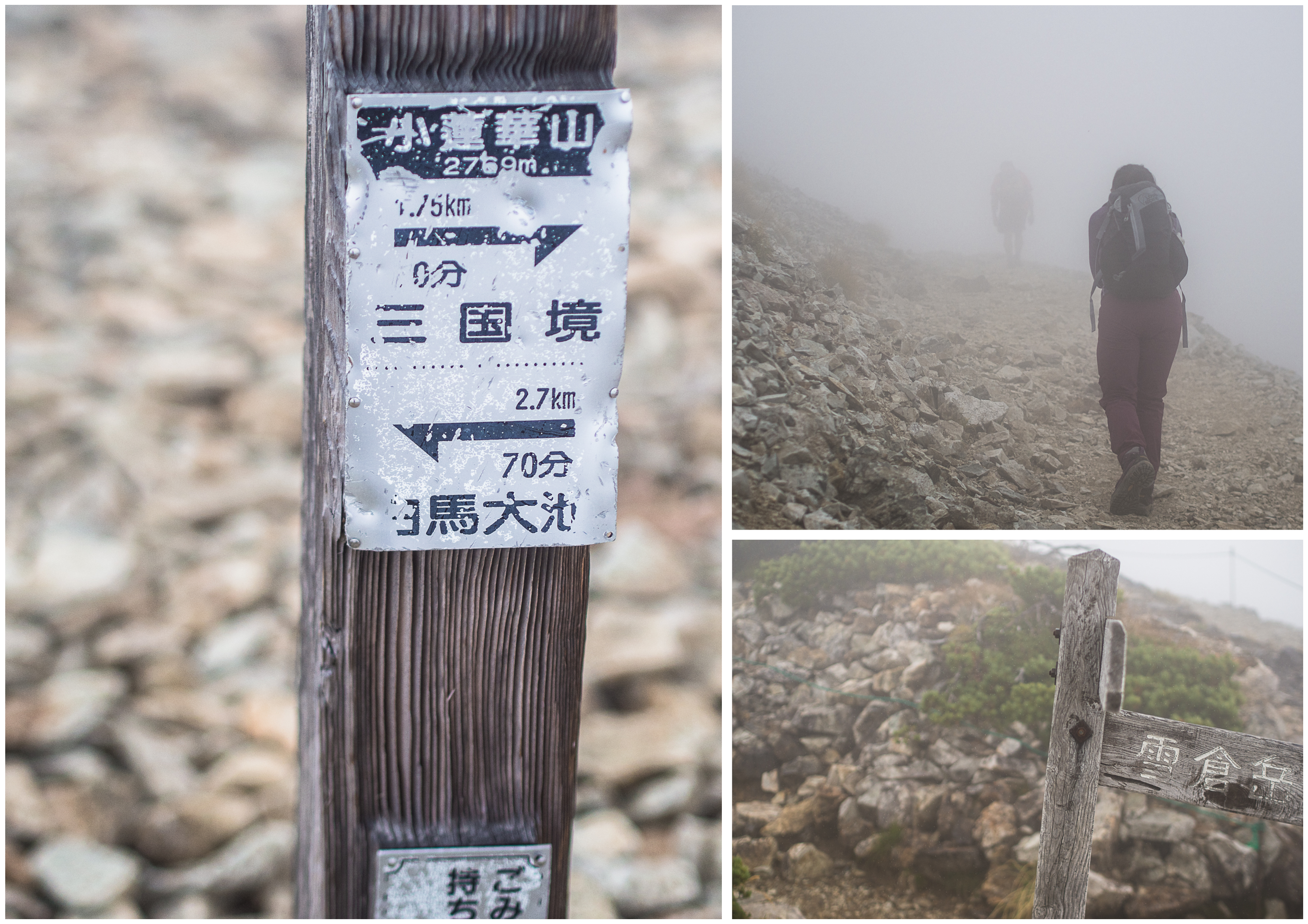
a trail marker
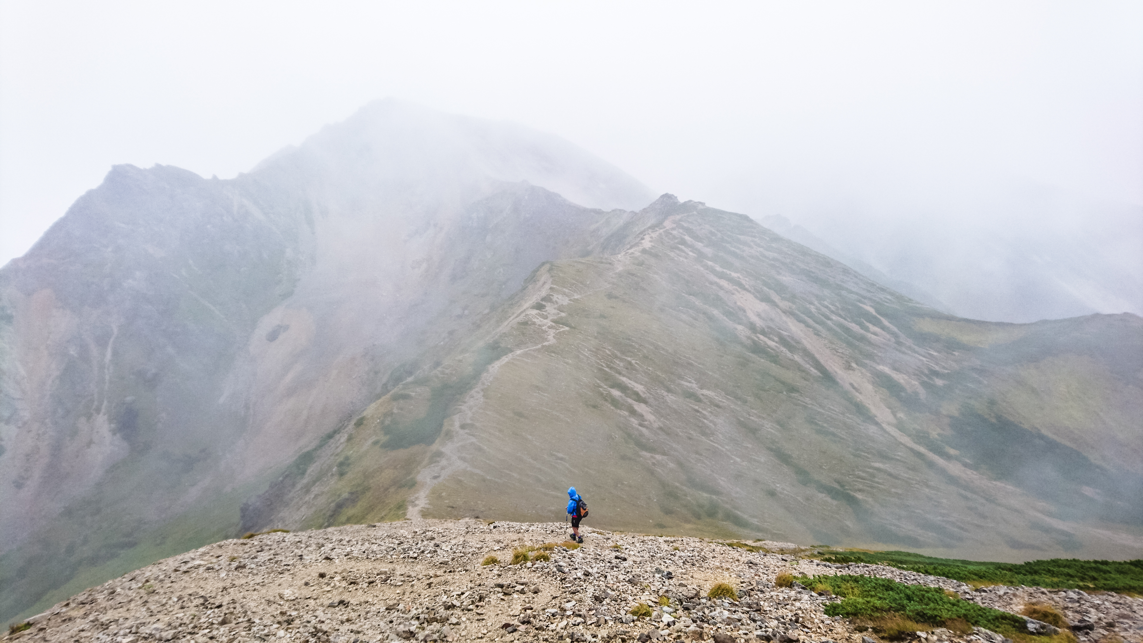
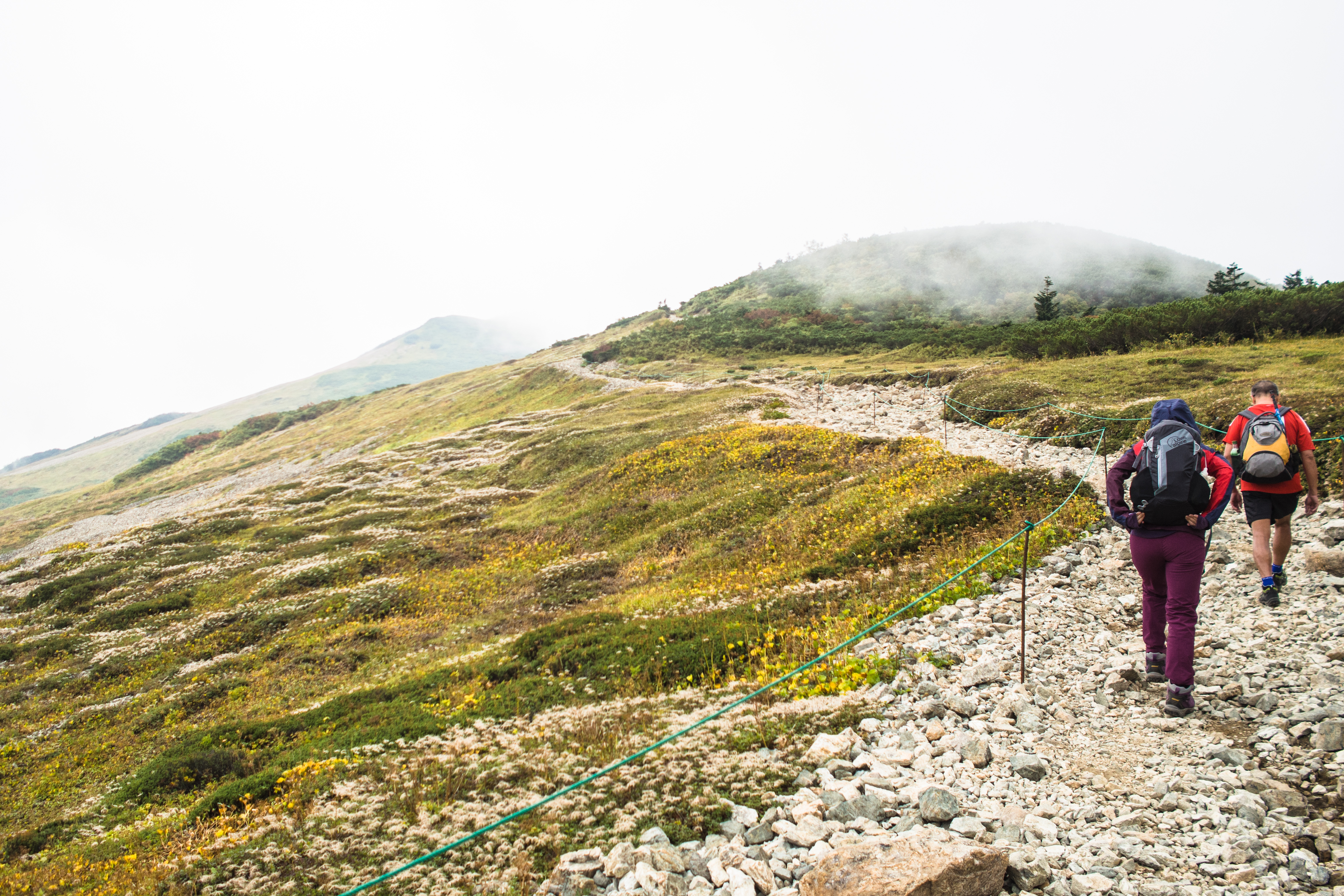
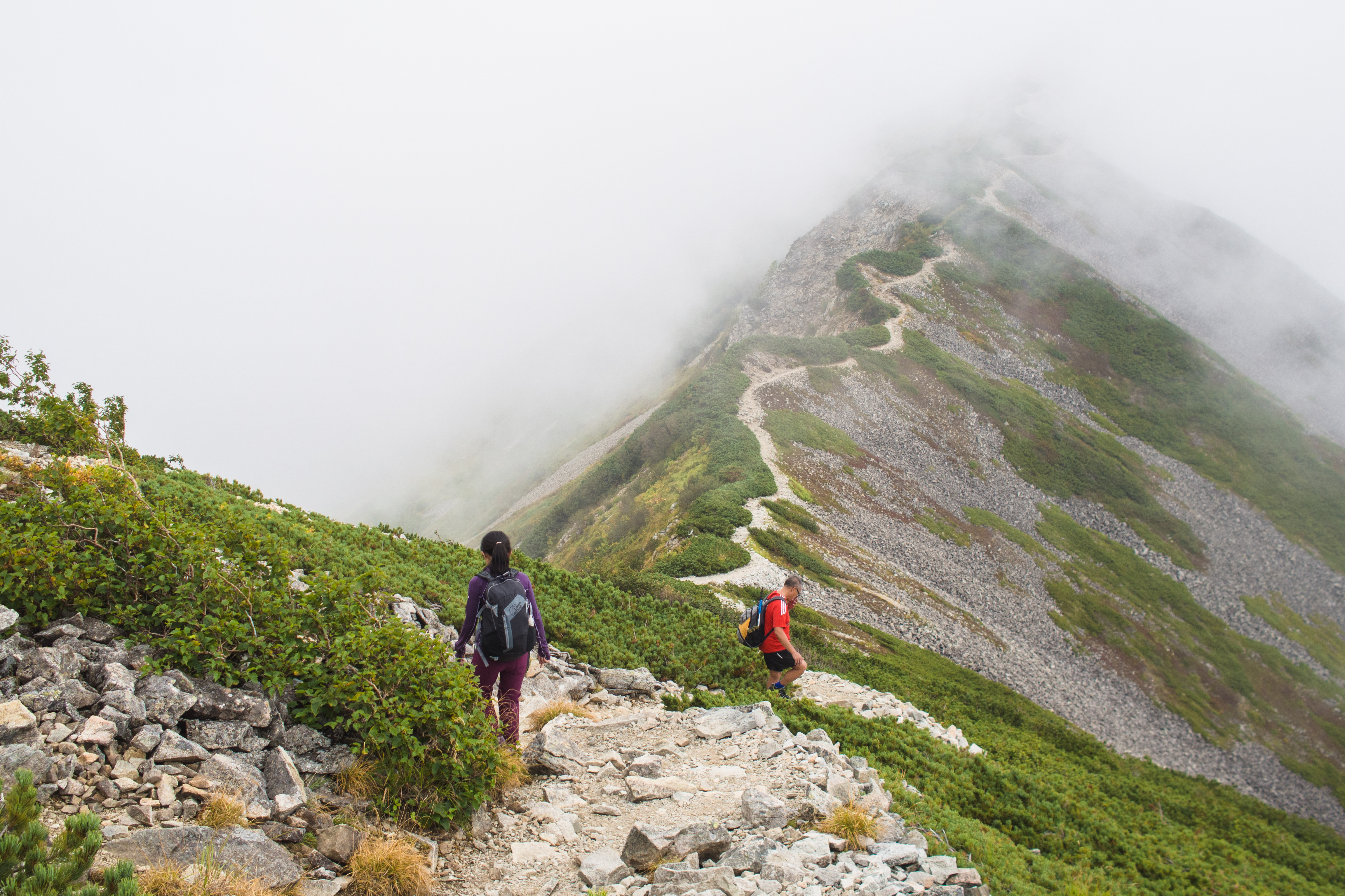
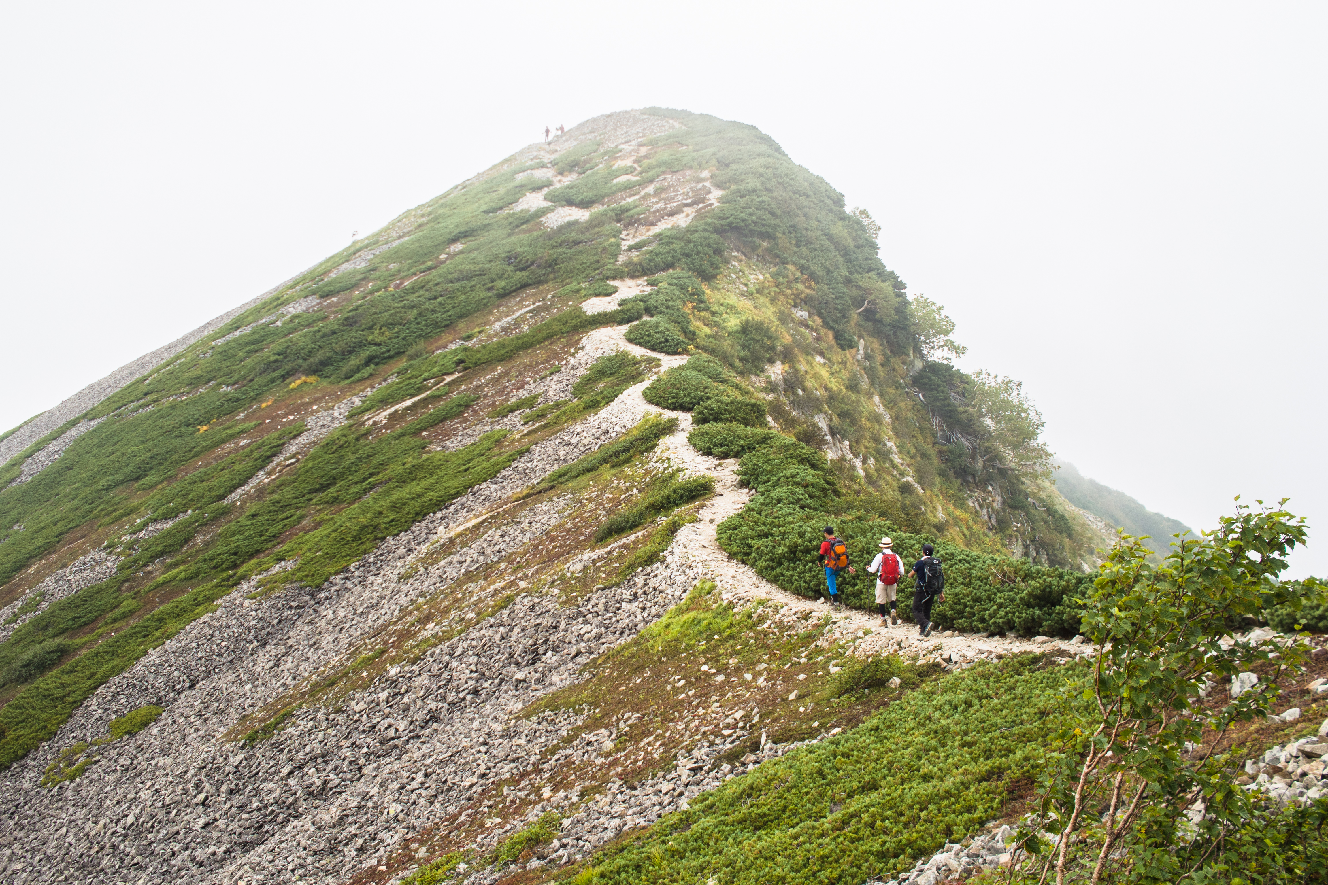
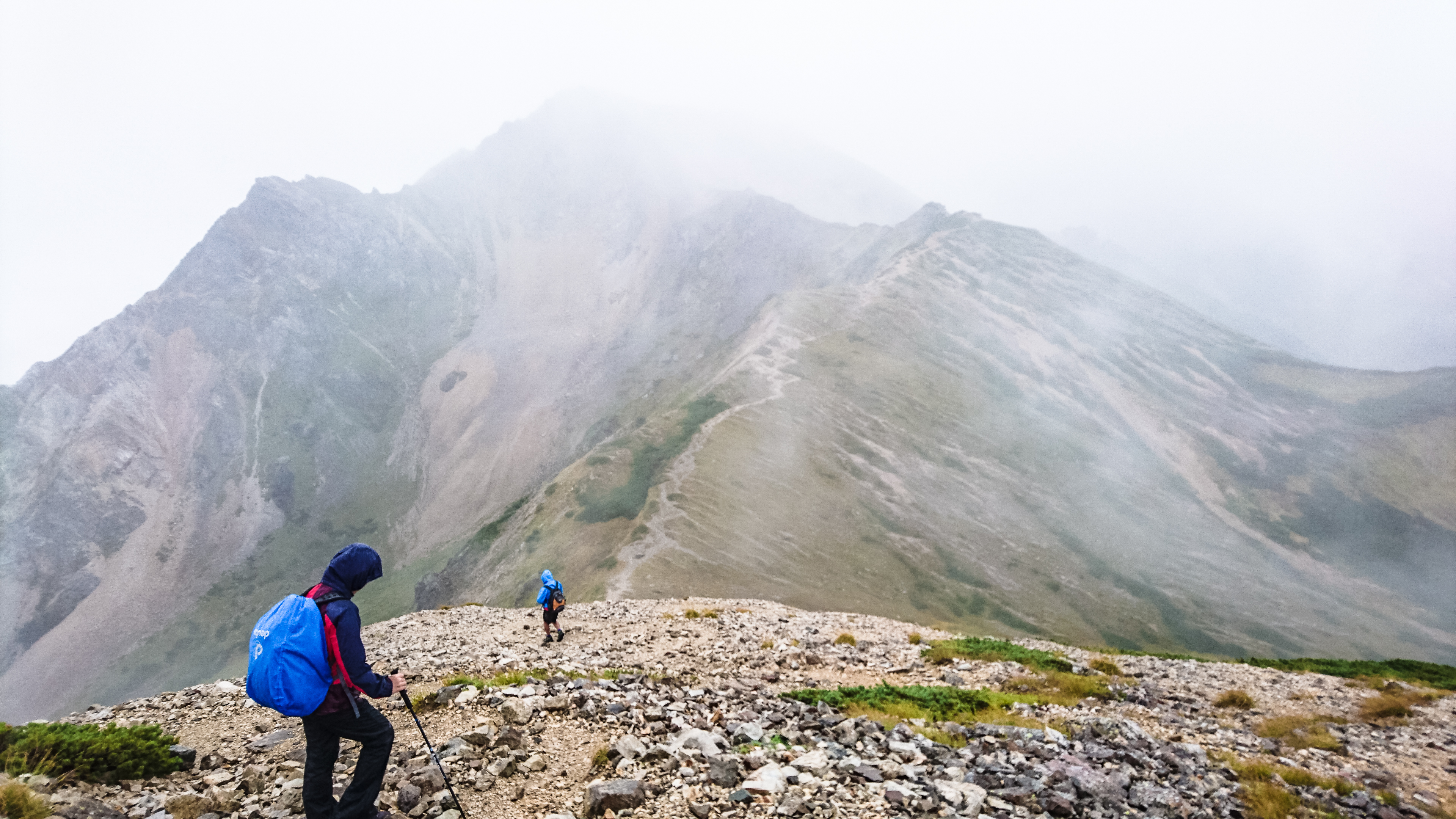
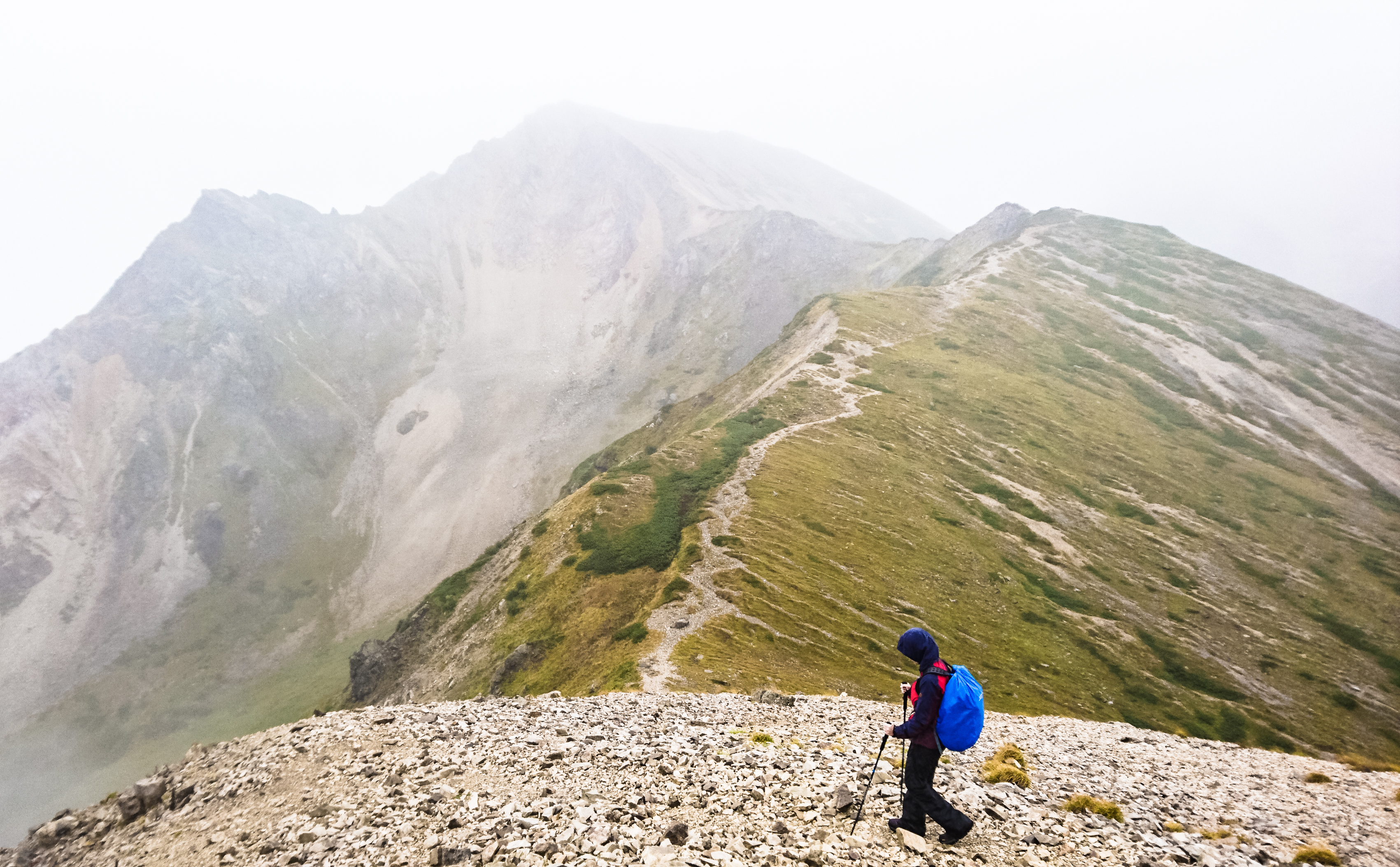
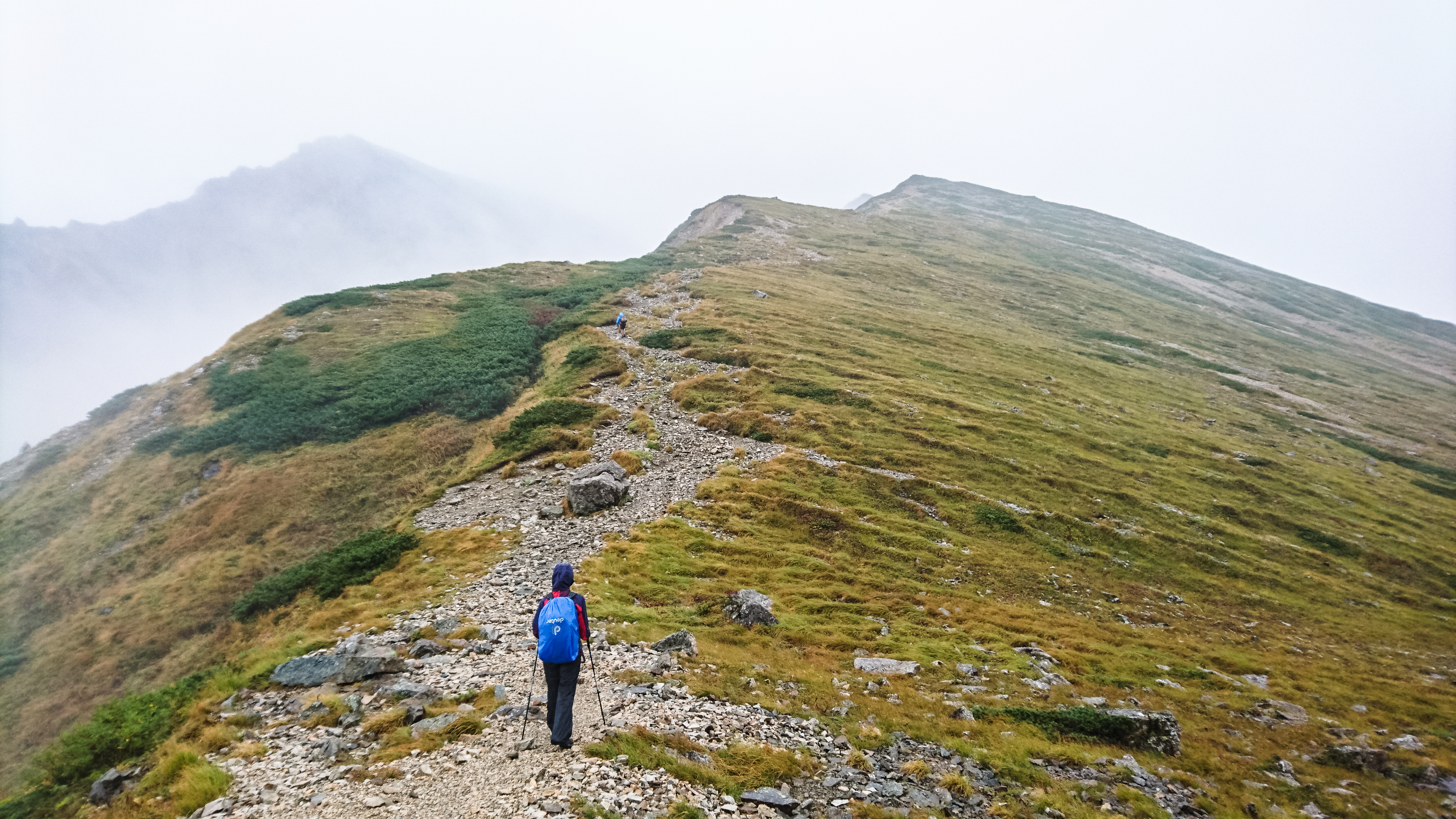
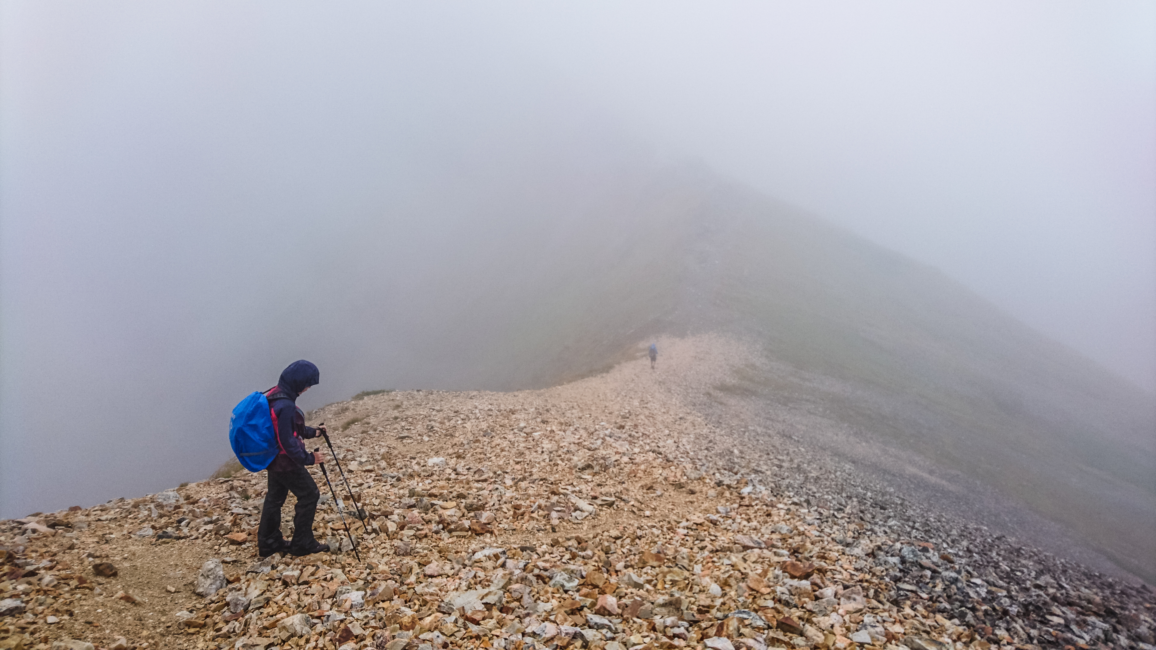
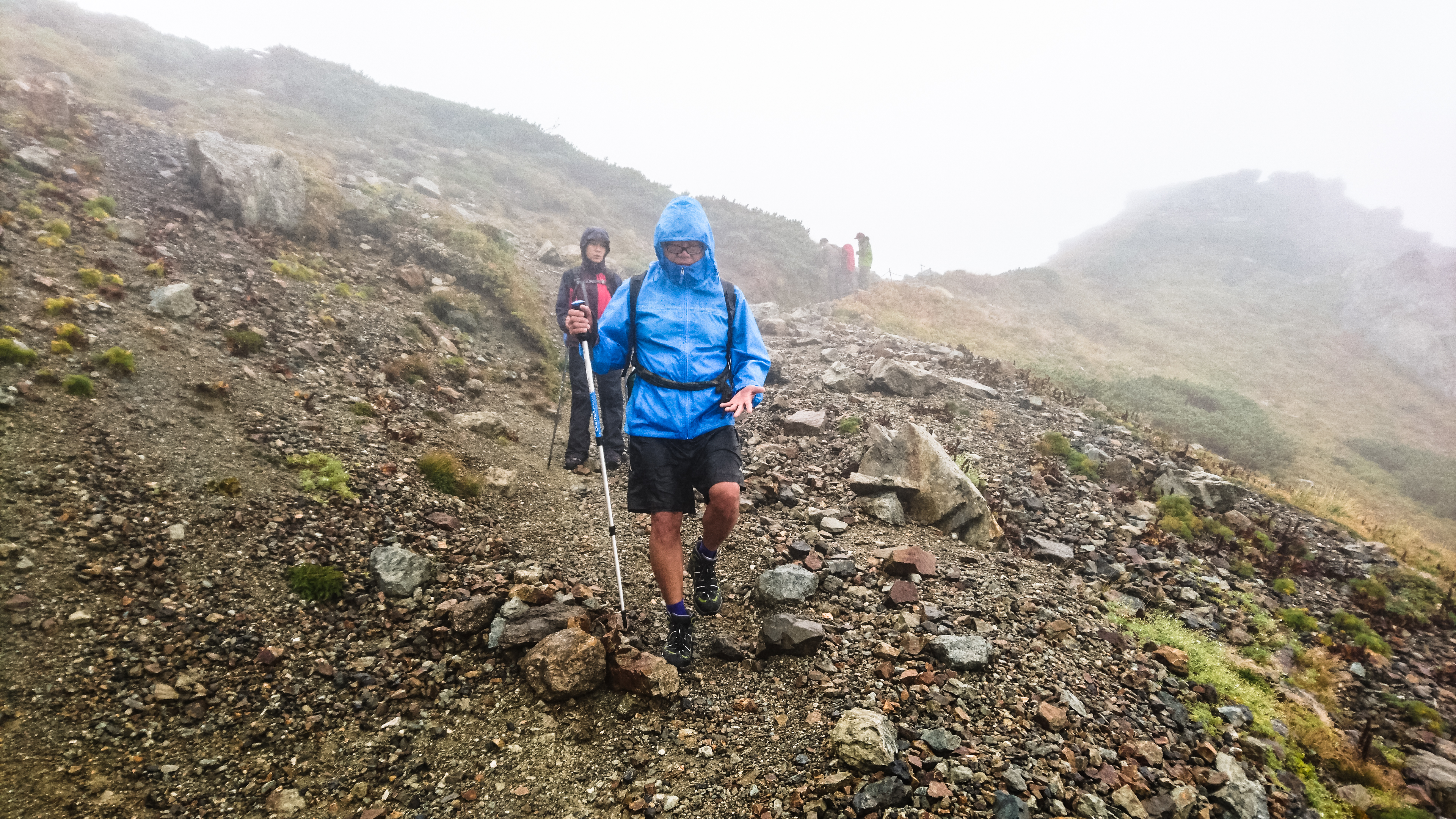
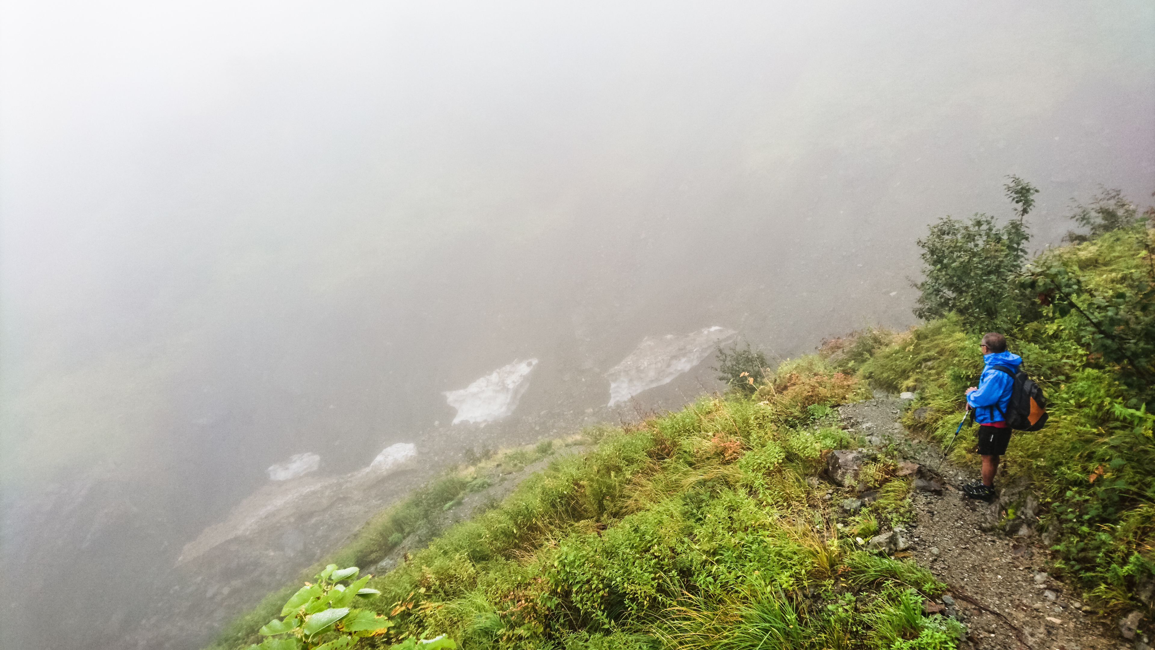
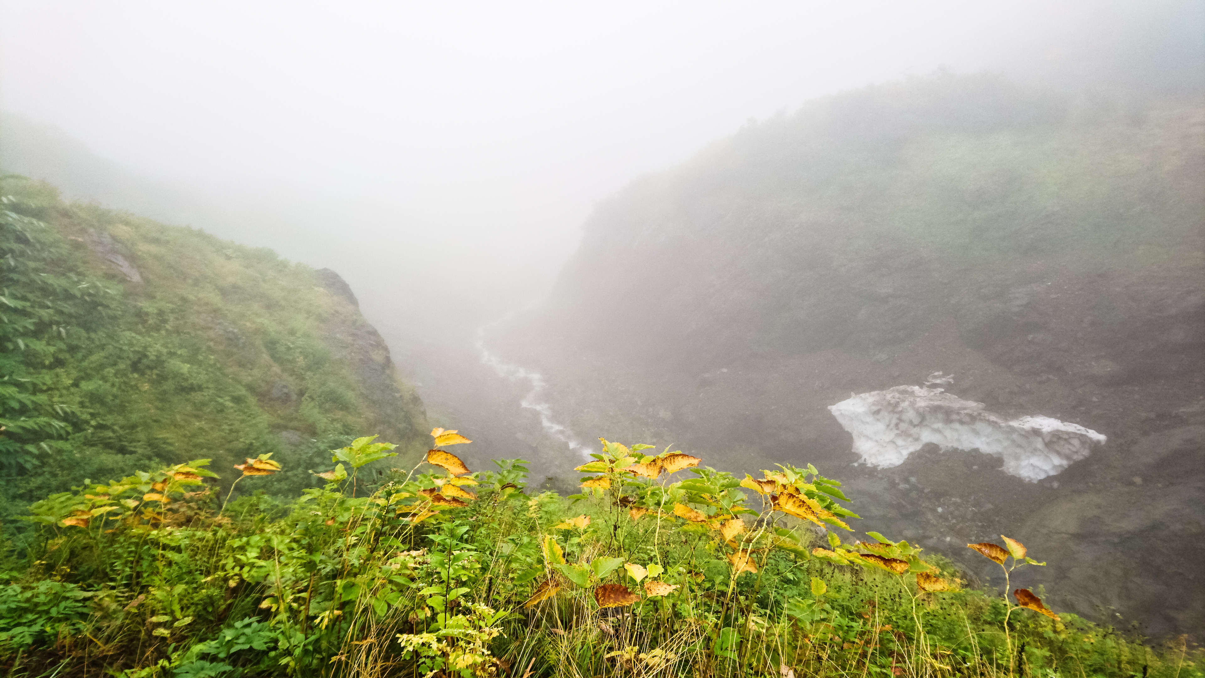
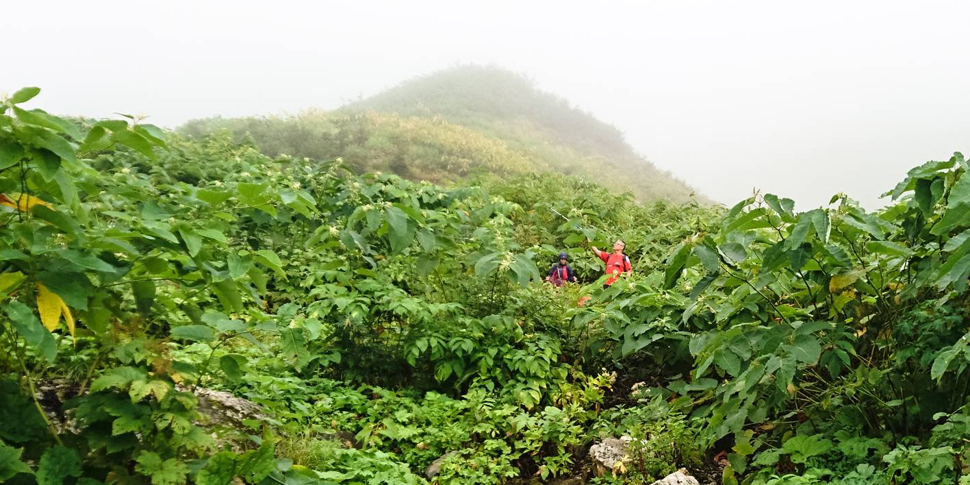
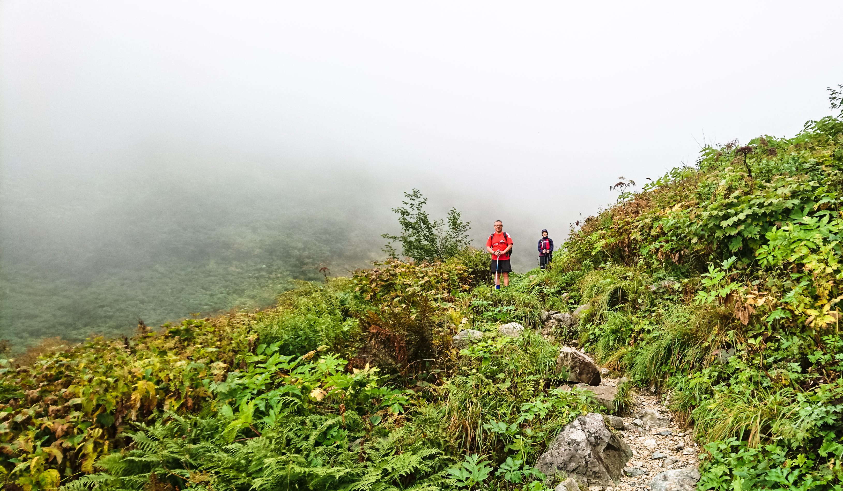
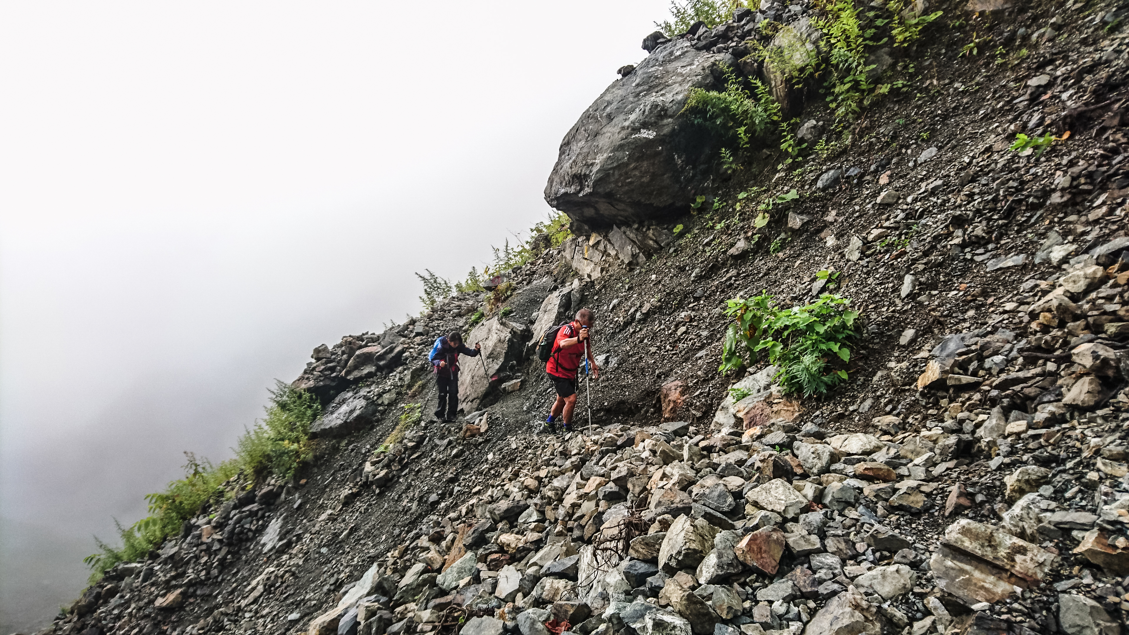
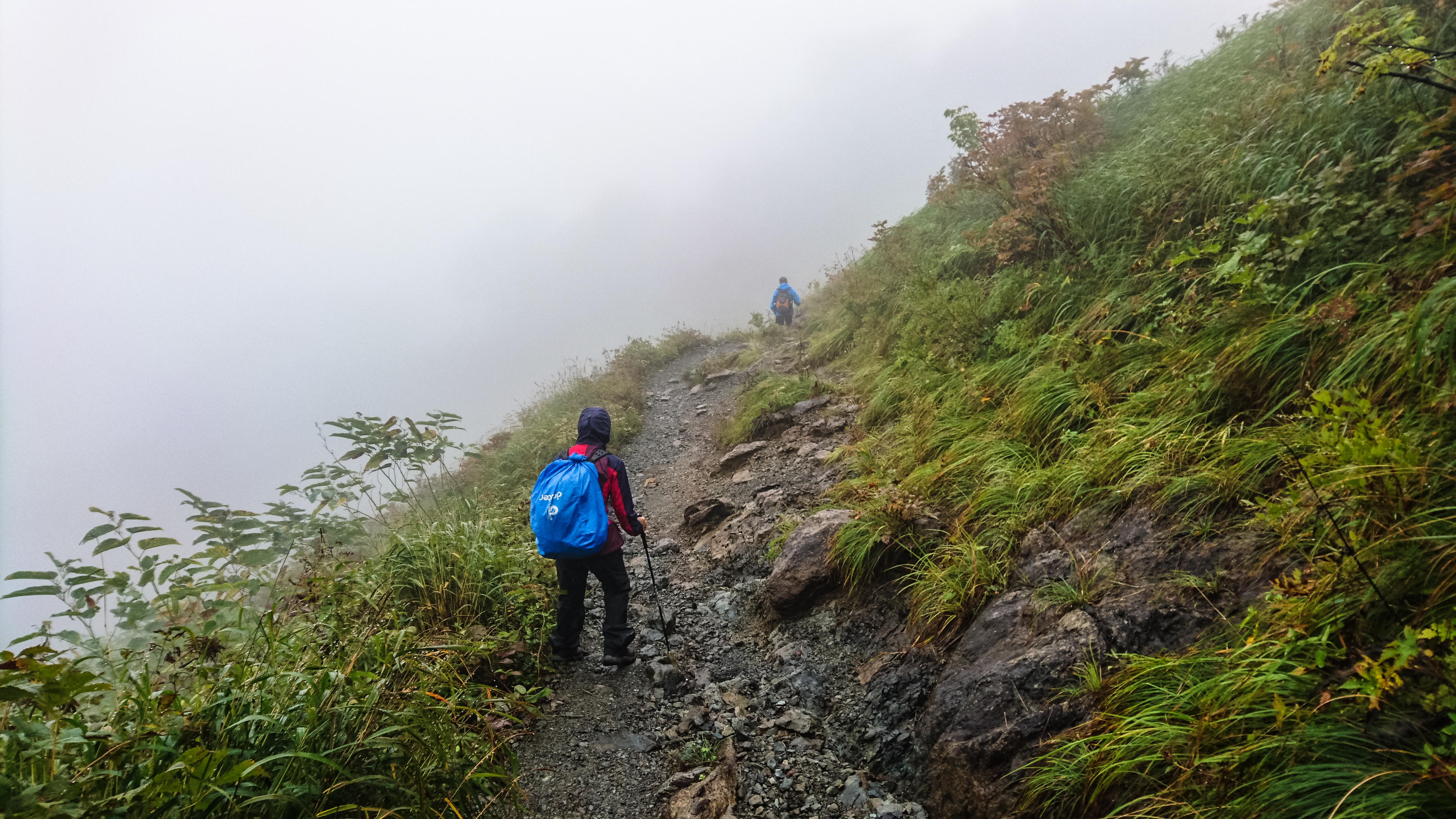
It was a long uphill climb towards Korengesan 小蓮華山(2769m), very scenic even though marred by mist. A little after we passed Sangokuzakai 三国境 (2751m), at the junction where a trail led to Yukikura Dake 雪倉岳 (2 hours), the rain came down on us – hard. We walked steadily for 1 hour in the pouring rain, reaching Mt Shirouma 白馬岳 (2932m) without much trouble. But there was no sense of elation because there’s not a thing to be seen – only dark, heavy raindrops.
second half of trek starts here
like it or not, the only way is up
goodbye lakehouse
view of the lake from the trail

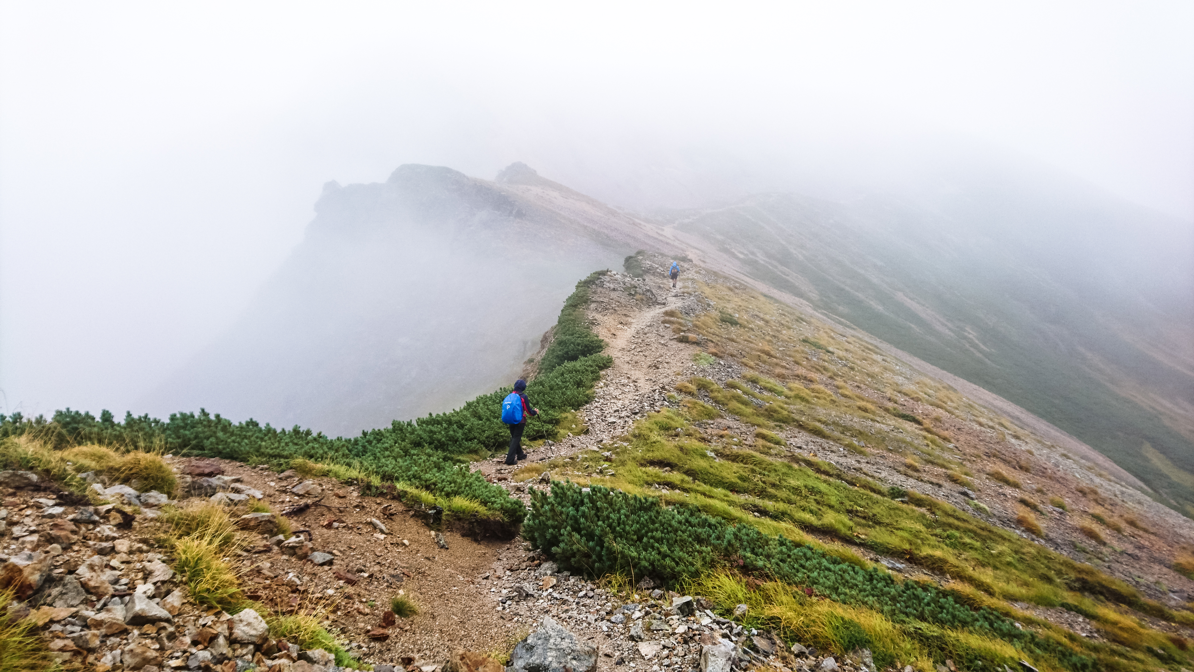
head into the clouds, we must
time to leave those clouds behind
hitting the ridge
the way we came from

into the mist again – it’s the only way
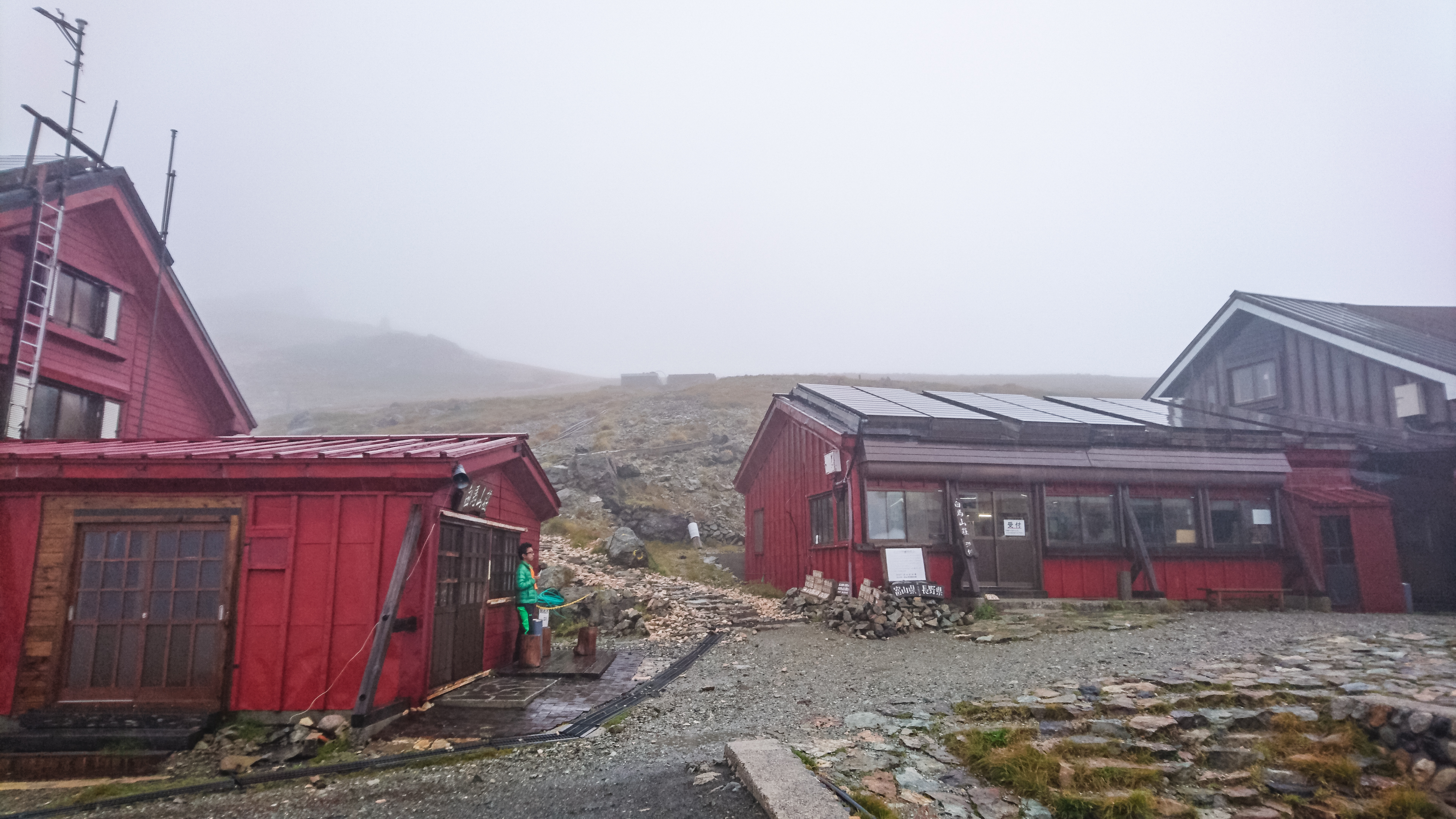
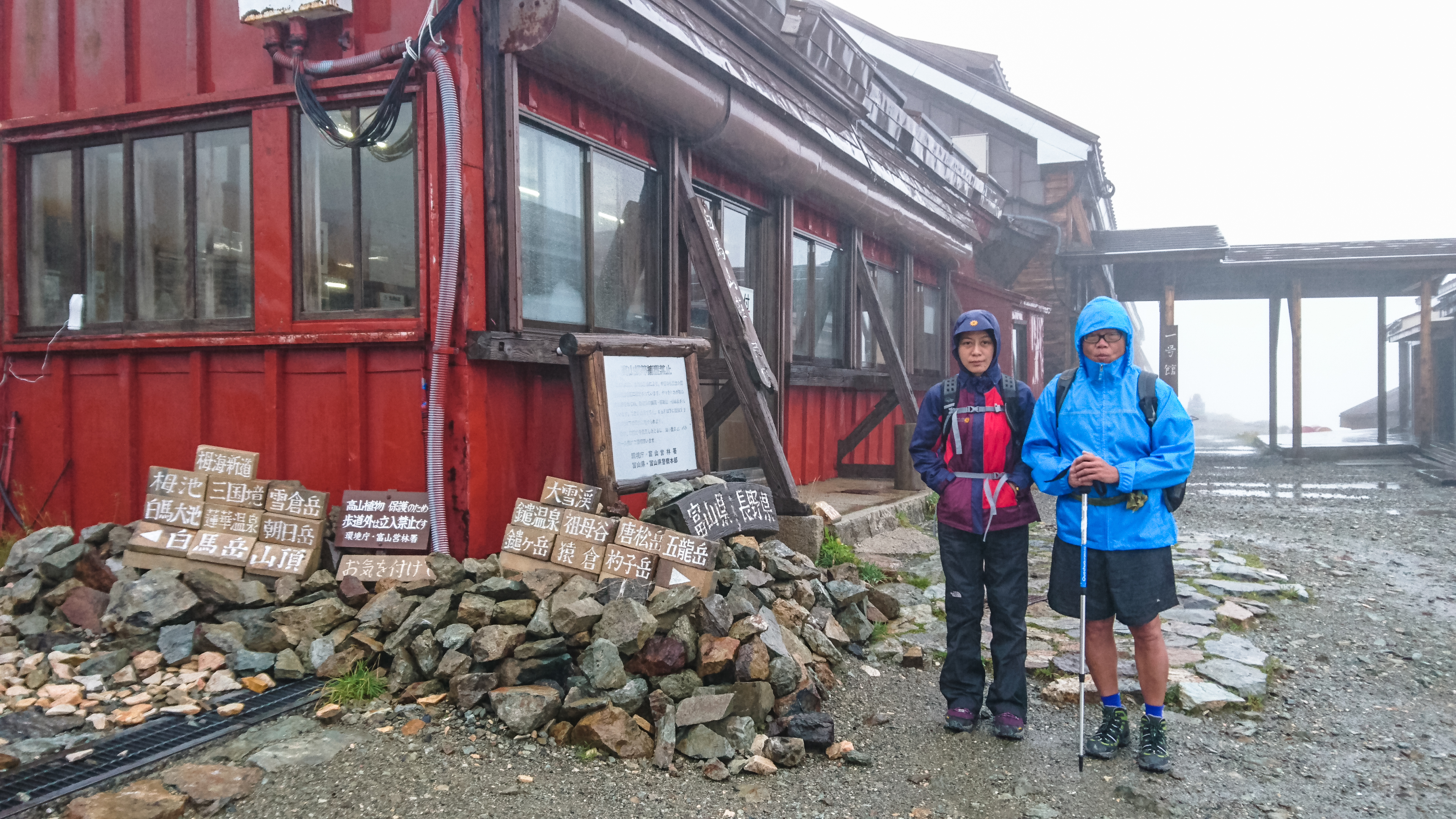
Visibility worsened as we headed down towards Hakuba Sanso 白馬山荘 (2832m). It was pretty dark all around, almost like dusk. For a while, we weren’t sure if we were on the right track because we had walked a long time and still, nothing. When we finally saw the red roofs of the Sanso, we were just 100m from it. Even before we could properly savour our relief, we had already stumbled into the reception hut.
where the rain started to pour, yukikura dake
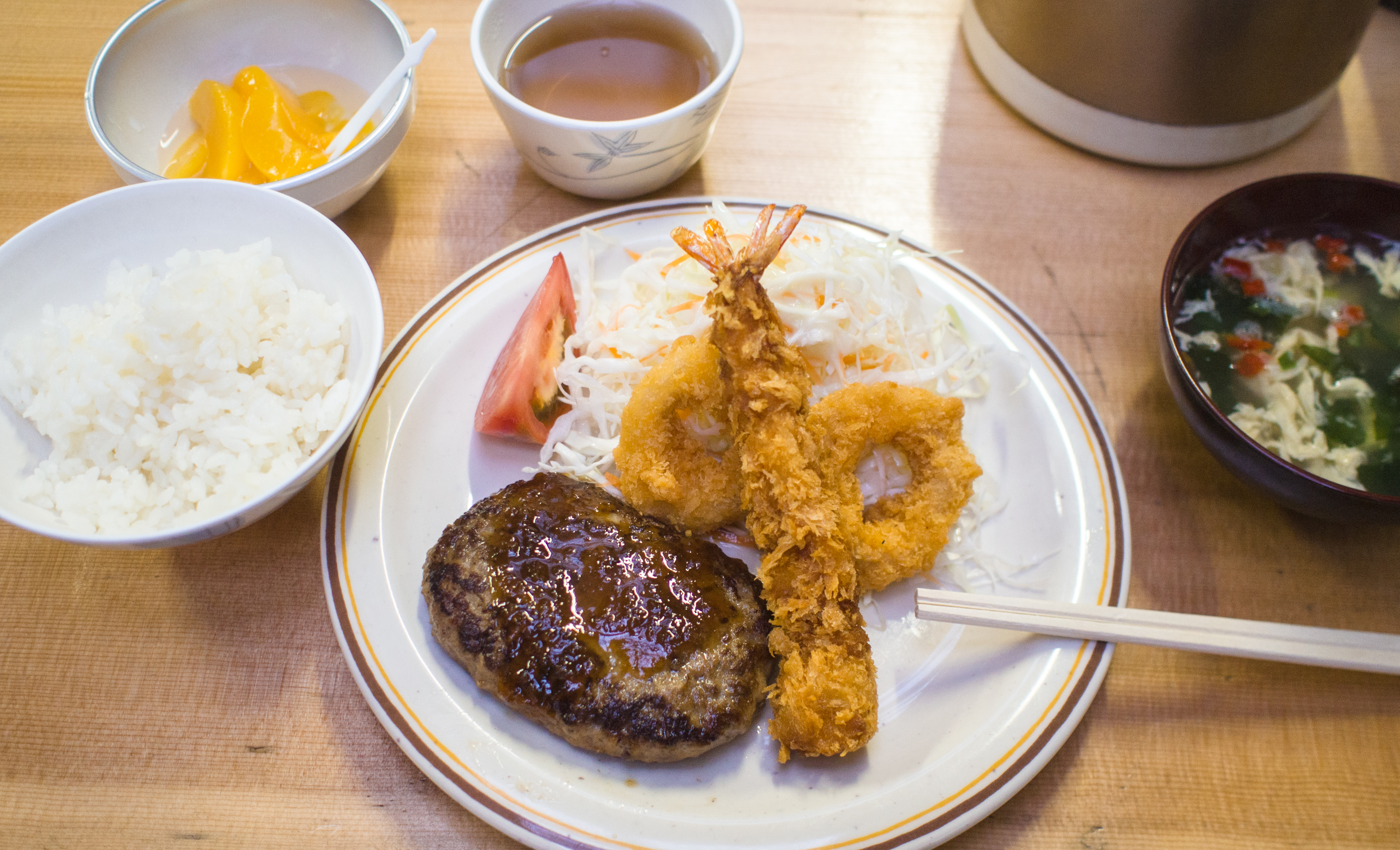
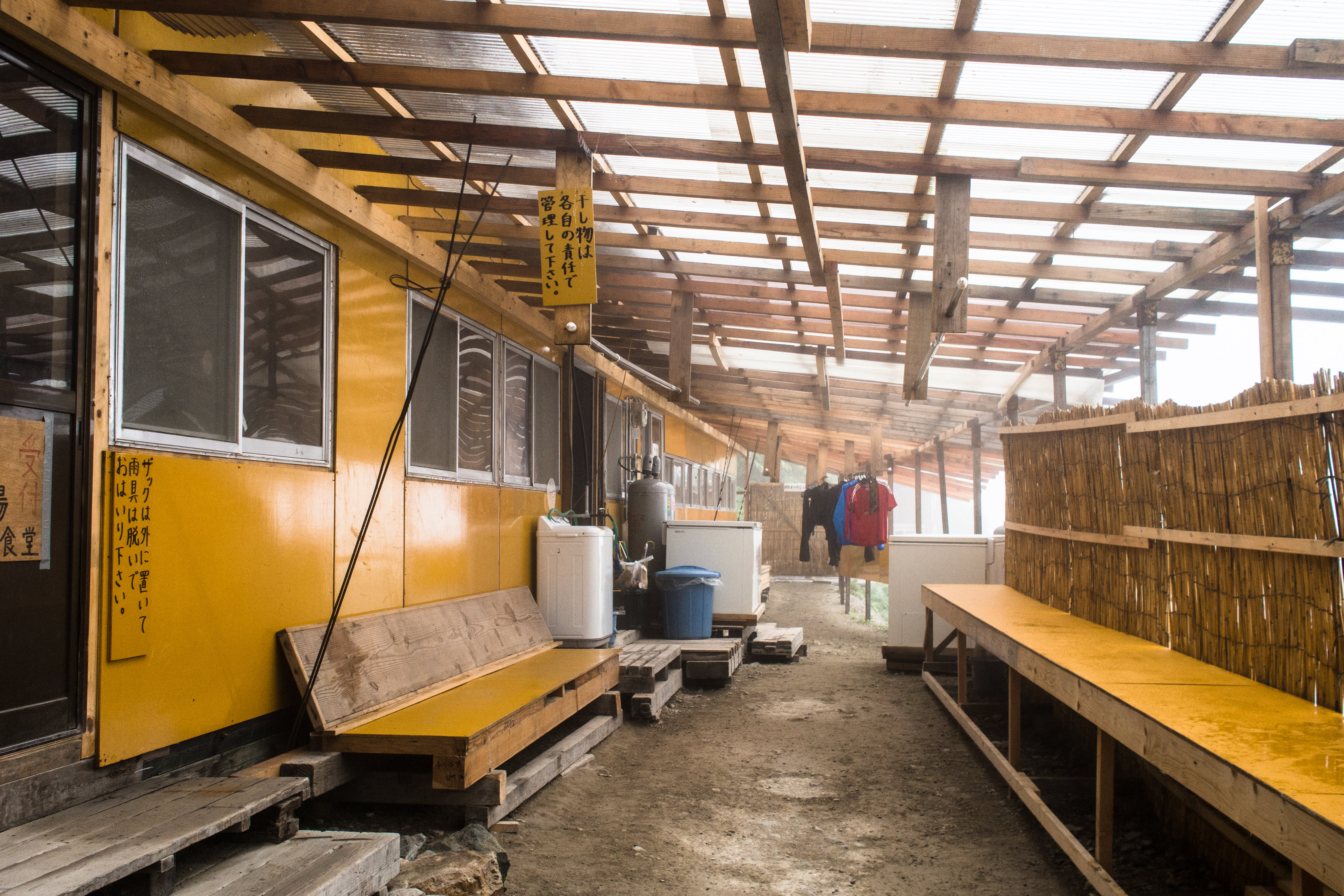
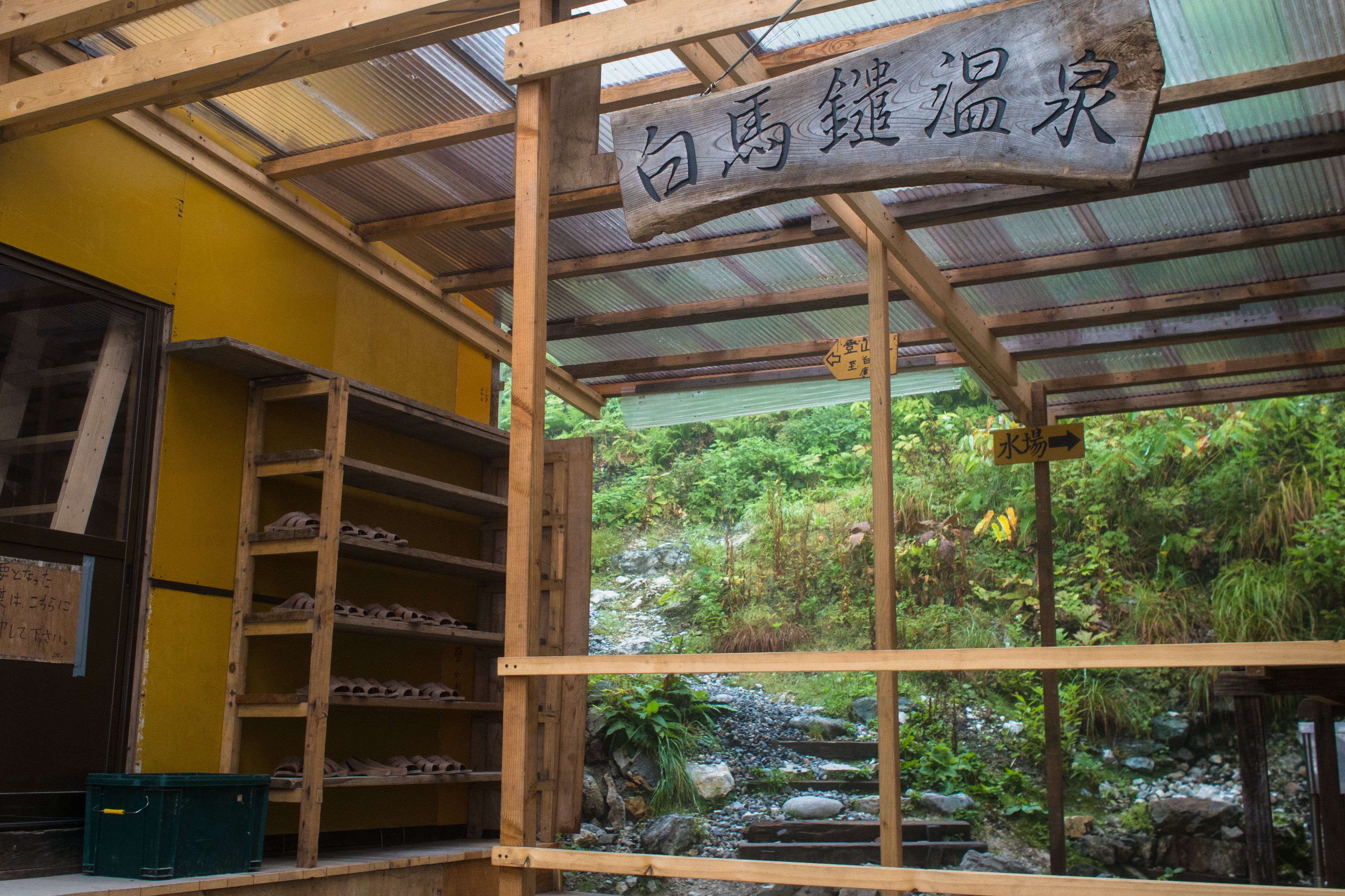
The Sanso (mountain hut) was so civilised it blew my mind away. There’s a drying room for us hang up wet clothes to dry (hangers provided); there’s a changing room for ladies next to it; slippers, mattress, blankets and pillows were provided; the toilets were clean, there’s toilet paper and they were free of obnoxious odors. There’s a living room for hikers to relax, read comics/magazines/books (provided) and heaters were there to keep us warm. At night, we had a sumptuous dinner of hot soup, japanese rice and hamburg steak. There’s also an area for hikers who preferred to cook their own meals. In short, you get to enjoy all the trappings of modern living, except take a shower.
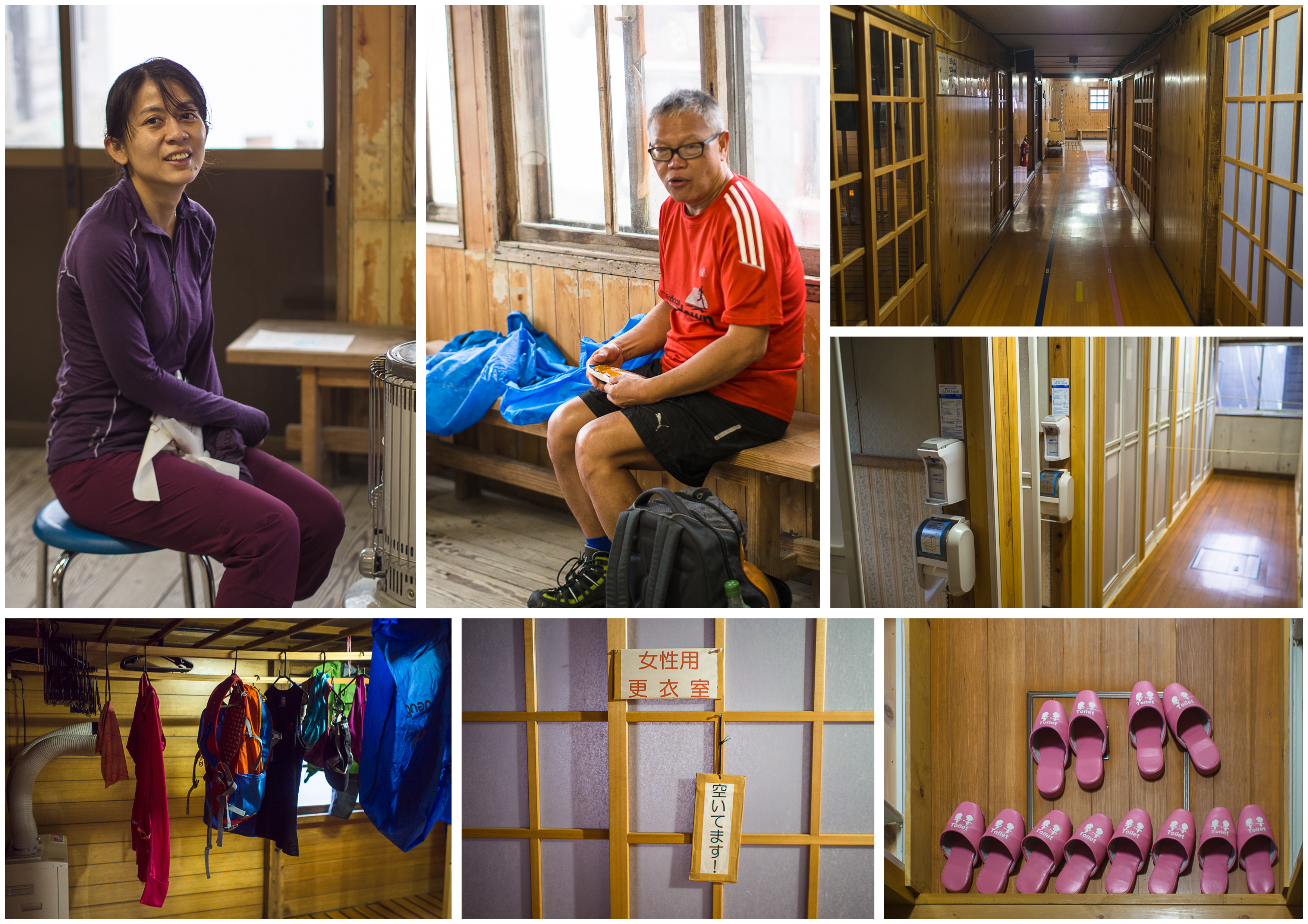
the amazing mountain hut
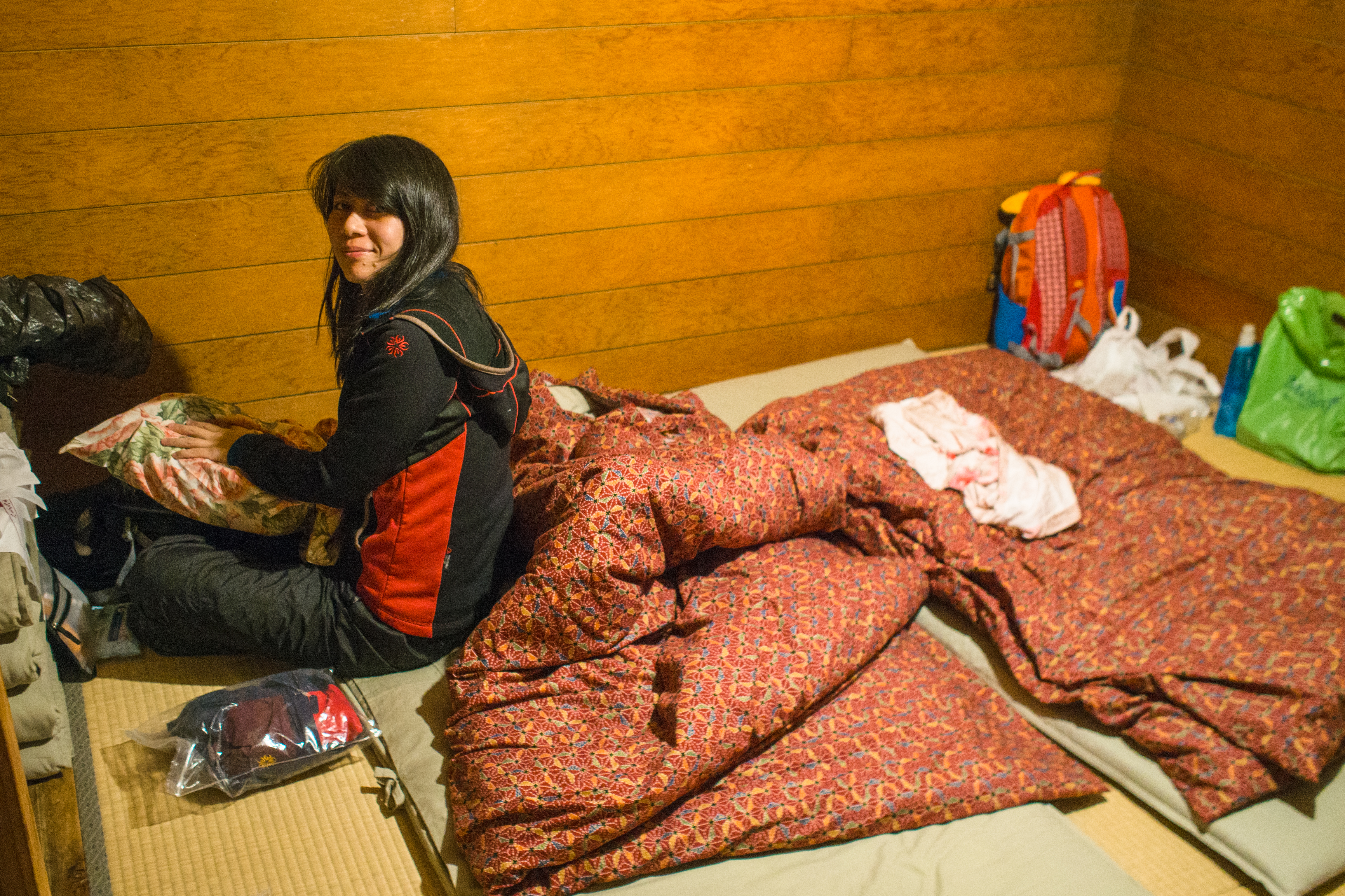
making the bed
The day’s walk took us 6.5 hours to complete (9am-330pm). Getting from hotel to the trail head took another 1 hour (taxi + gondola). The night’s stay set us back by 10,533 yen each (including lunch, dinner and 2 bentos, takeaway to share).
Day 2: The bedevilled wind sang a wild song
(Hakuba Sanso ->Yari Onsen Goya Sanso)
It poured without a pause the entire night. By breakfast, we decided we’d just head out, rain or no rain since we didn’t see any signs of it abating. It seemed we were the only foolhardy ones heading out that morning.

the reception hut
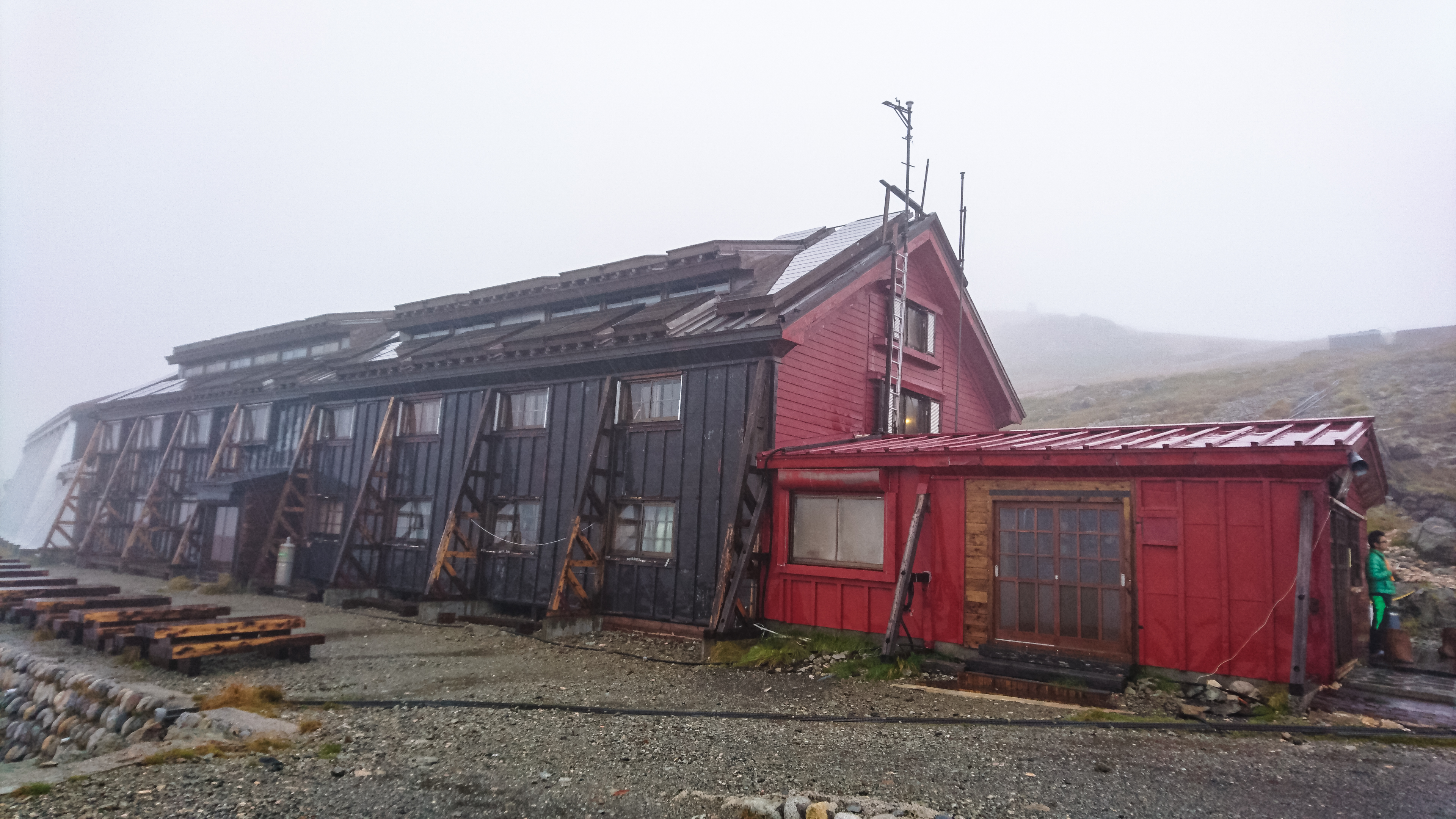
the main hut
taking a smoke break
even though it is raining … my boss said we have to keep our asses moving
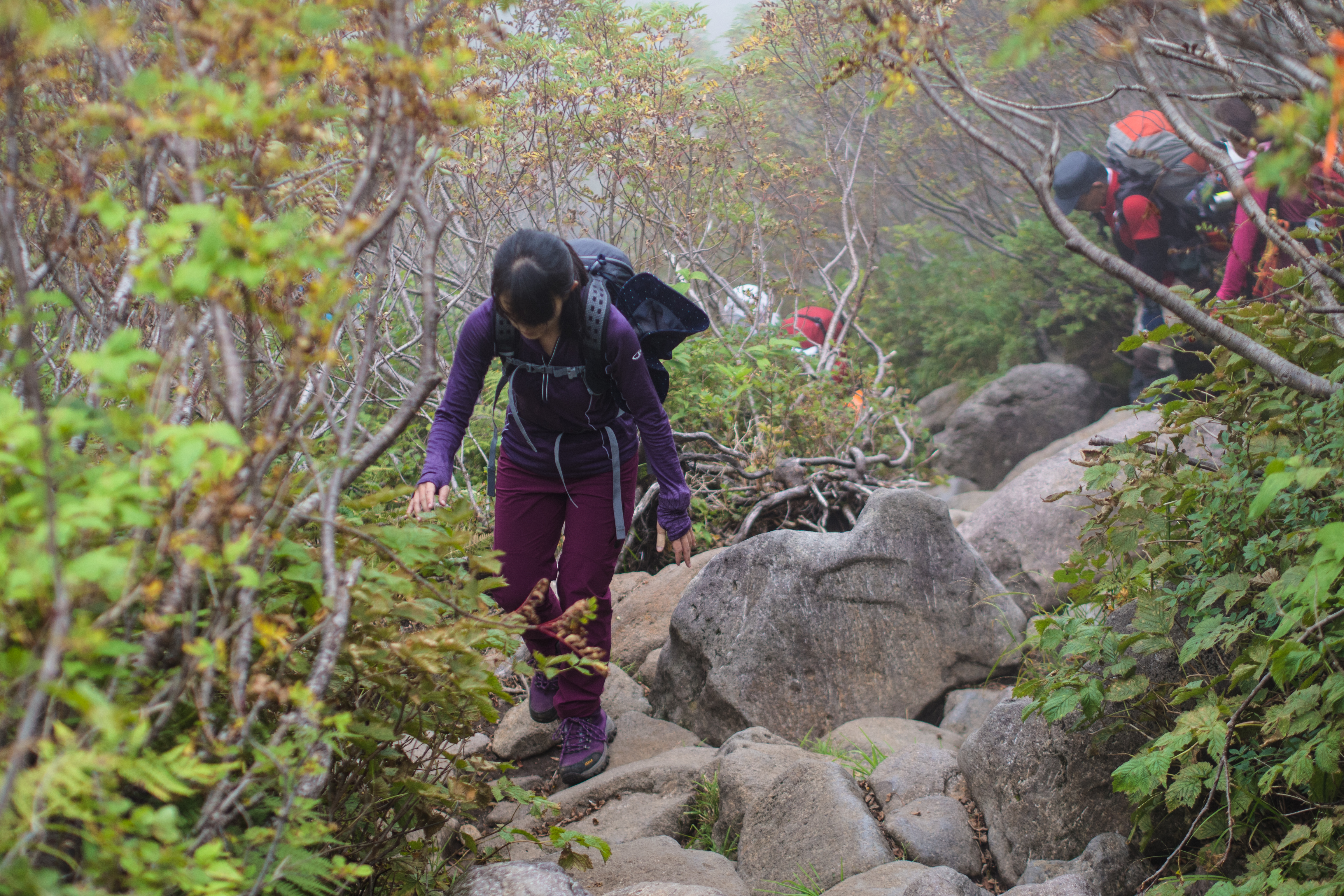
It was the worst, longest, 2 hours of the entire 3-day trek. The rain was bearable but the wind sheared right into the bones (even with heat packs), and there was no where to hide. We didn’t meet a single soul until about 1.5 hours into the trek near Shakushi Dake 杓子岳 (2812m). After that, the wind began to dance even more frenziedly around us and not long after, a group of hikers appeared. They had walked from Tengu Sanso 天狗山荘 – so we were not the only crazy chaps around here.
sayonara, hakuba sanso
which way – in the end we took the wrong way (my bad)
bracing for a descent then a climb
just keep walking
a short plateau before it starts again

the valley – while the skies are still clear
another ridge and another
walking down into the rain and wind
We hiked up Shirouma Yarigatake 白馬鑓ヶ岳 (2903m) (because the boss said we should), then staggered down from its peak, hoping to reach the split junction to Yari Onsen soon (there’s an alternative trail that circles around Yarigatake, but it wouldn’t have been fun right?). We still couldn’t see very far and only saw the trail markers when we were just a few paces away. There were 2 hikers coming up from Yari direction, one wearing a thin grey t-shirt, holding an umbrella. The thoughts that went through our heads then: Wow, very strong; can that umbrella fend off that wind? Is that a magic umbrella?
Going down towards Yari Onsen 白馬鑓温泉小屋 (2100m) put us out of reach of the teeth-shattering wind. It was still drizzling but it felt like we had just escaped hell and went to heaven (we noticed the 2 guys had stopped to review and reassemble their garbs).
heading down towards yari onsen
rocks and more rocks
finally, less rocks and more foliage
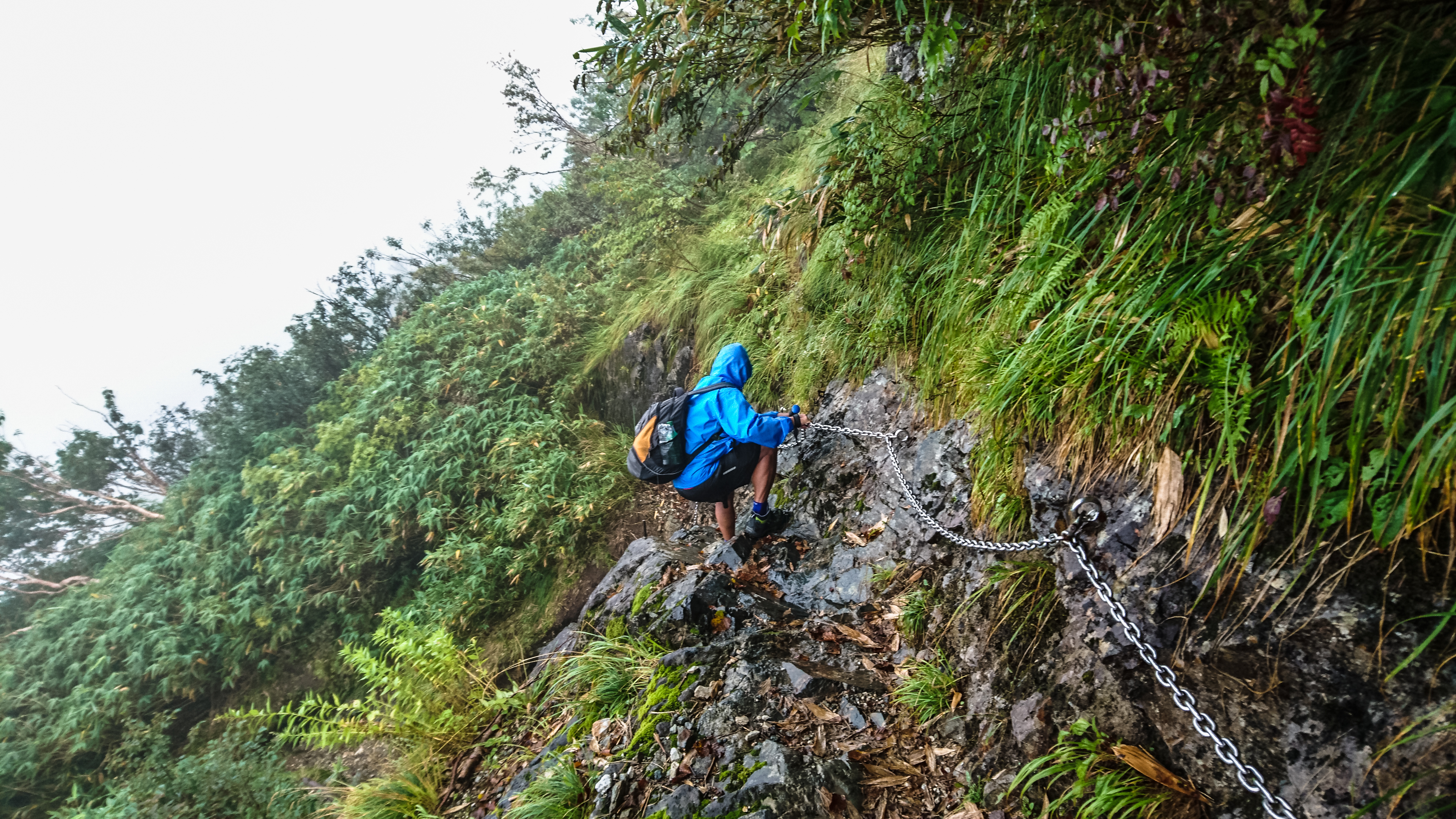
chains are provided at the tricky parts
there’s still remnant snow
view, just before reaching yari onsen
We arrived at Yari Onsen at 1145am, taking 5 hours in all (started at 645am, reached Yarigatake at 9am, reached junction at 930am). We got the onsens all to ourselves for a while.
2 hours laters, another 2 hikers appeared at the Sanso (it was still raining). That made a total of 5 of us staying at Yari Onsen that night.
no drying room so we hung our clothes outside
the grand entrance
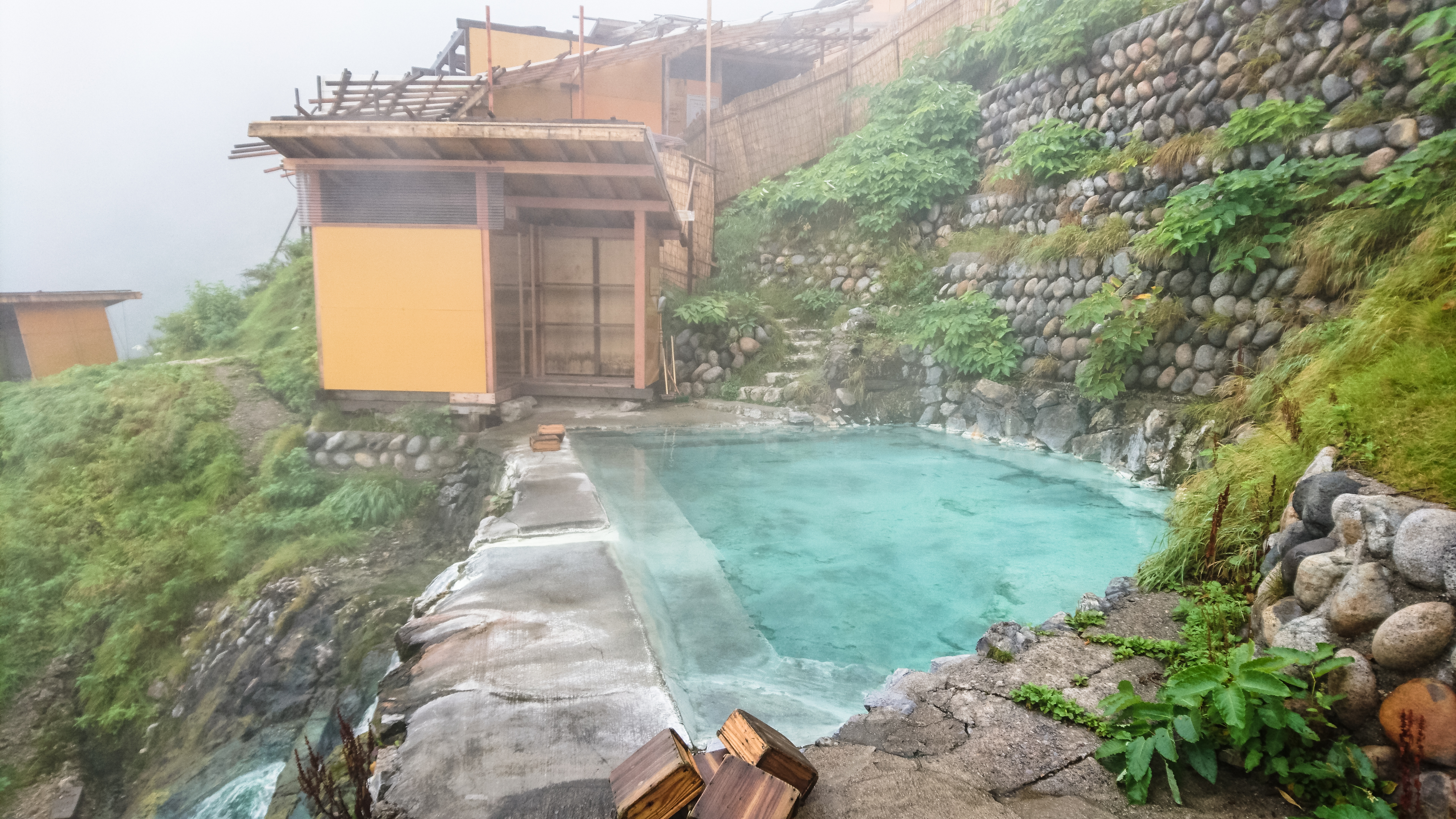
the outdoor onsen
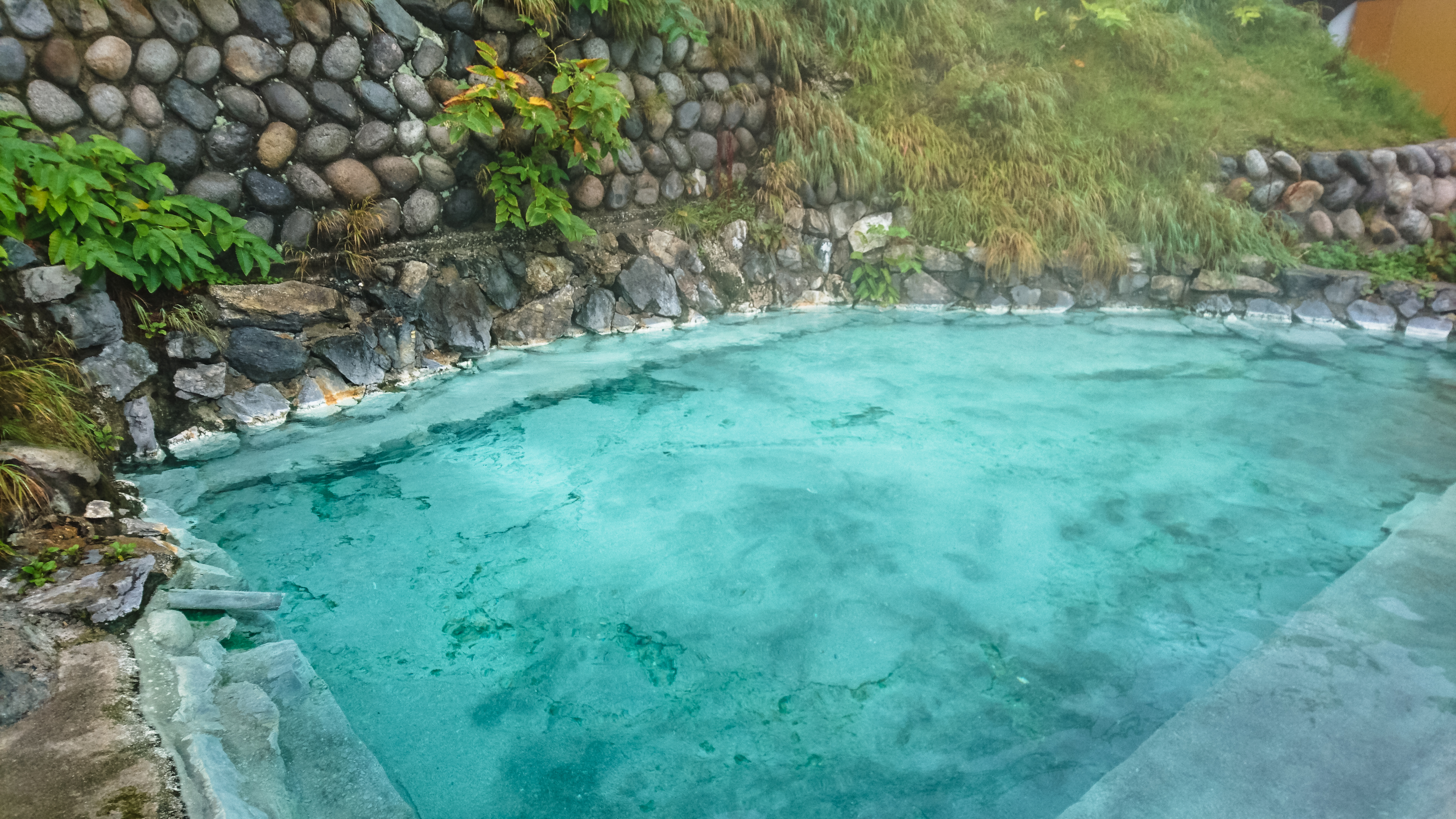
the onsen water is constantly refreshed – that’s why it is so blue
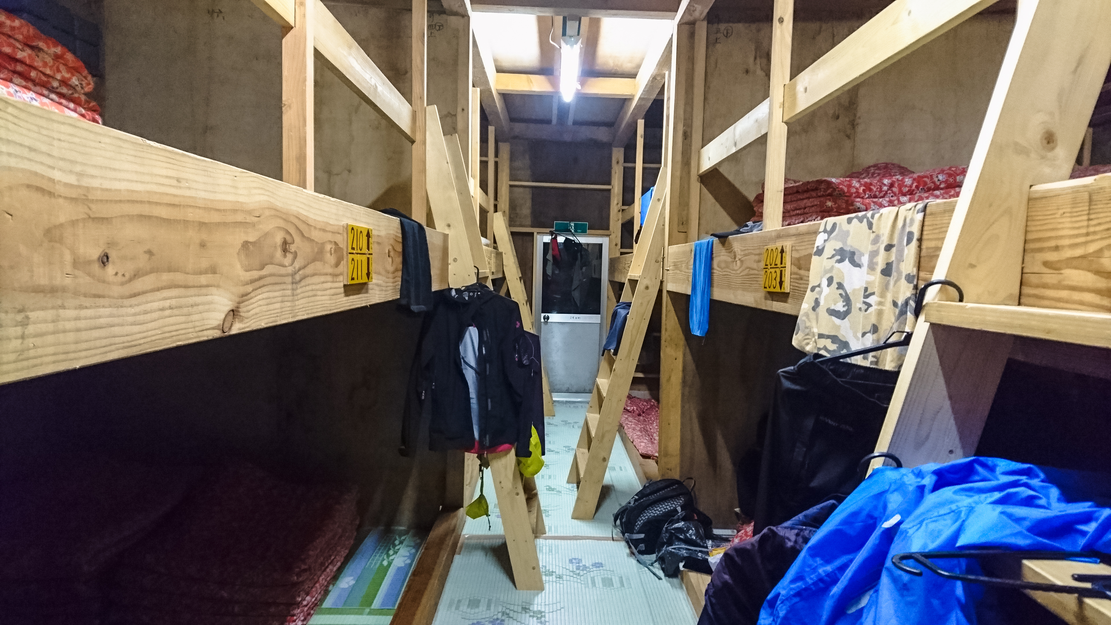
the bunks inside – had whole place to ourselves (almost)
We paid 9,800 yen each (including breakfast and dinner).
Day 3: The clouds parted then changed its mind
(Yari Onsen -> Sarukura)
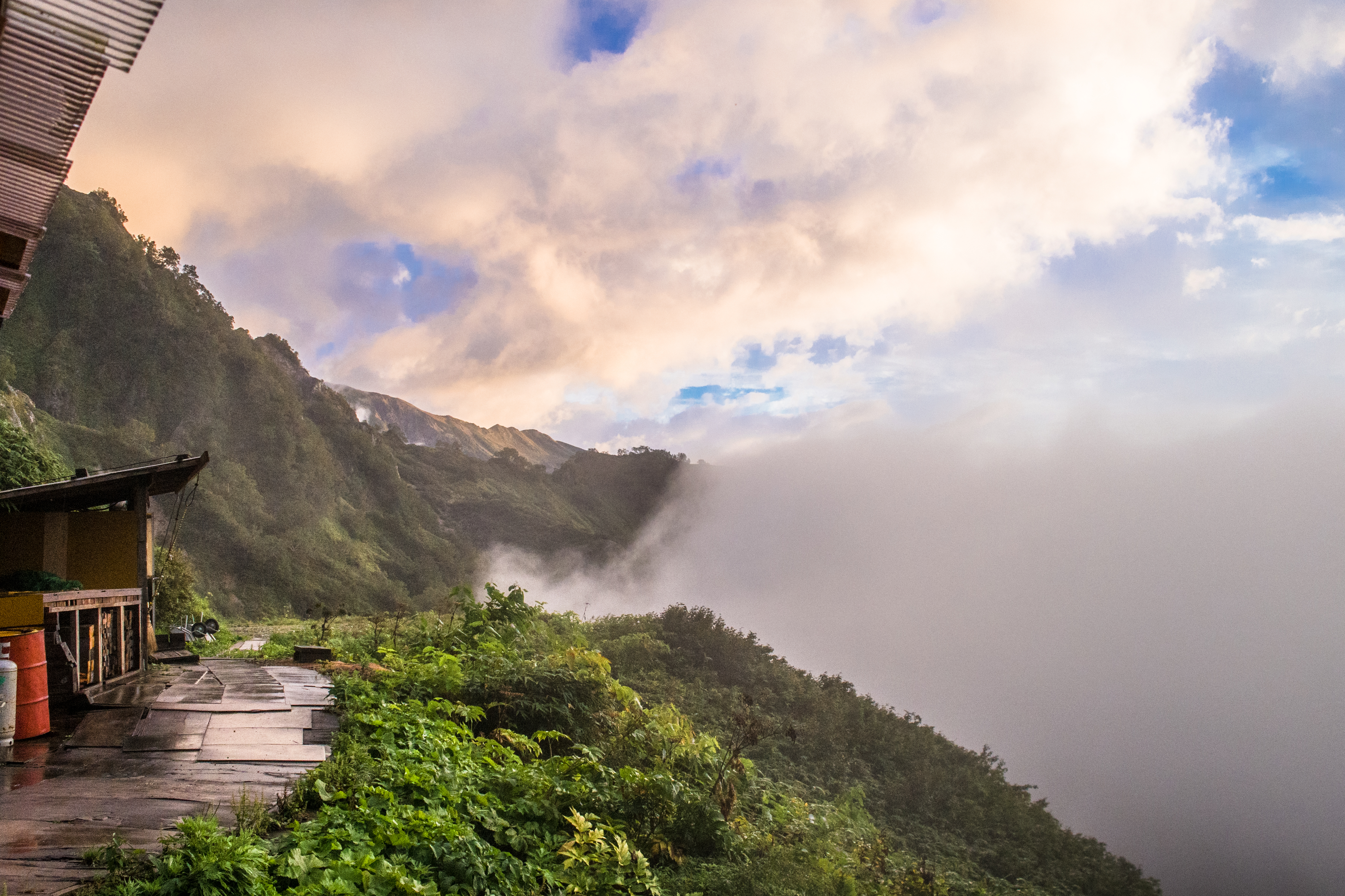
The boss’s bodyguard woke us up before 5am telling us to look out for the sunrise. Since we had nothing better to do and we couldn’t sleep a wink anymore (went to bed at 7pm), we acquiesced. A wise choice because we didn’t see blue sky again after that.
before sunrise
morning has broken
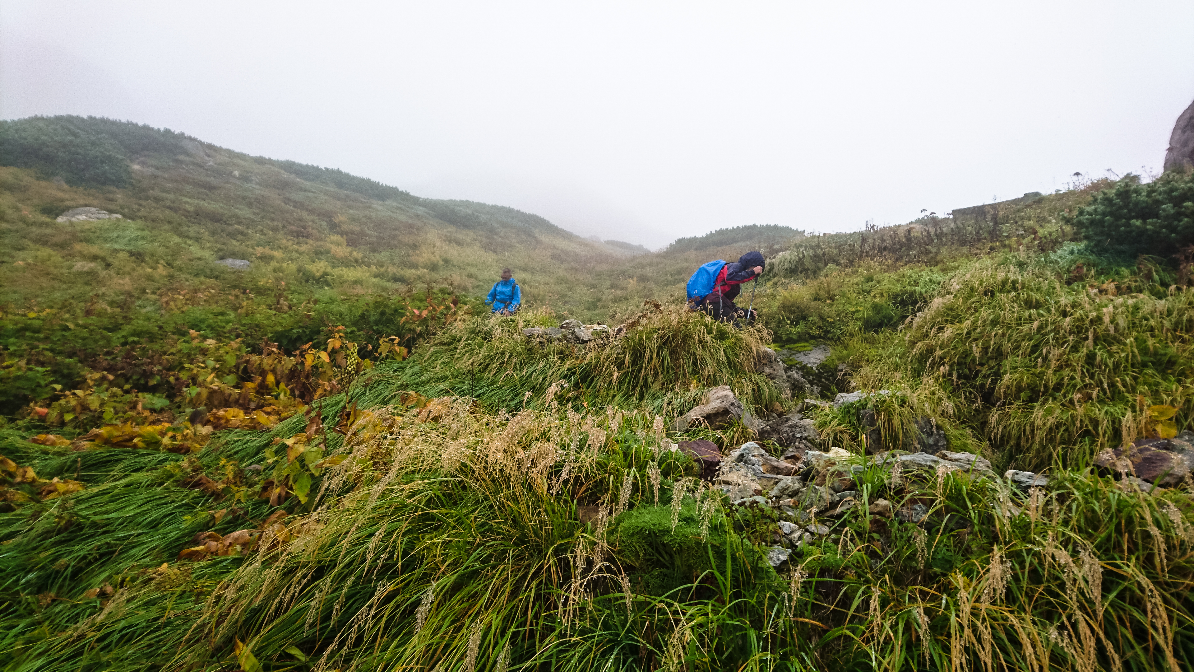
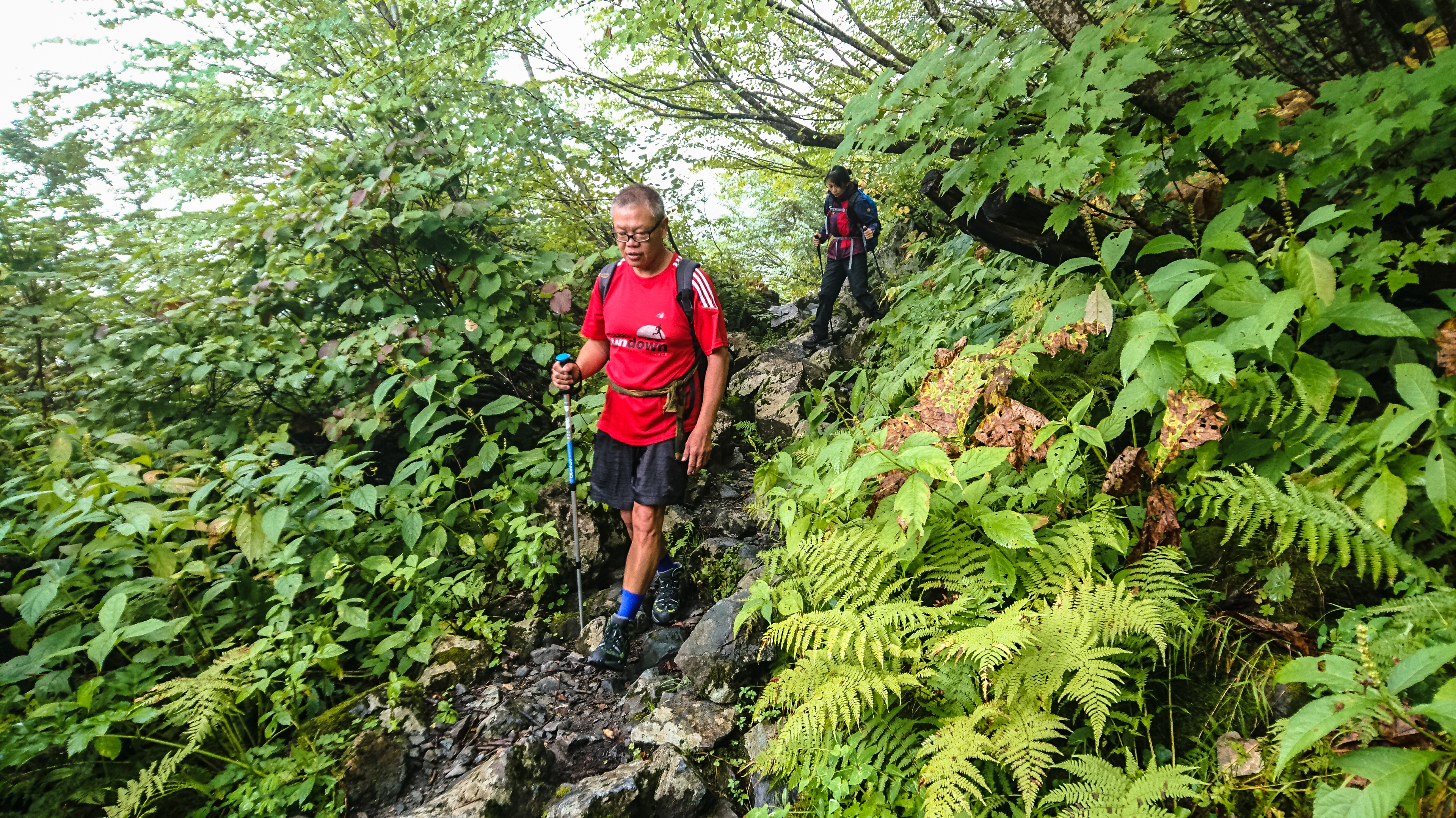
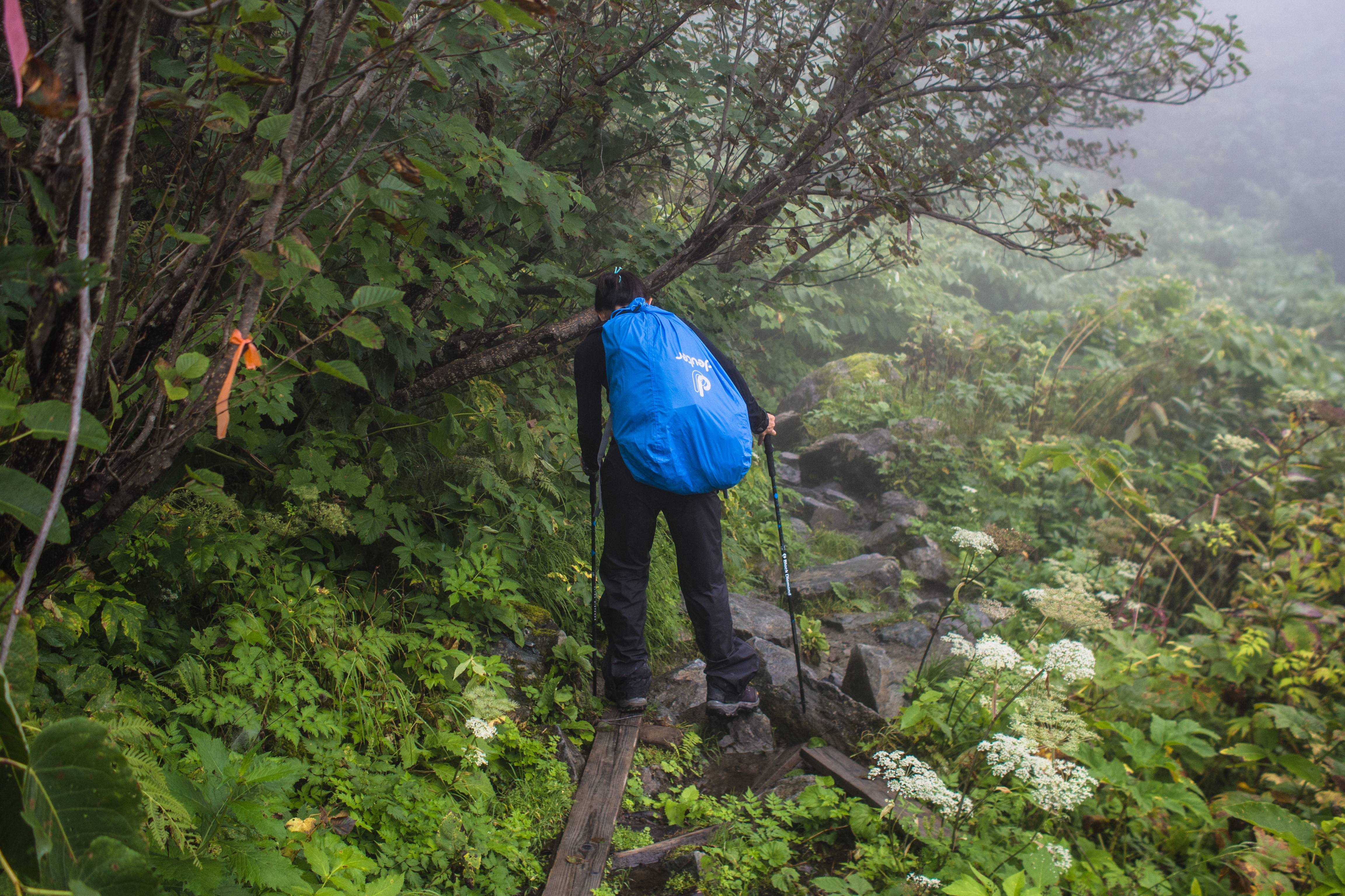
The hike down from Yari Onsen was still marred by rain but no less dramatic. There were lots of green and many waterfalls. the path narrowed considerably at some parts so we had to keep a look out for the trail markers (I went off-course once). As we hiked deeper into the forest, the path became rockier. Rocks are are no good when it rains – they’re slippery and tricky to navigate – so we took longer than the estimated 4 hours.
look! a bird! (maybe)
finally a proper trail
almost like a rain forest trek
some parts of the trail are very narrow
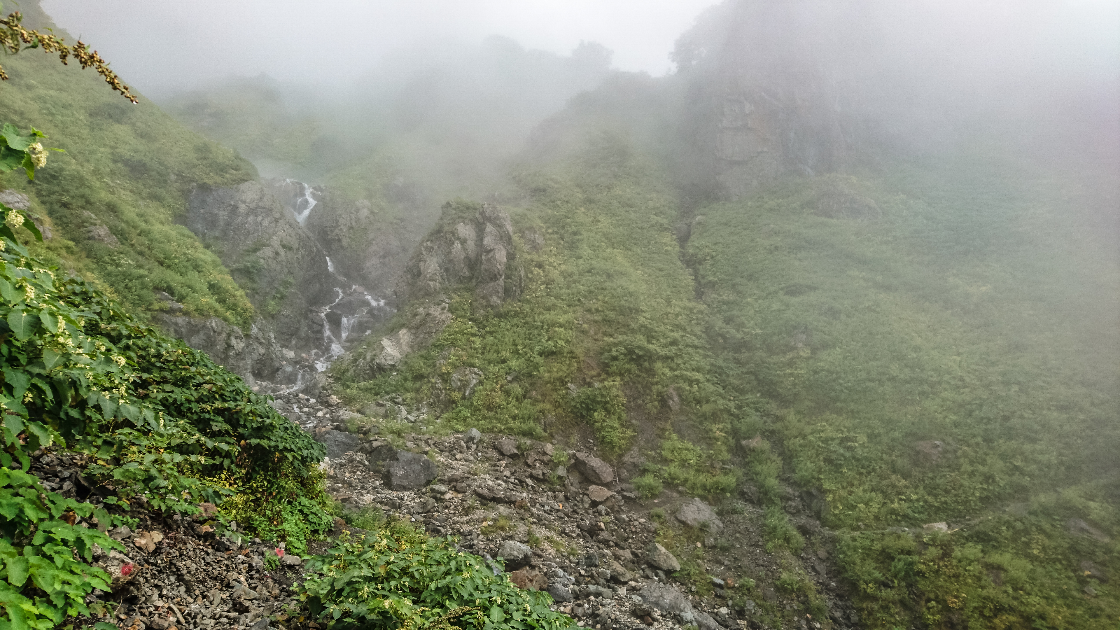
waterfalls, one of many
a wet, watery trek
the trail widens, as we get lower
sarukura sanso
goodbye sarukura
We reached Sarukura Sanso (1250m) 4.5 hours after we left Yari Onsen (7am – 1130am) and hopped into a taxi (3000 yen) right away (it was there waiting). We were starting to miss the trails already, but nothing could be allowed to stand between us and a proper bath – not even lunch.
Hiked 12-14 Sep 16
References: garyjwolff, hiking in japan, deep like pow, hakuba connect, summitpost, hkadventurer, hakuba blog and Wendy (ex-colleague, (my) personal trekking consultant, full-time retiree).

OMG! so beautiful
What camera are you using?
thanks thanks!
olympus omd em5
Thank you so much. This is a great description of the hike I am wanting to do when I visit Japan in late October (hopefully over the course of two days). Unfortunately, it looks like the huts are closed by late October. I am thinking of backpacking and bringing up a tent to sleep next to the huts. Hopefully this is not an issue out of season. Thanks for fantastic description and sharing any additional insight you may have.
Rich
Hello Rich, thanks for visiting.
There is a campsite (up to 100 tents) beside Hakubadake Chojo Shukusha (白馬岳頂上宿舎). This mountain hut is just less than 10 mins from Hakuba sanso. I’m not sure if they accept tent reservations (about 1200 yen per pax) after hiking season but you may like to send them an enquiry @https://yamagoya.hakubakousha.com/facility/ but I’m afraid the website is only in Japanese. There’s a lot of snow so frankly I’m not sure it is safe because I read that avalanches are quite common on the Daisekkei and it gets quite windy up there. All the best and I wish you a safe hike!