
Hidden In the Mist: A piece of Europe
We were beat after MacLehose so we weren’t sure if we could make it to Lantau. Thankfully, the foot massage at Happy Foot helped revived us somewhat so the next day, we pressed on to Lantau Island as planned. I was debating whether to do Lantau Peak (Stage 3, Steep ascent) or Sunset Peak (Stage 2, less steep than Lantau Peak). Finally settled on Sunset Peak (大東山) after consulting friends (really beautiful they said).
All-right.
We took a ferry from Central Pier, #6 (an hour’s ride to Mui-O). It was first-come-first-served and trips were frequent; the Octopus could be used too. That was the easy part.
Once disembarked at Mui-O (梅窩, Plum Nest), we were a bit lost. Which bus? To complicate matters, it was a public holiday – Dragon Boat Festival – and the little town was deserted. The bus office was closed so we couldn’t ask anyone. Finally we decided to take a taxi. But the queue was 100 metres long and there was no taxi. Eventually, after braving the wrath of an irritated bus conductor and using sign language, we found out that bus #1 would bring us to our desired destination: a certain stop along South Lantau Road which was before the top of a hill.
Suddenly, as we were about to board, the people of the 100m queue abandoned their stakeouts and rushed to join us in the bus too.
Actually, all the buses from mui-o goes to where we wanted to alight. See map below. The octopus can be used for the buses too.

Our destination was Nam Shan (南山 South Ridge), Check Point 5, start of the Lantau Stage 2 Trail. We had to alight before the top of that hill which stood between Mui-o and Pui-o (貝澳 Mussels Bay).
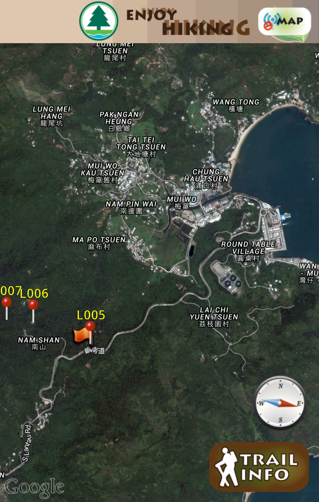
From Mui-O to Nam Shan, Check Point 5
This trail would lead us to Sunset Peak and then down to Pak Kung Au (伯公坳 Grand Uncle’s Hollow). Total distance: 6.5km.
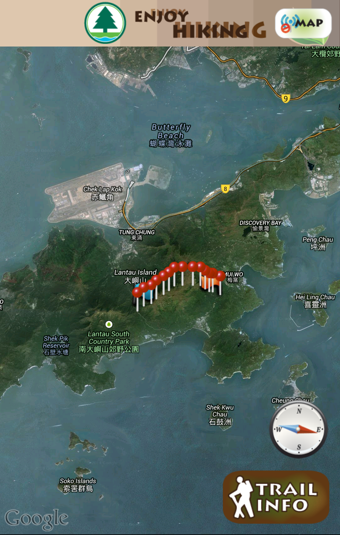
Lantau Sunset Peak Trail, CP 5 to CP 18
The stop wasn’t so far from Mui-O but being first timers, we had to make doubly sure before announcing our departure to the driver. By then, we were already over the hill. Good thing the bus stops were not too far apart.
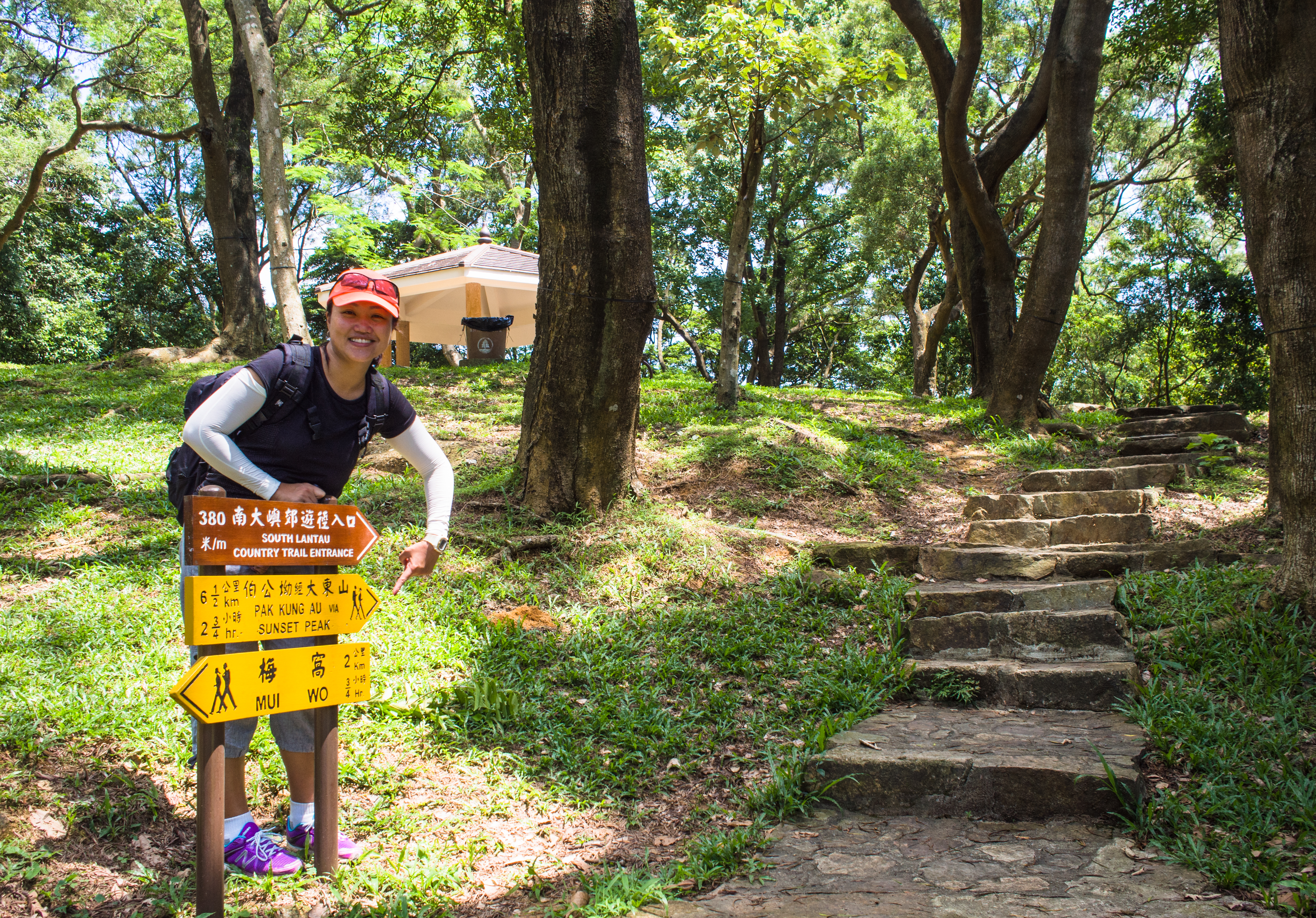
Here’s the tell tale sign
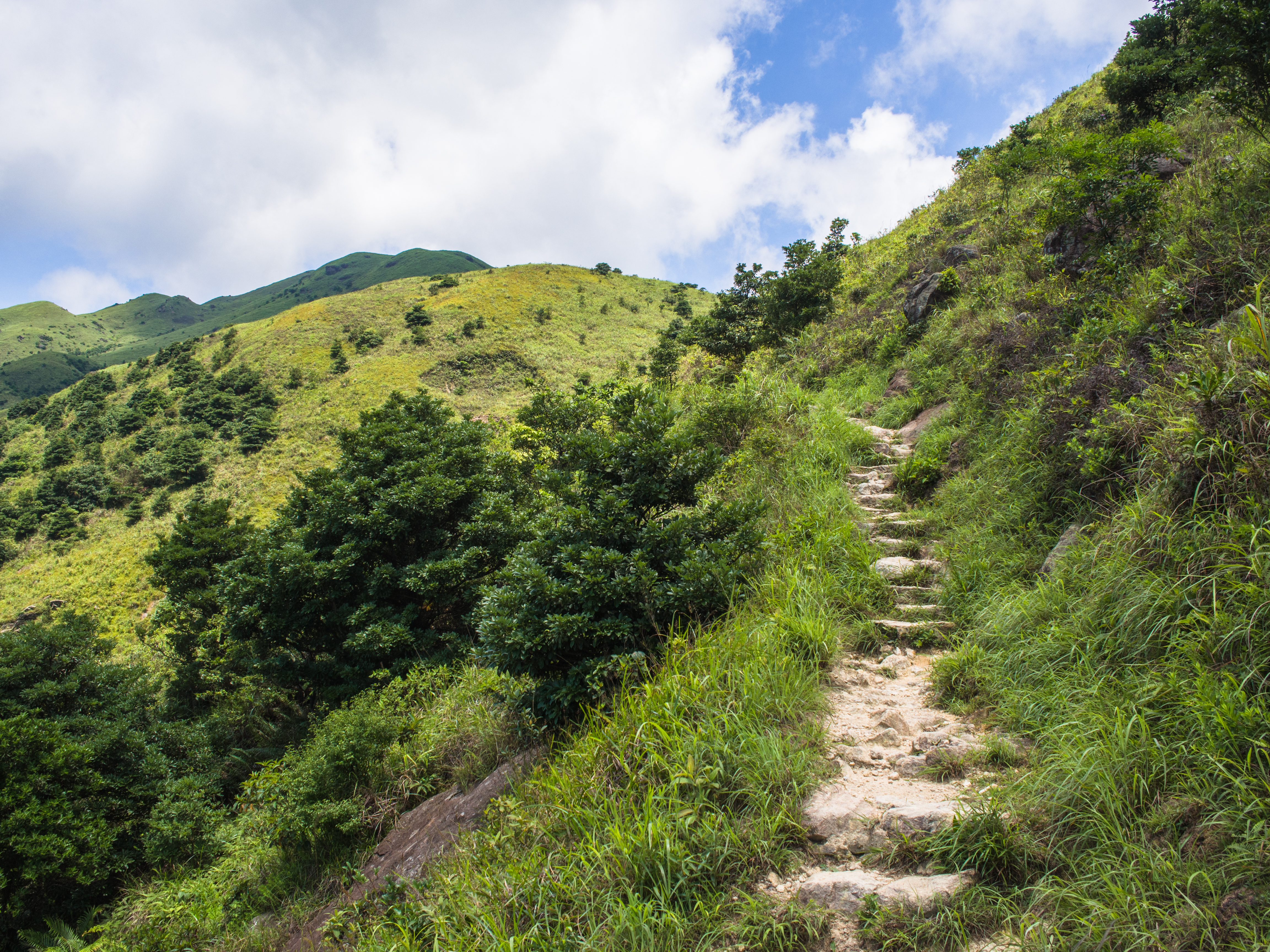
We found the first check point easily. The trouble was, after the sign, the steps and the folly up there, the trail opened up into a wide expanse with a couple more trails spiraling out in different directions but there were no signs until you get to the individual trails. Anyway, keep to the trail to the left side.
The trail started to climb steeply soon, so we were surprised when we came to a helicopter landing pad. How did they sneak that in?
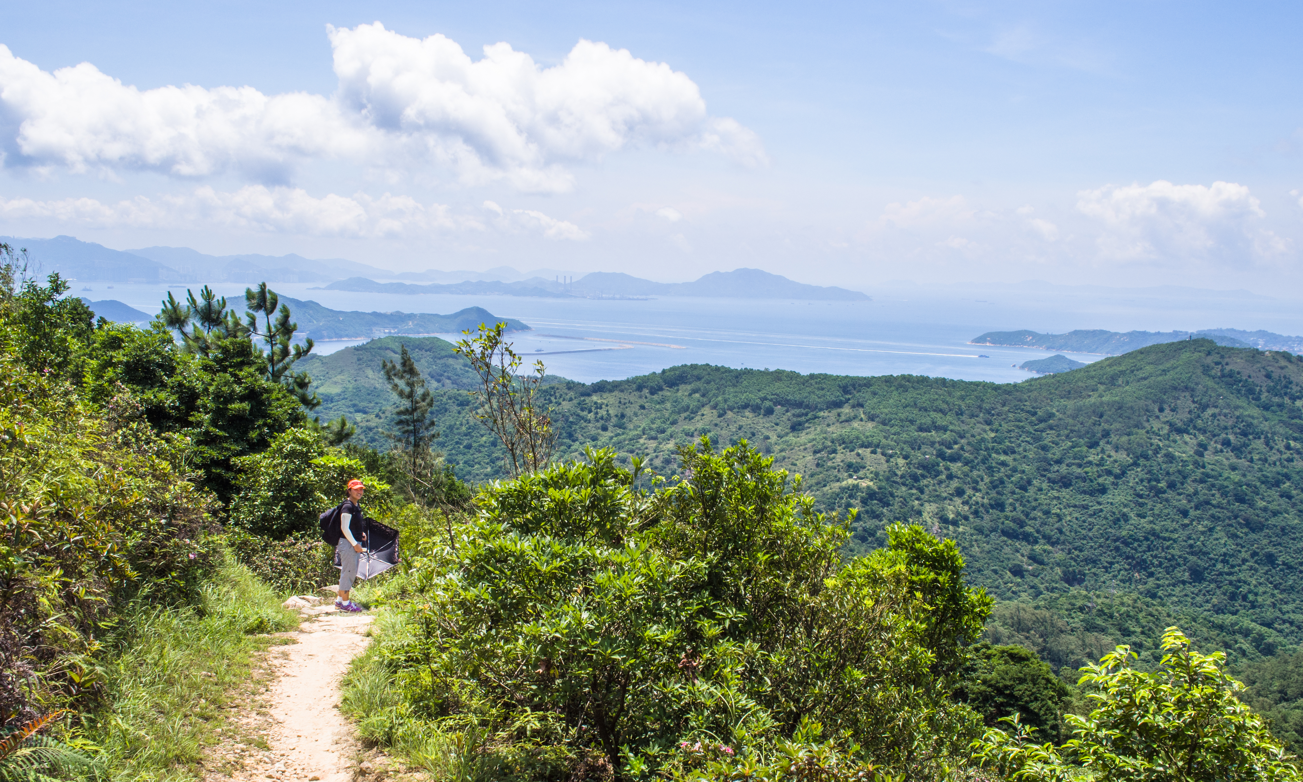
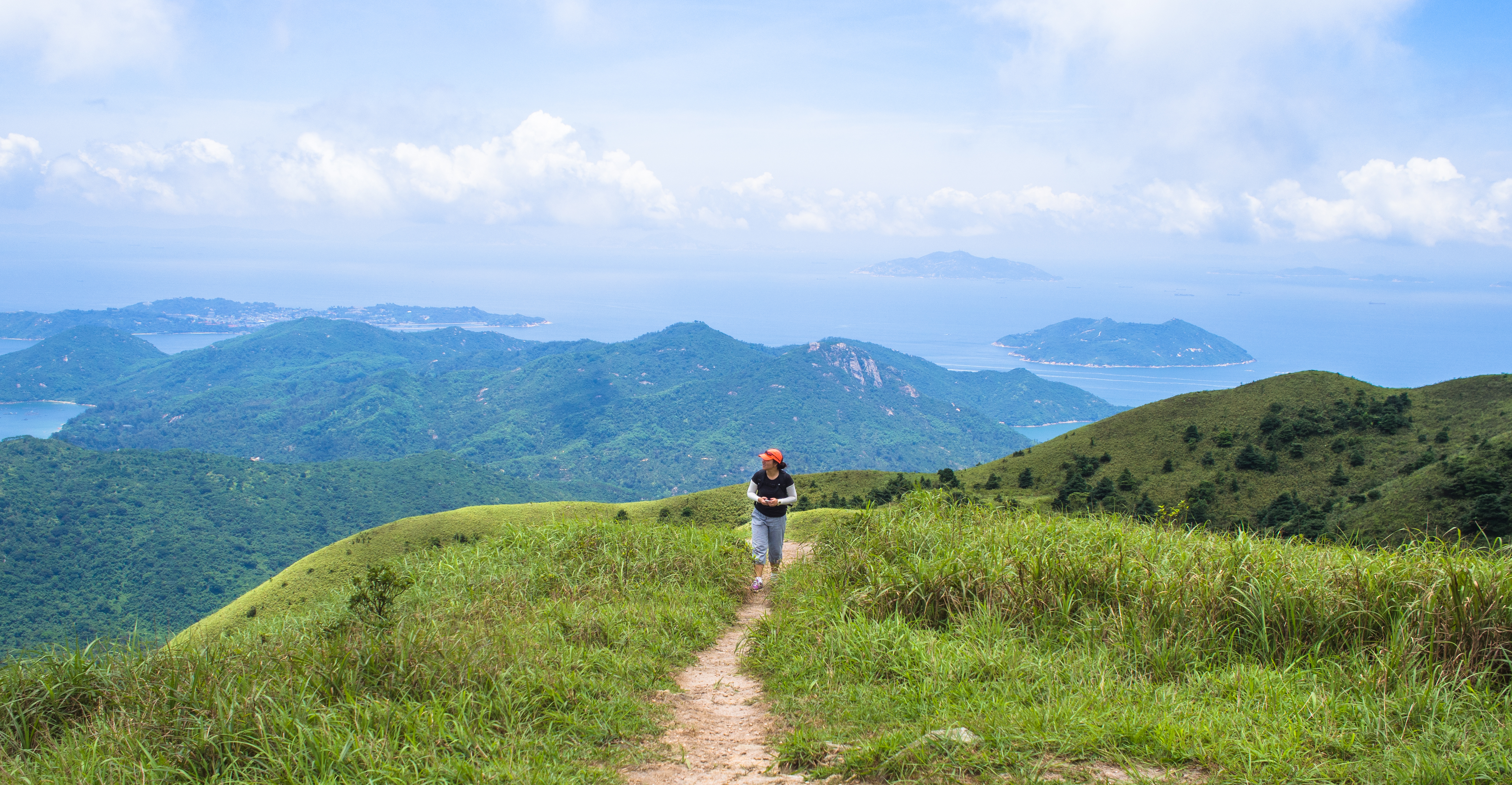
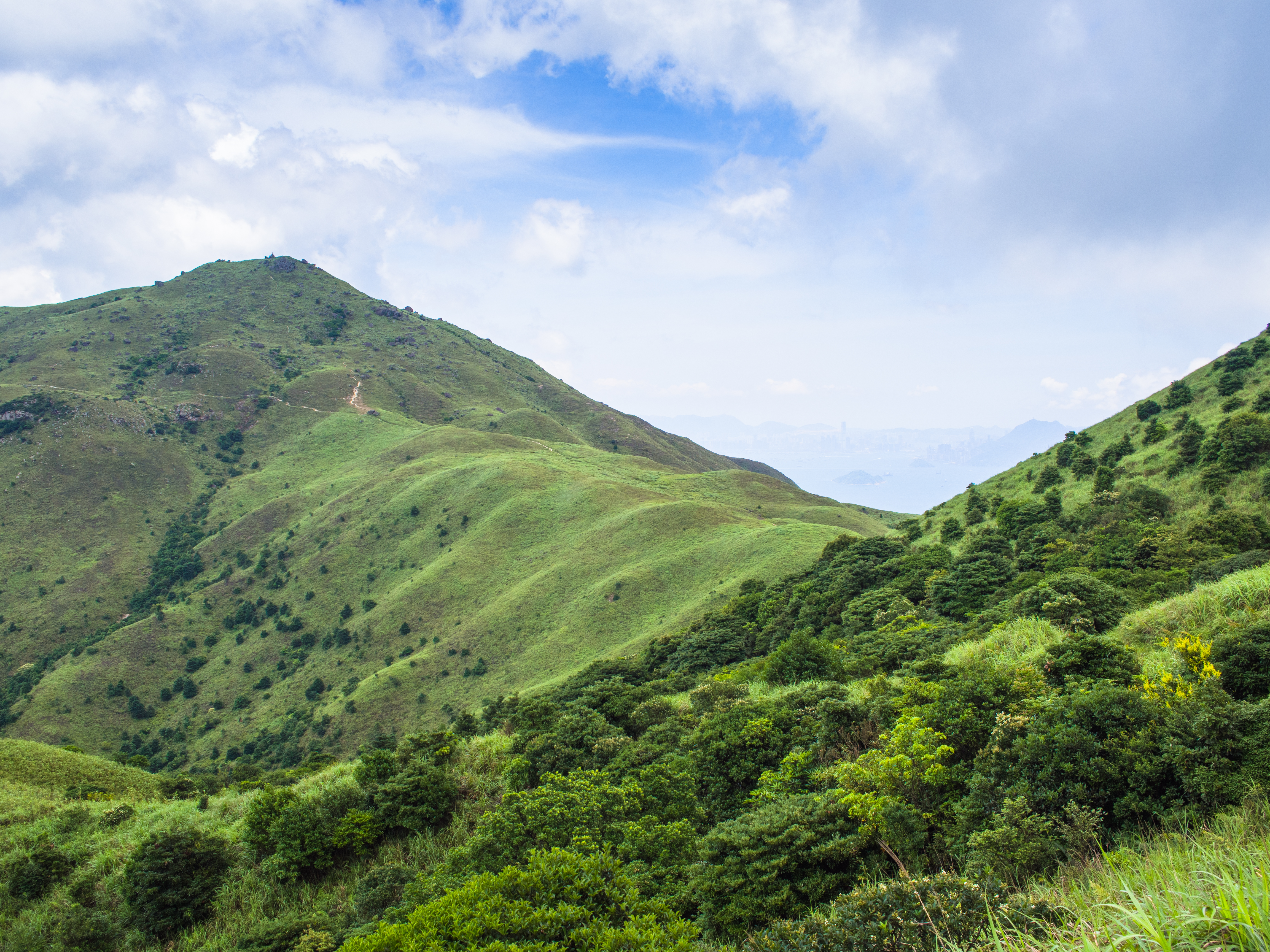
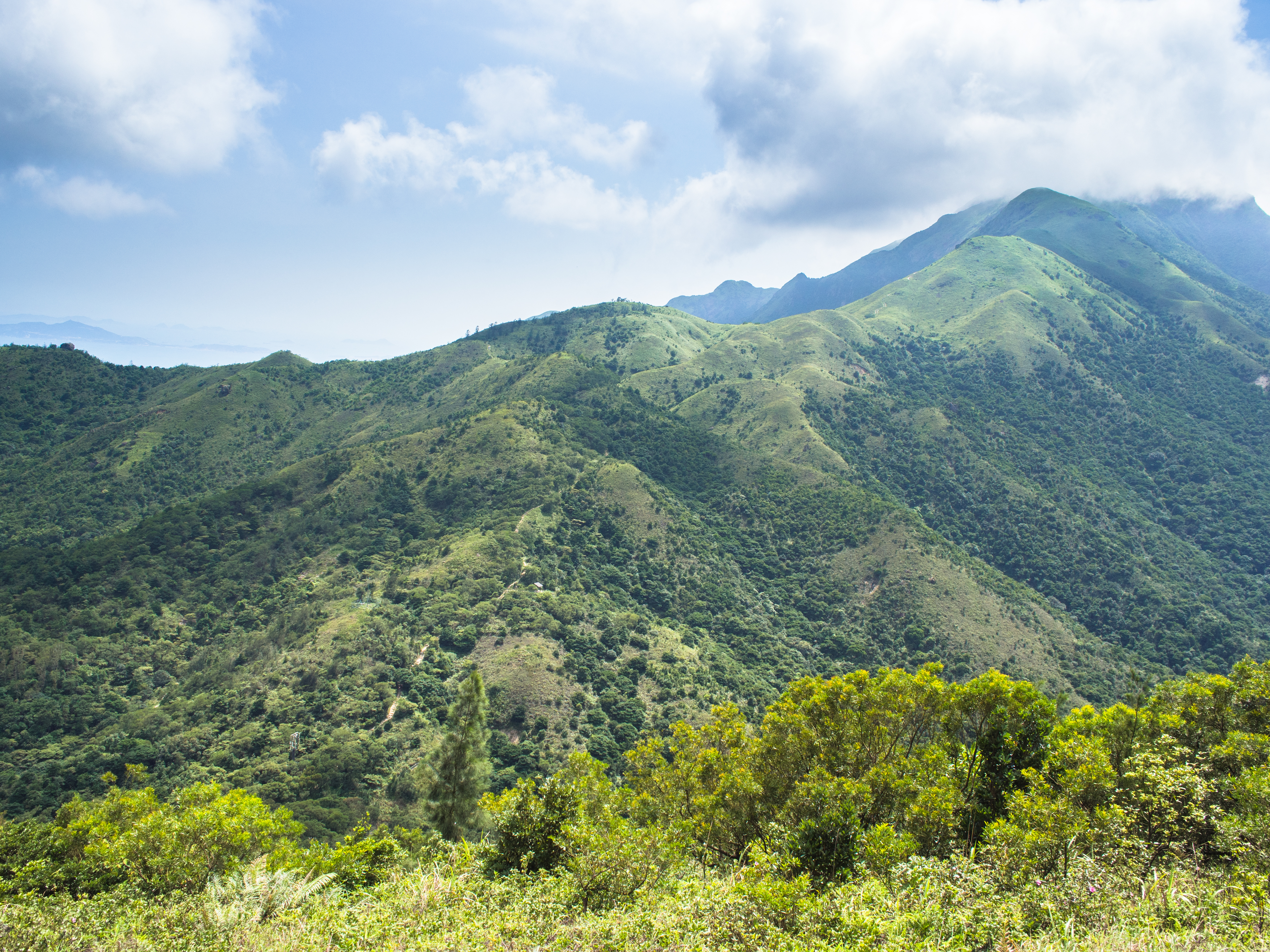
Before long, we emerged into the open again to breath-taking scenery.
The umbrella was out because it was another hot day
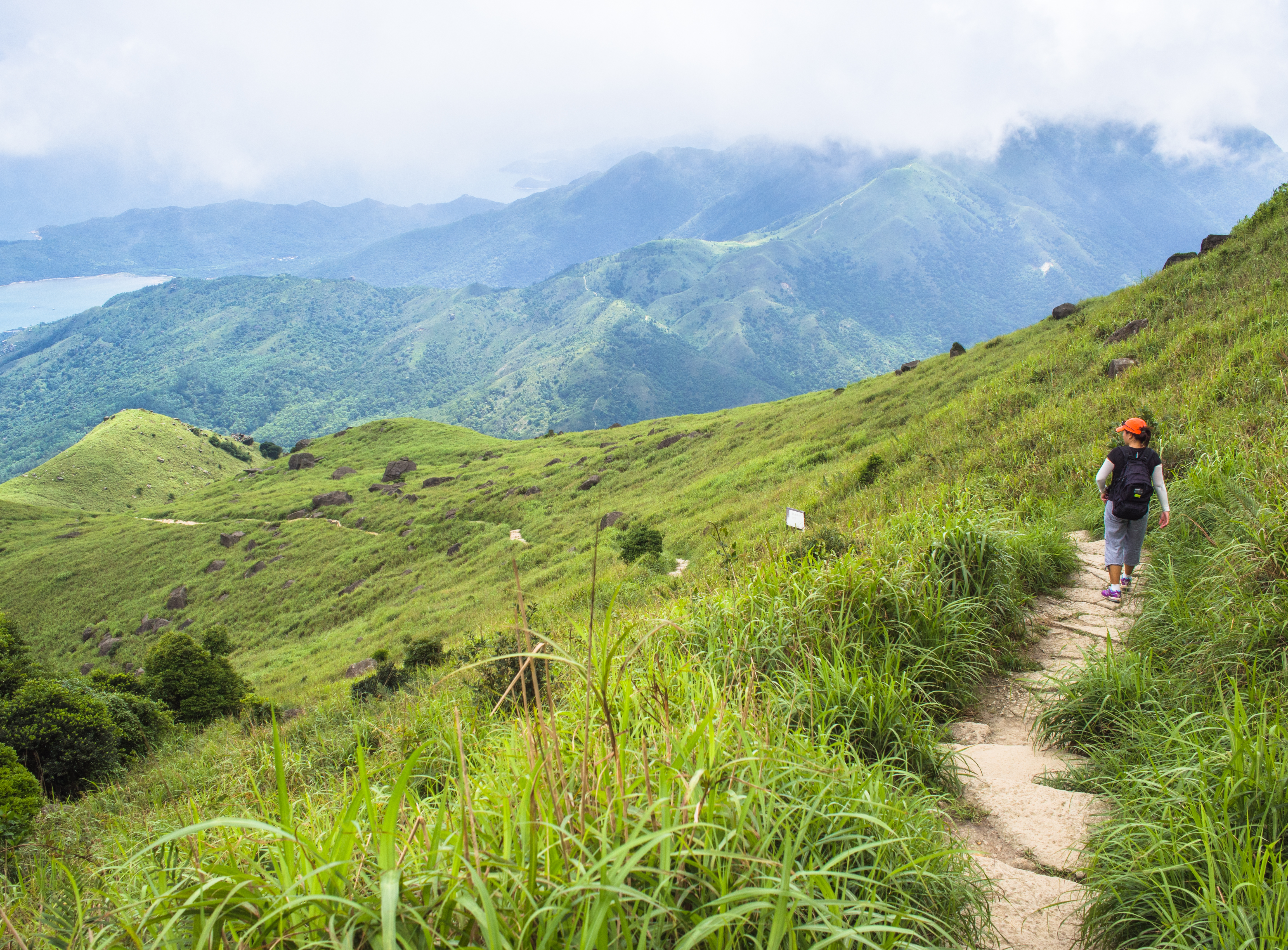
The trail was green but unshaded
But what a nice view
And the green kept going on
Green hills, blue sky, white clouds – a nice backdrop for a photo shoot
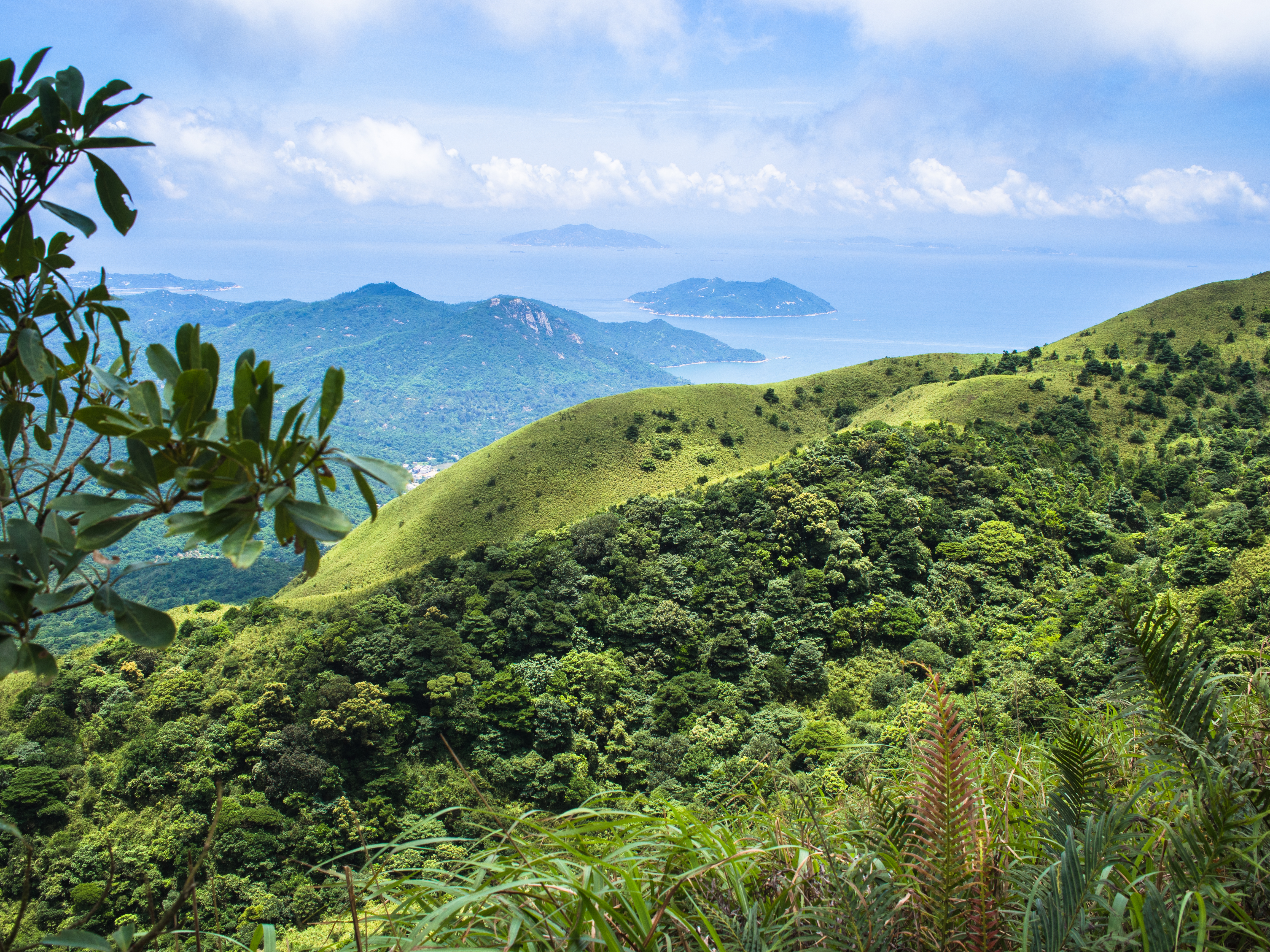
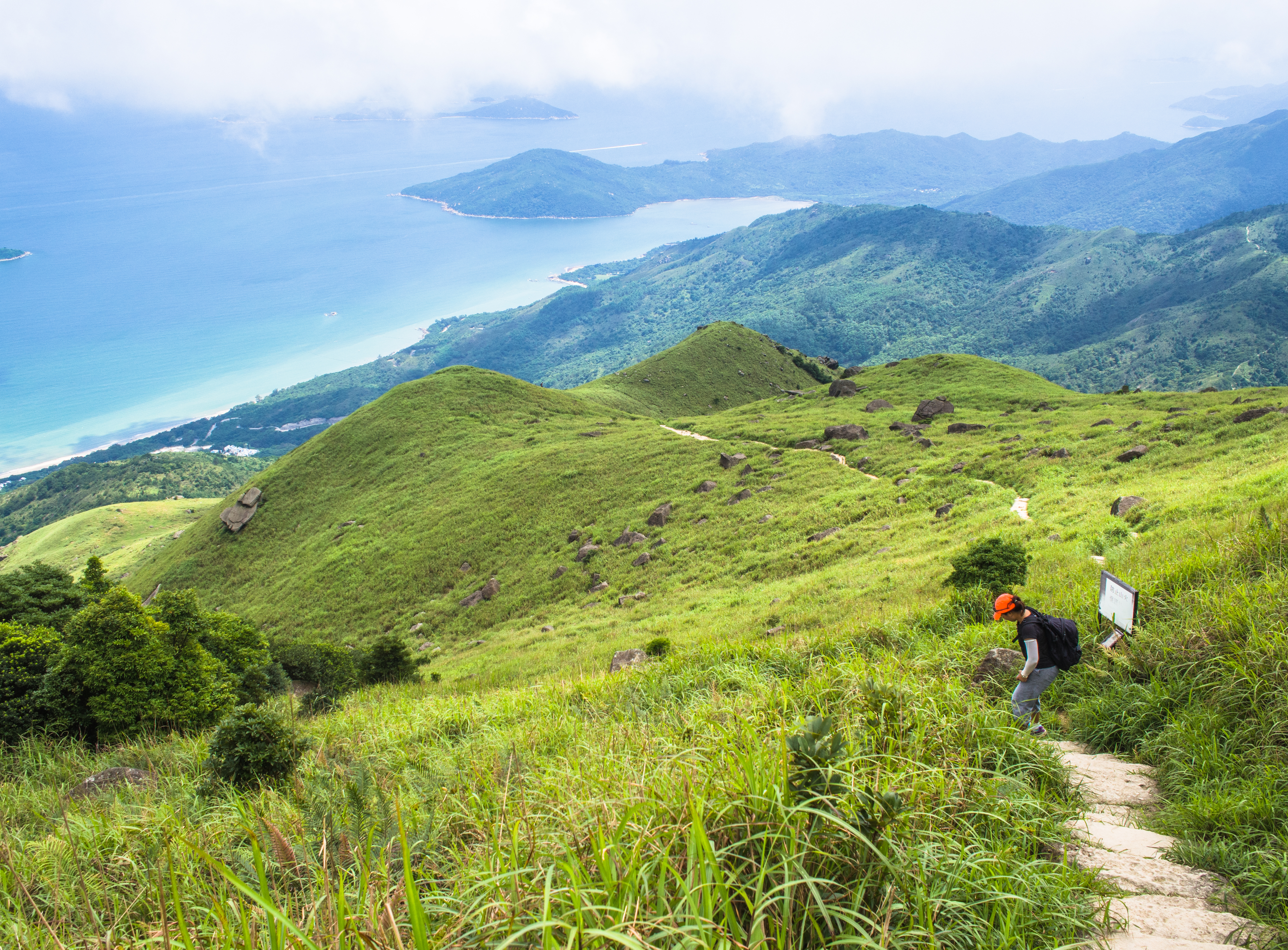
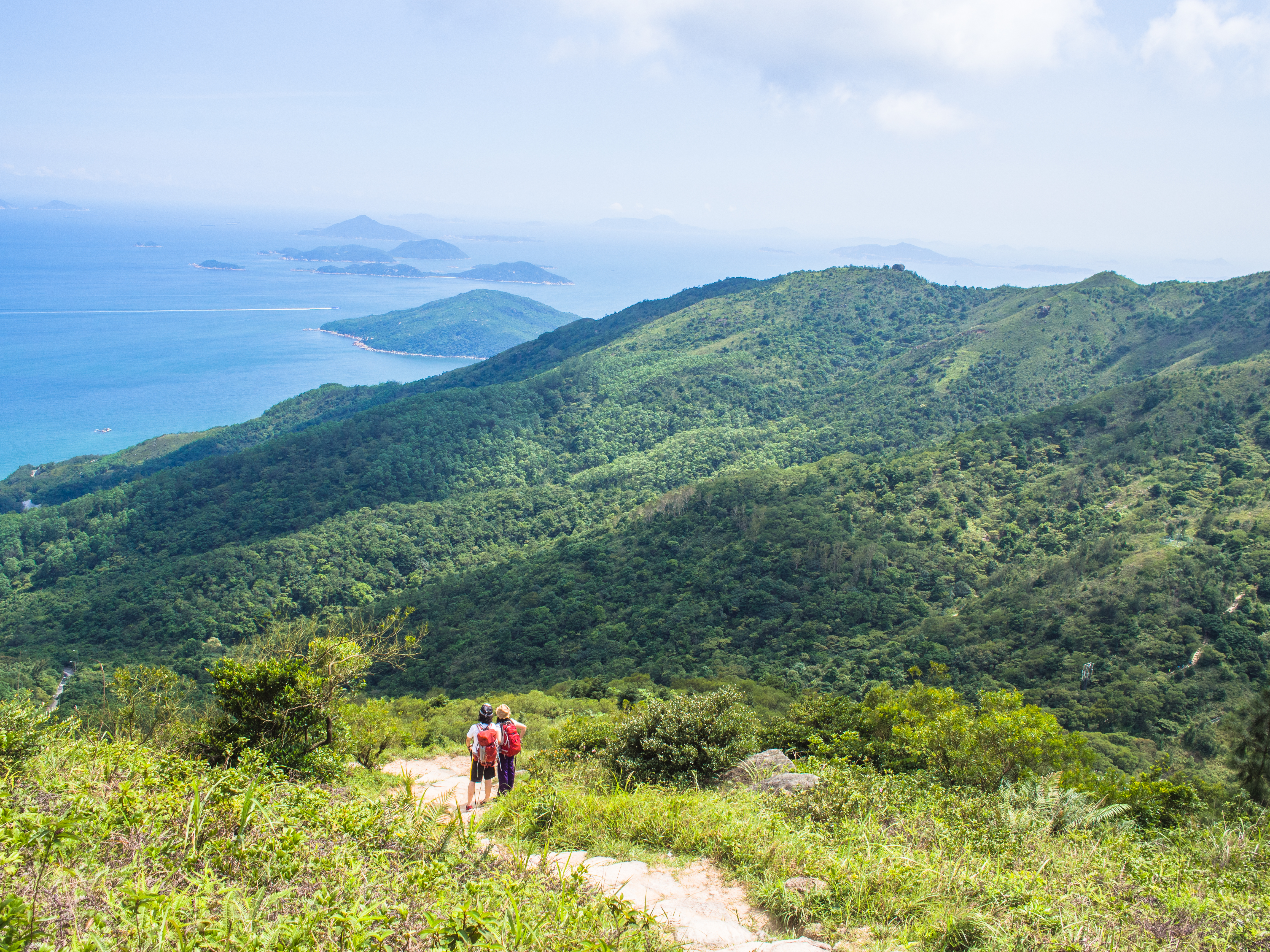
We followed the trail around the hill and came to a clearing that showcased a panoramic view of the bays and islands.
Leaving the sea and islands behind
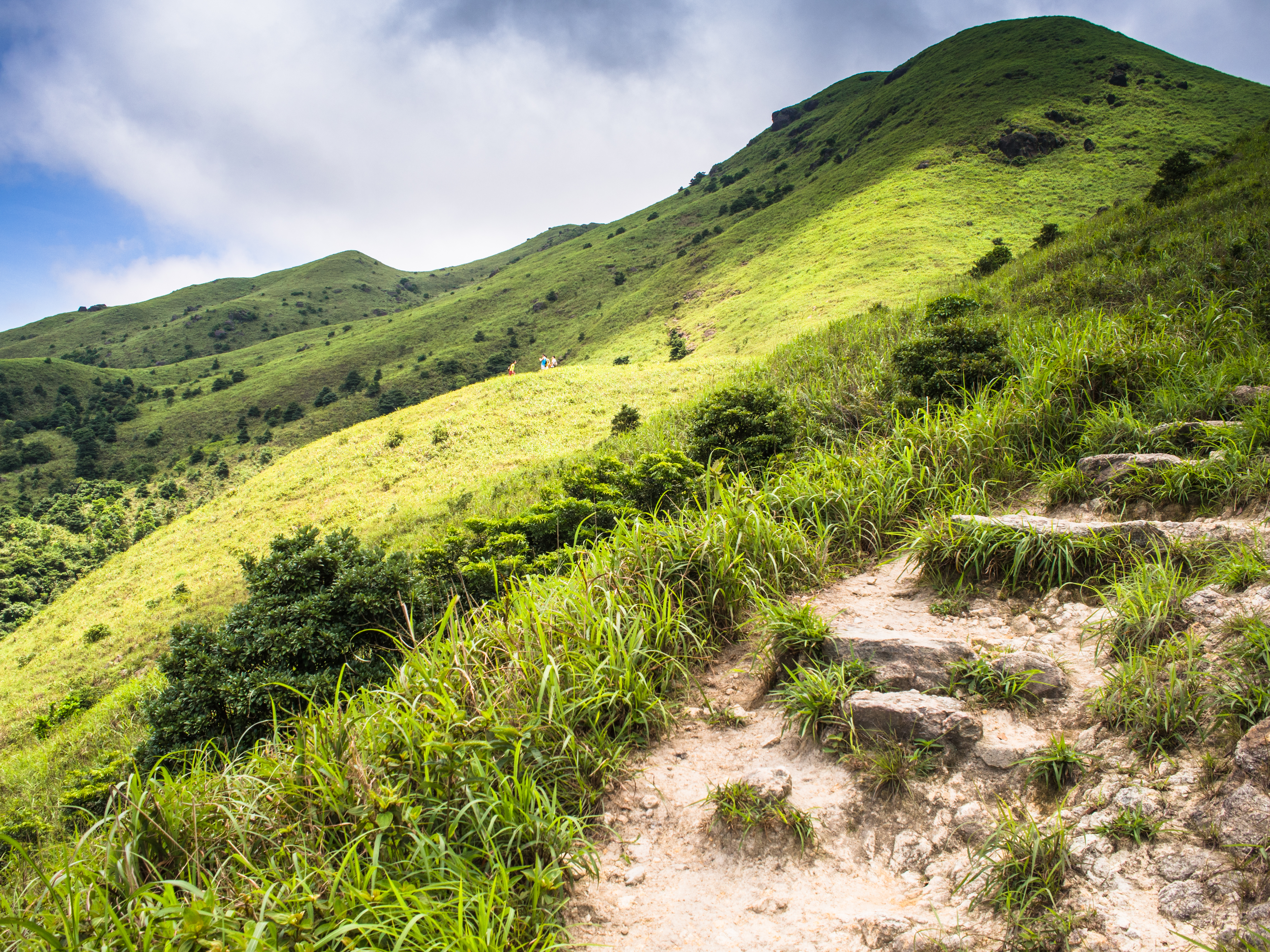
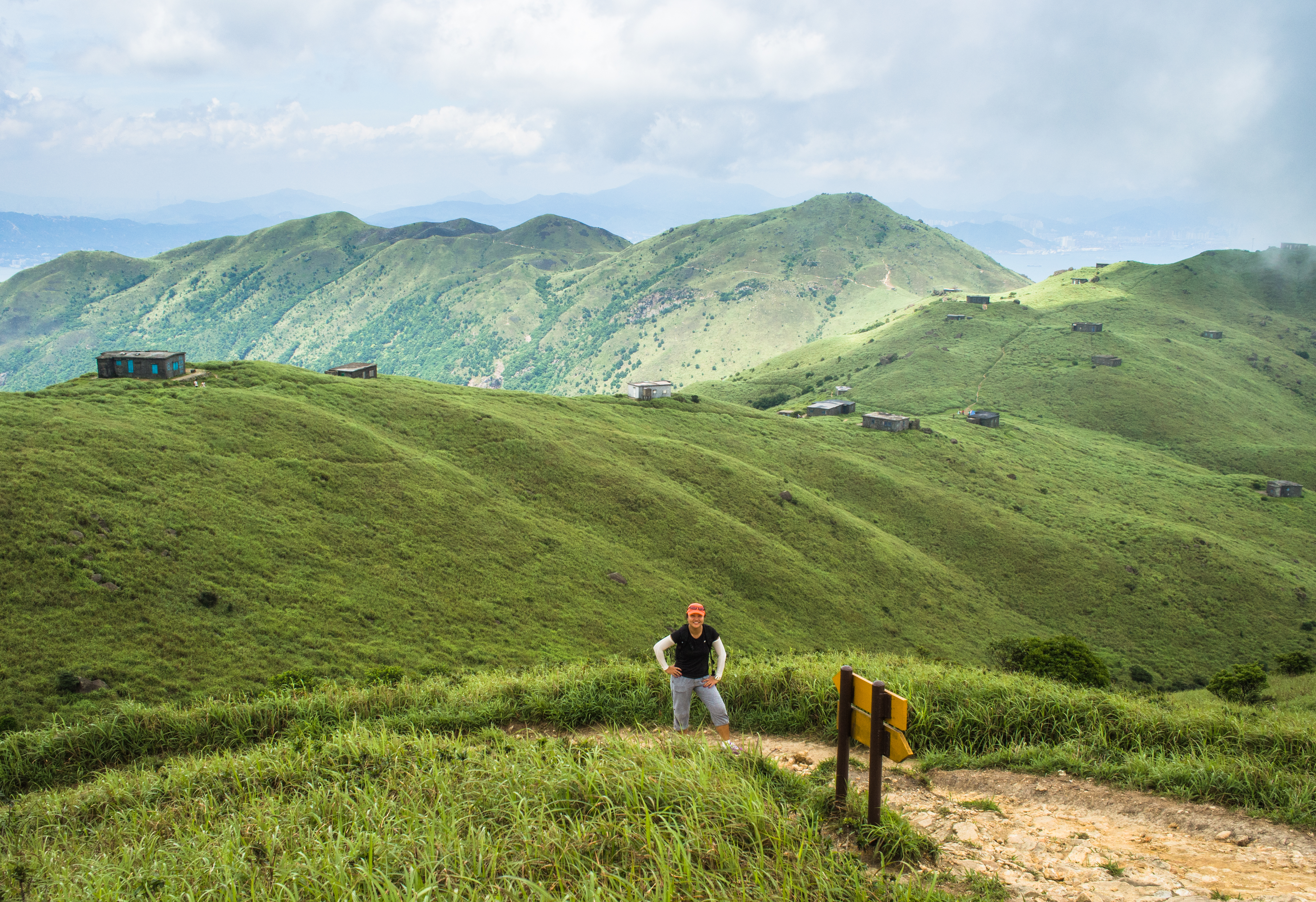
Further up, a new checkpoint
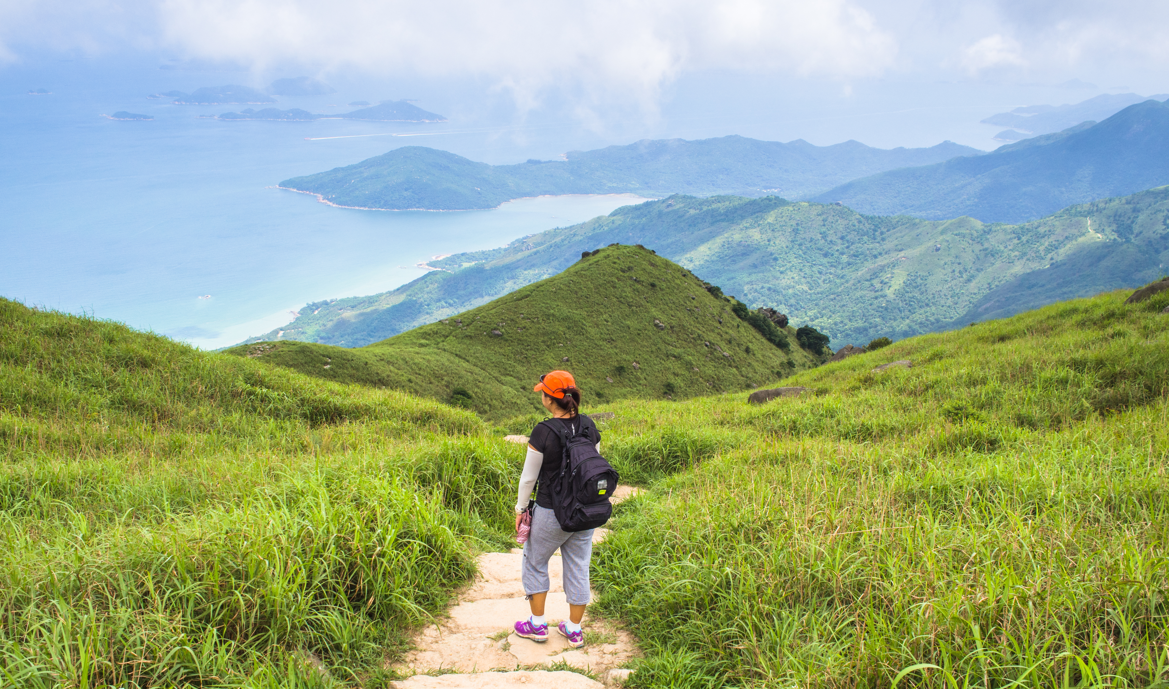
That led to this hill. What hill is this?
Moving on, leaving the hill behind
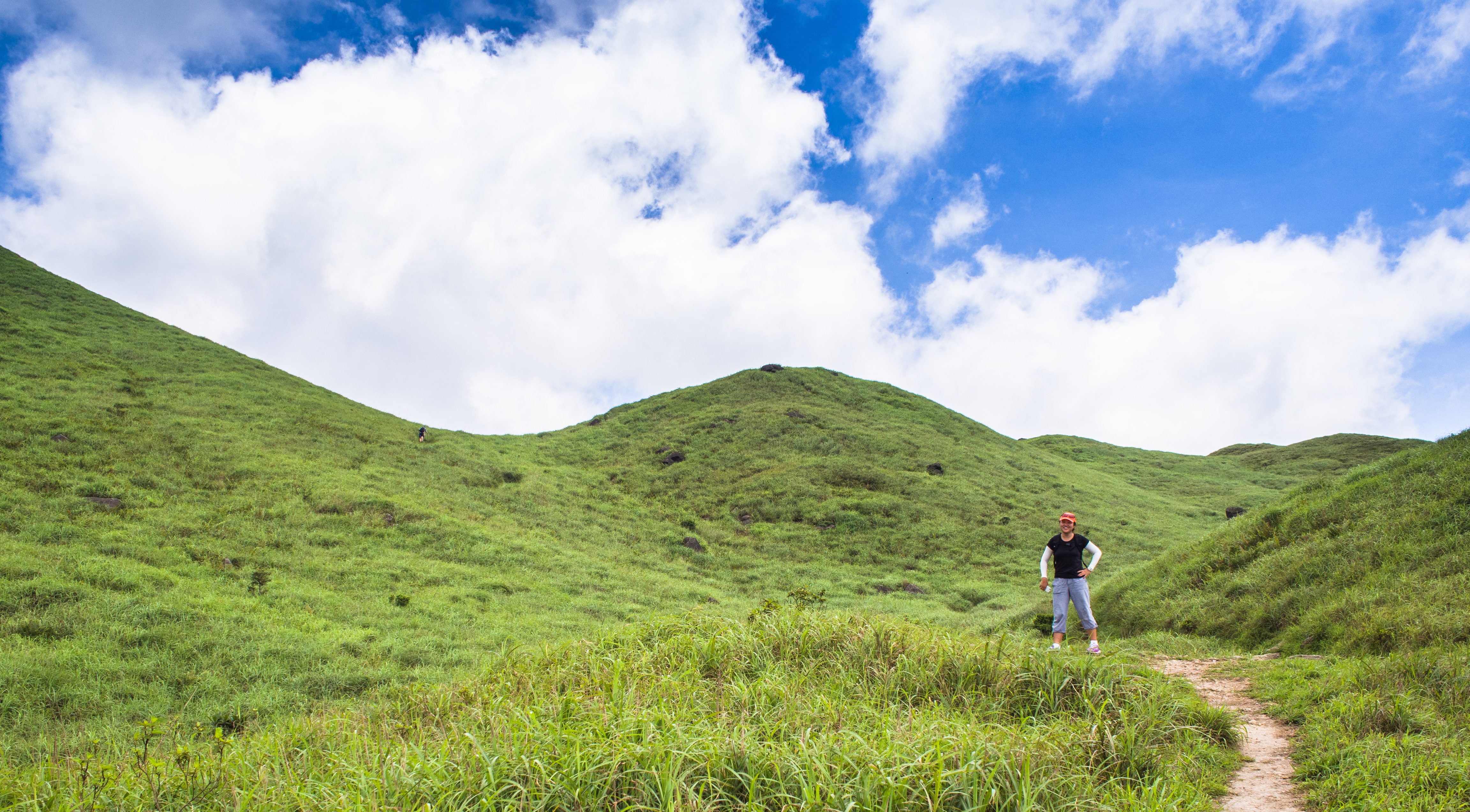
Gorgeous green
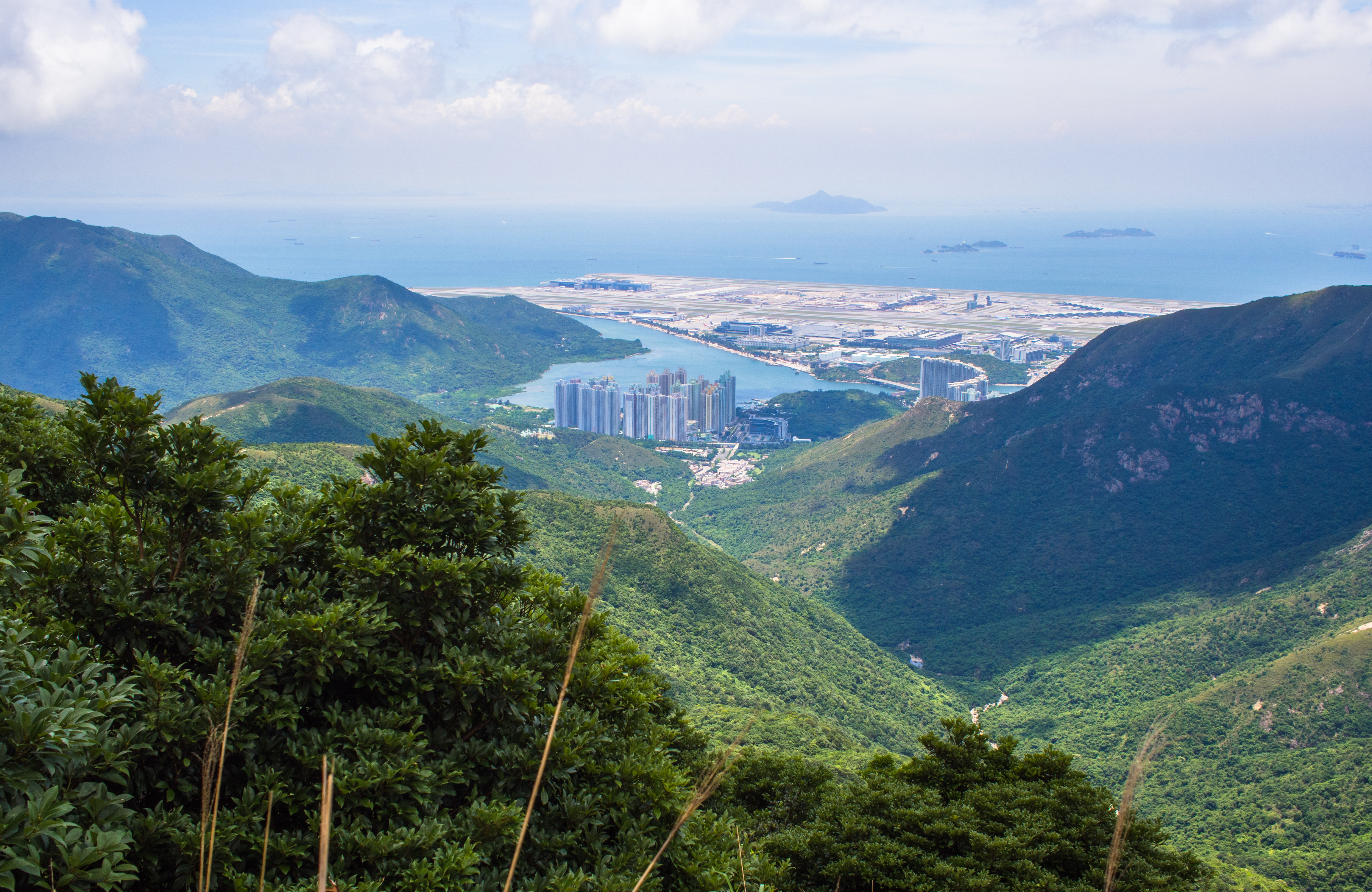
The airport. Somewhere out there, there’s a nice waterfall.

Another Check Point?
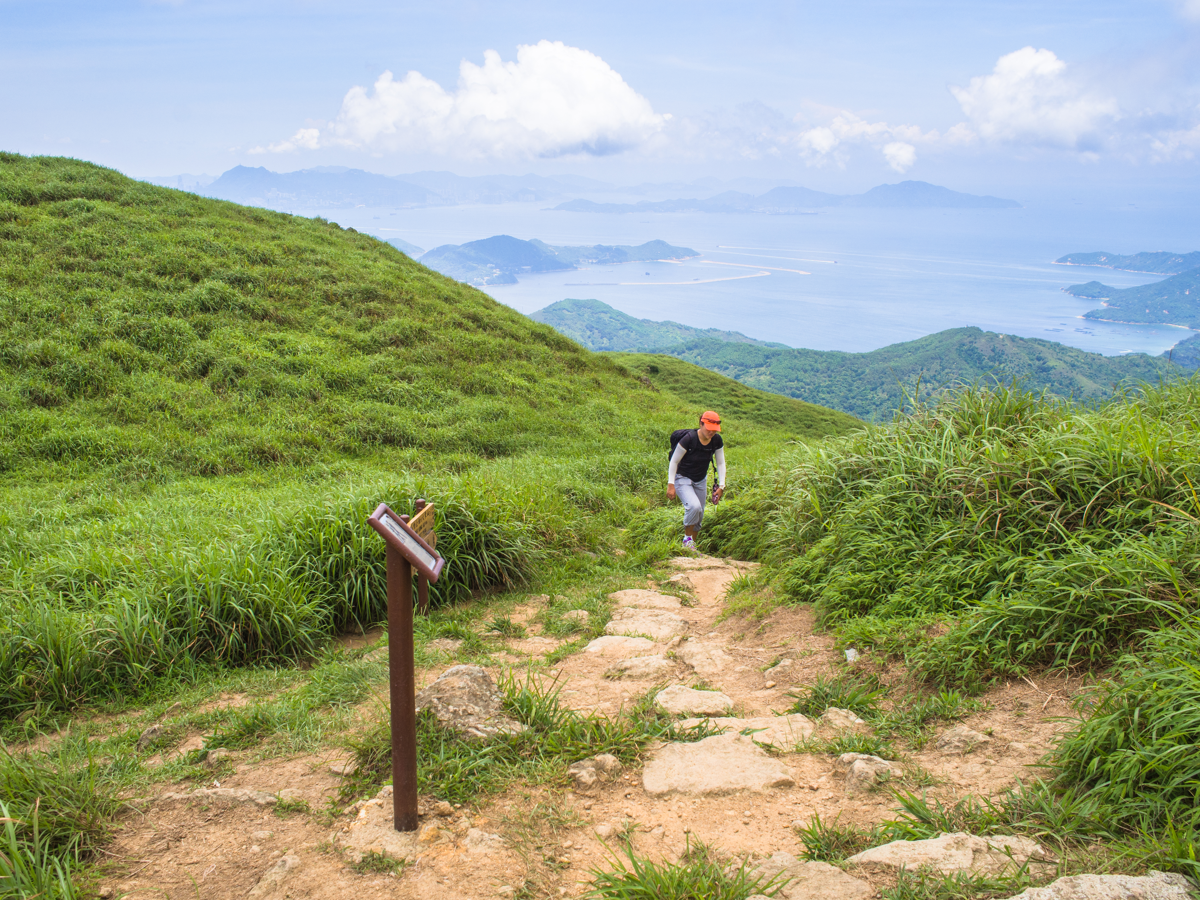
here was the part where the trail crossed another one: Wong Lung Hang Country Trail (黃龍坑 yellow dragon pit). we met some hikers who came up via this route.

Milestone!
Not long after, we came to the camping huts, shrouded in the mist. It was almost like we were in Europe. As it was all very nice and cool, we lingered and stayed to enjoy the sights and watch hikers stroll by.
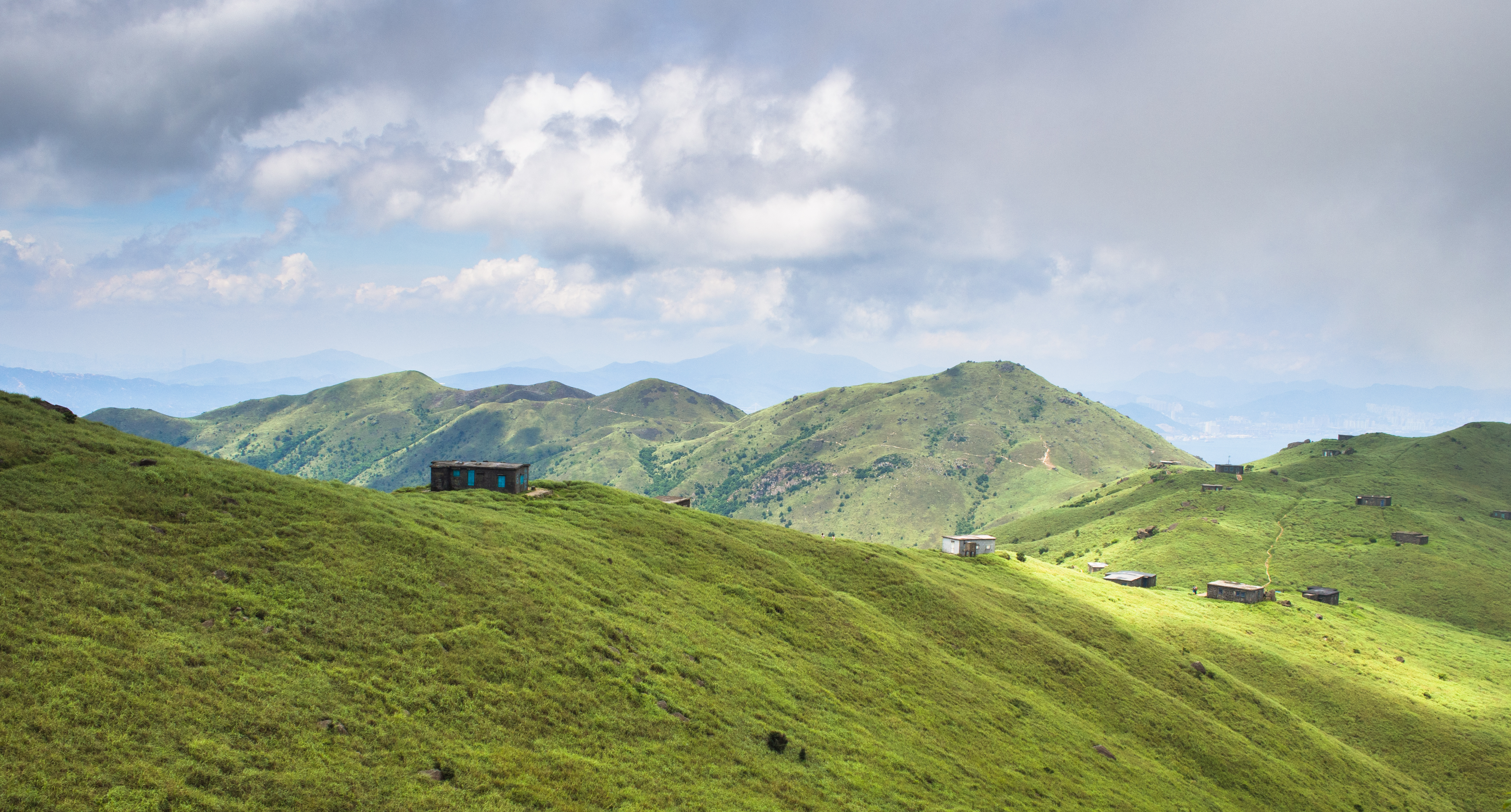
Camping huts on ridge

Take 5 at house #18: watching people go by
It got misty
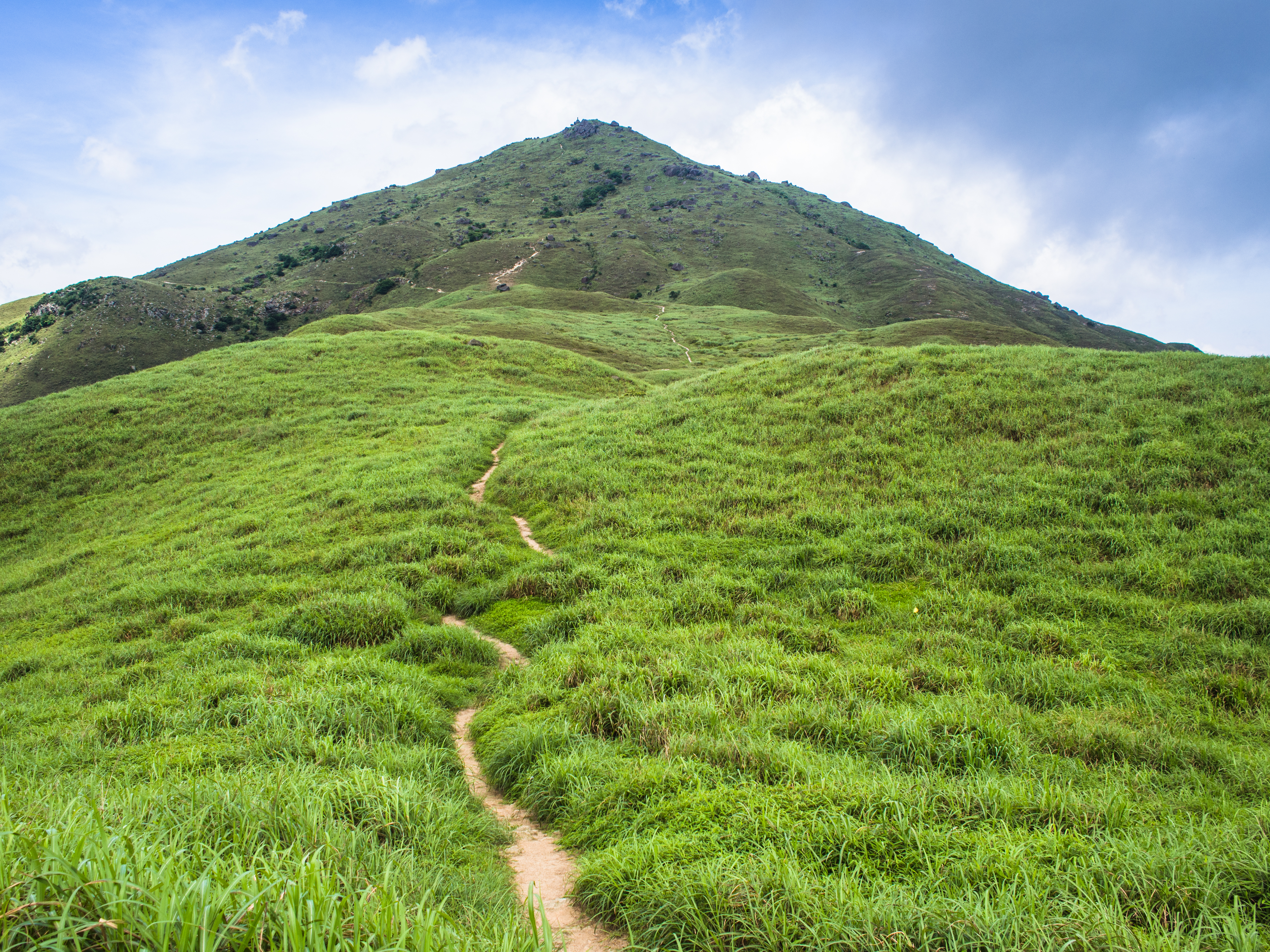
When we felt we’d dawdled enough, we made our way past the camping huts towards sunset peak.
Walking towards Sunset Peak

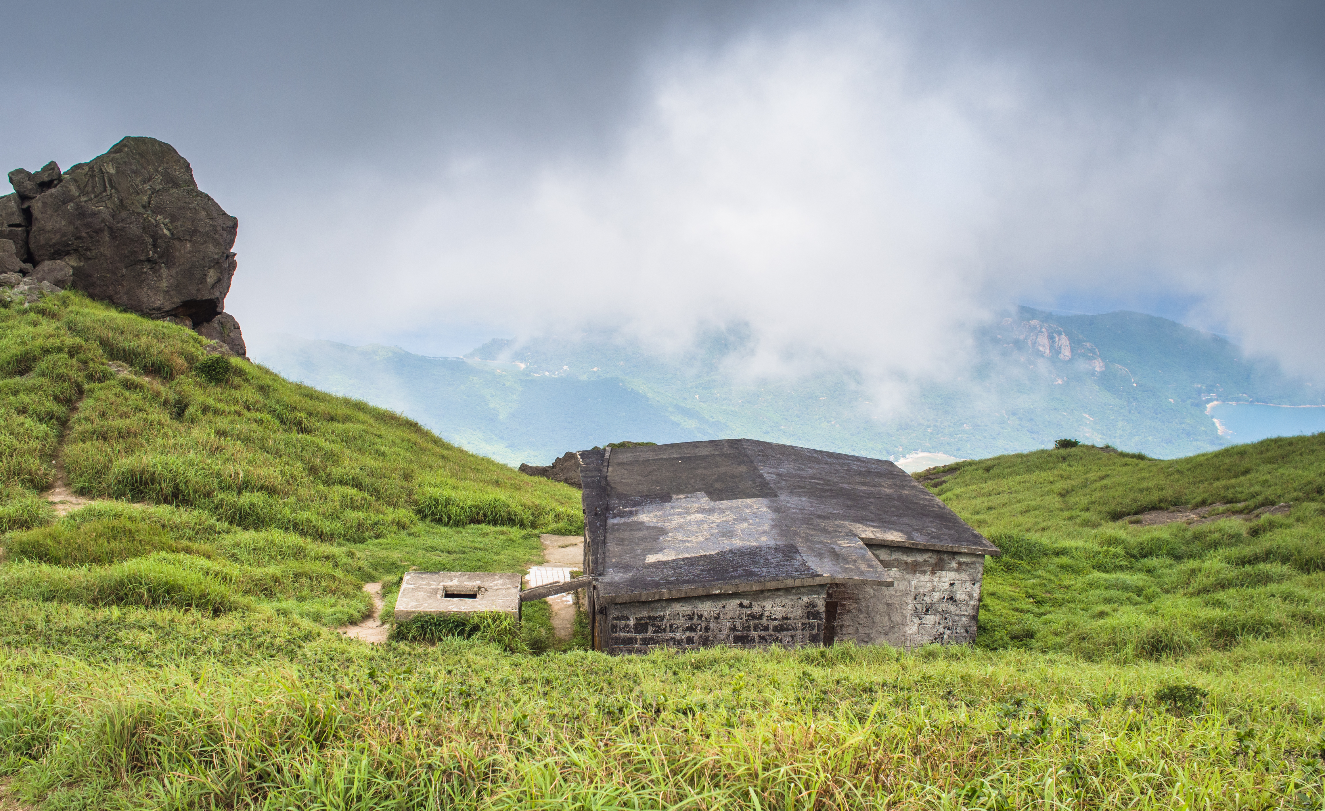
Rocks along the way to the peak (to the left)
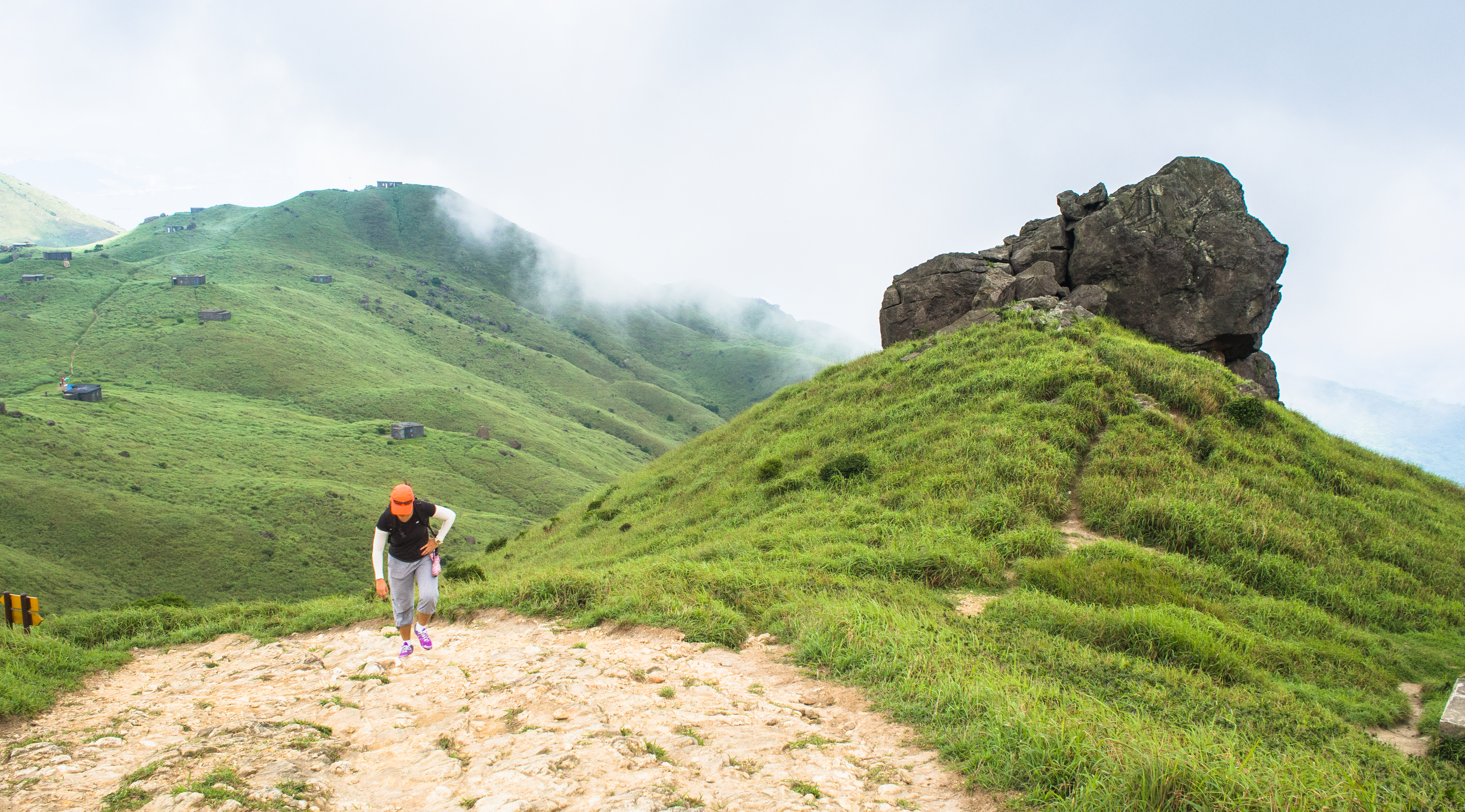
Climbing, climbing, it was steep
At the peak, there was a clearing from where we could look down to the bay below.
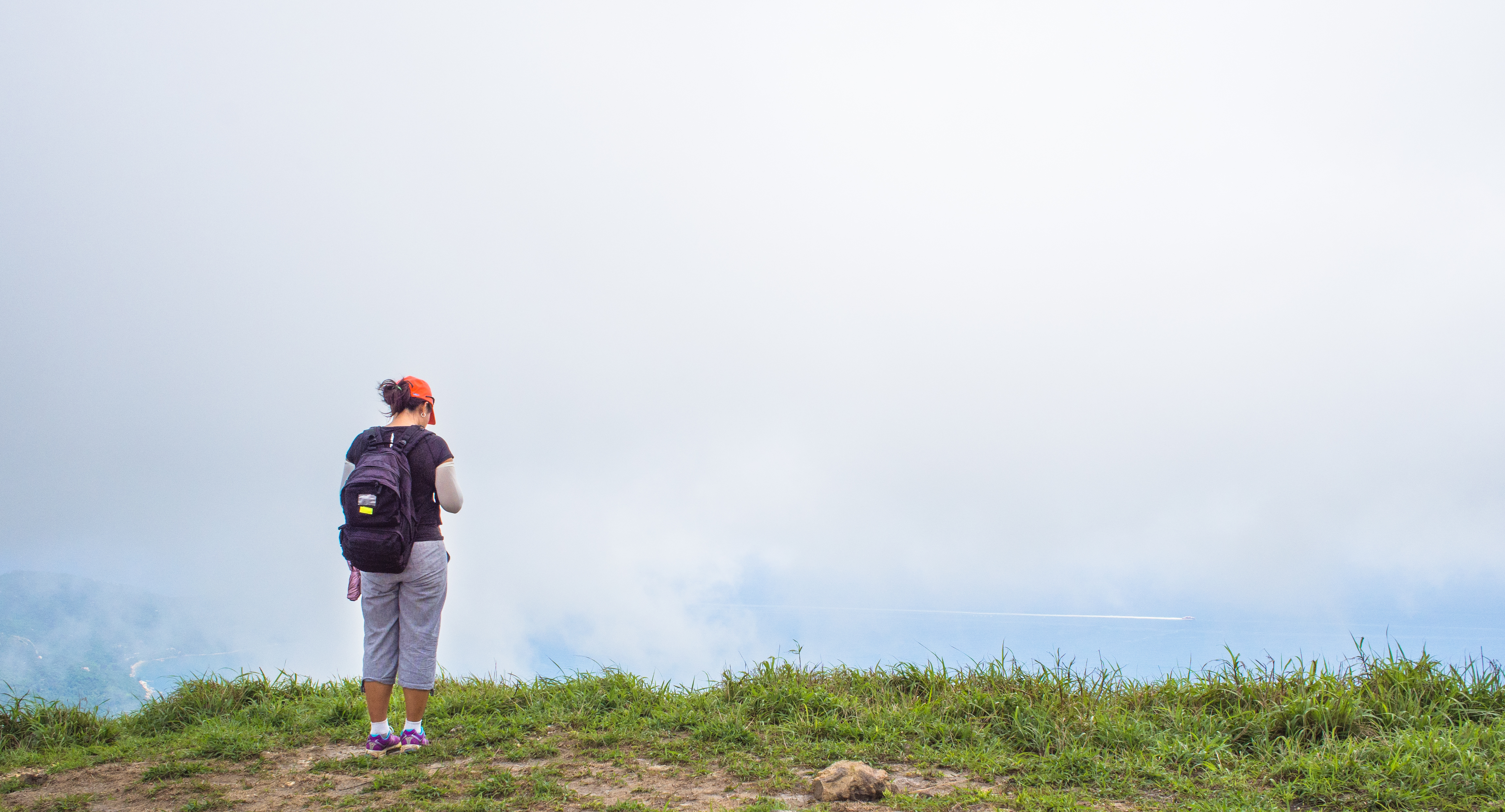
Trying to get a signal on the phone?

No, actually admiring the beautiful bay below – maybe Pui-O?
On the way, there were many big stones, such as this.
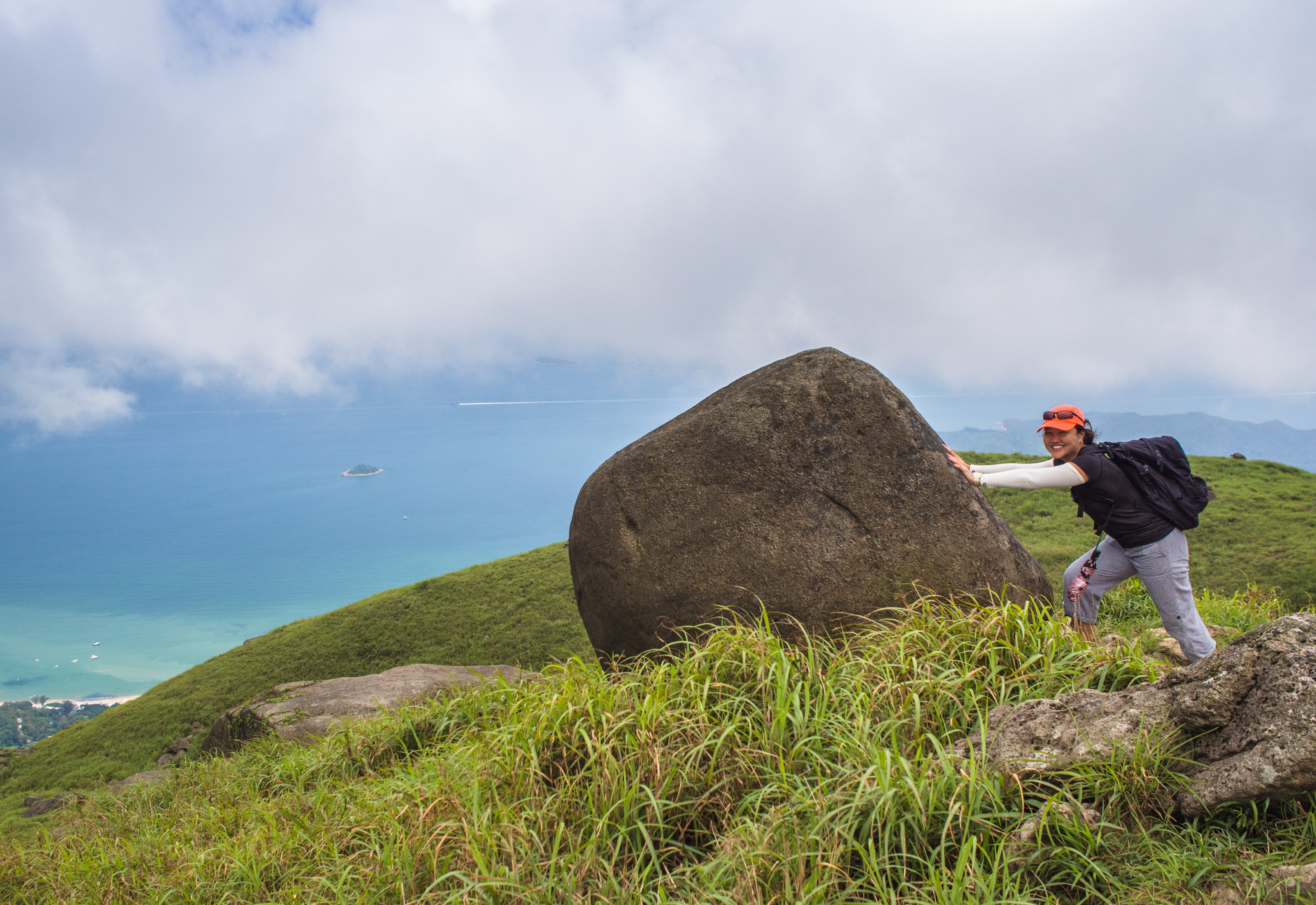
A test of might
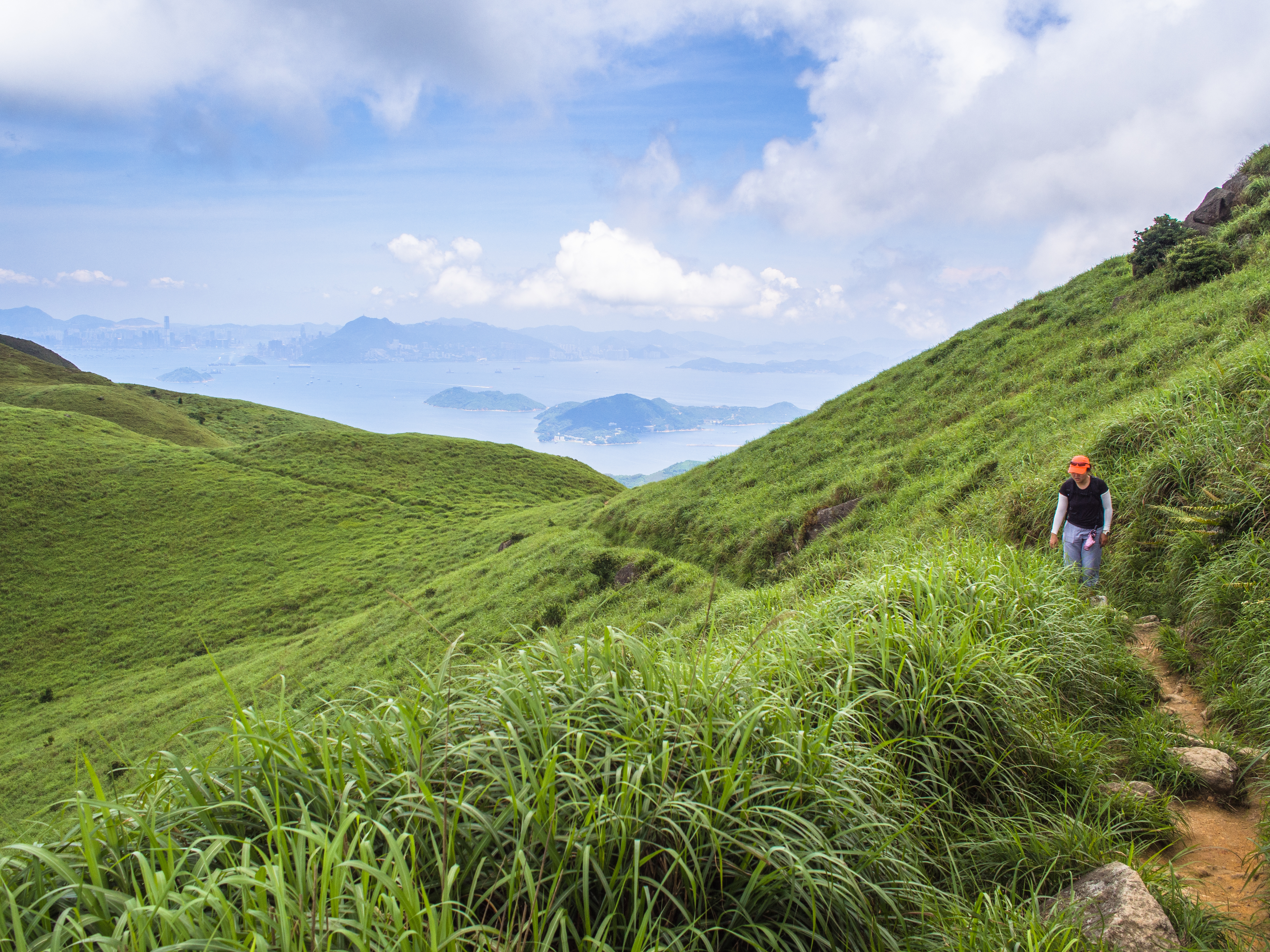
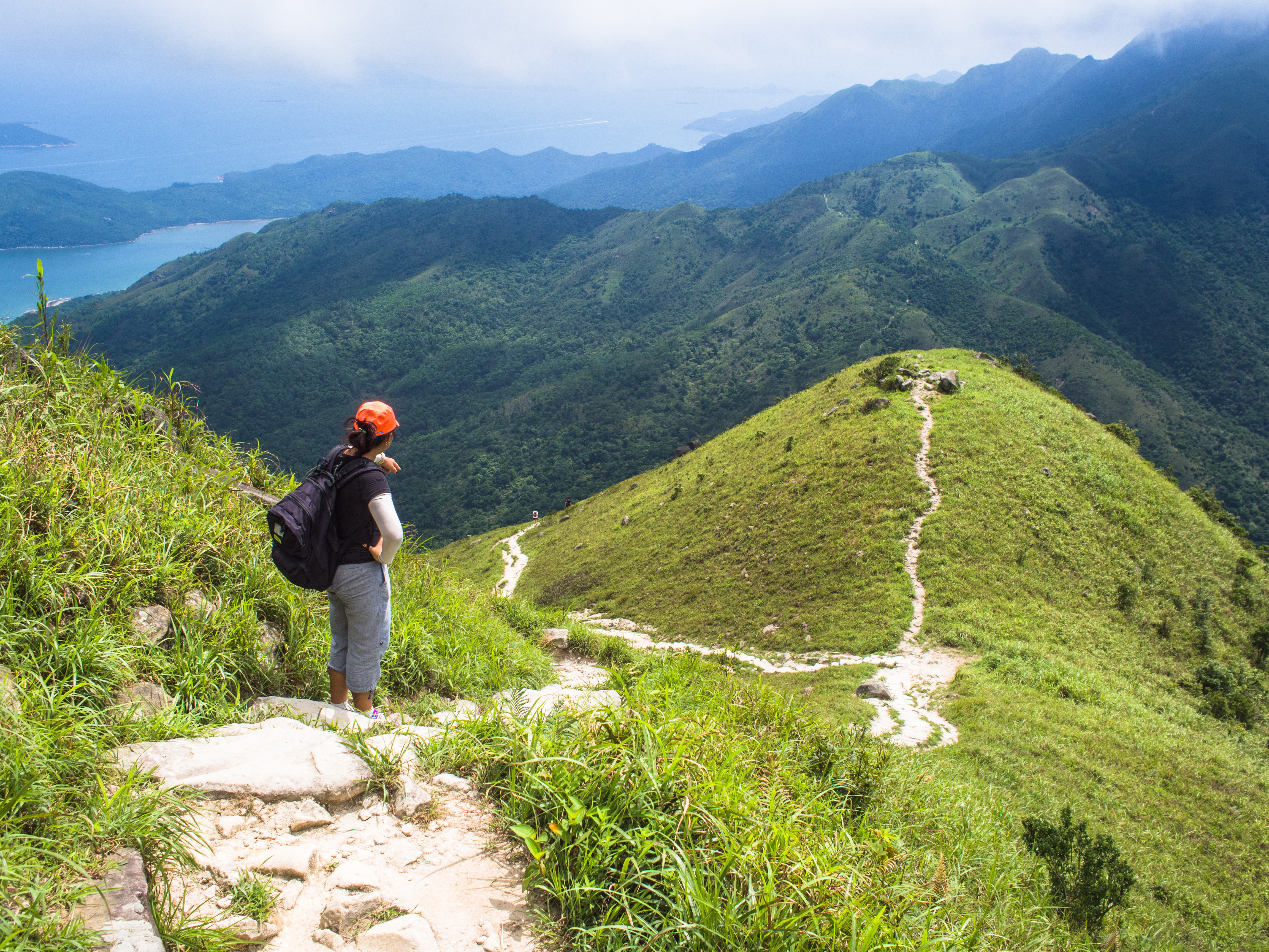
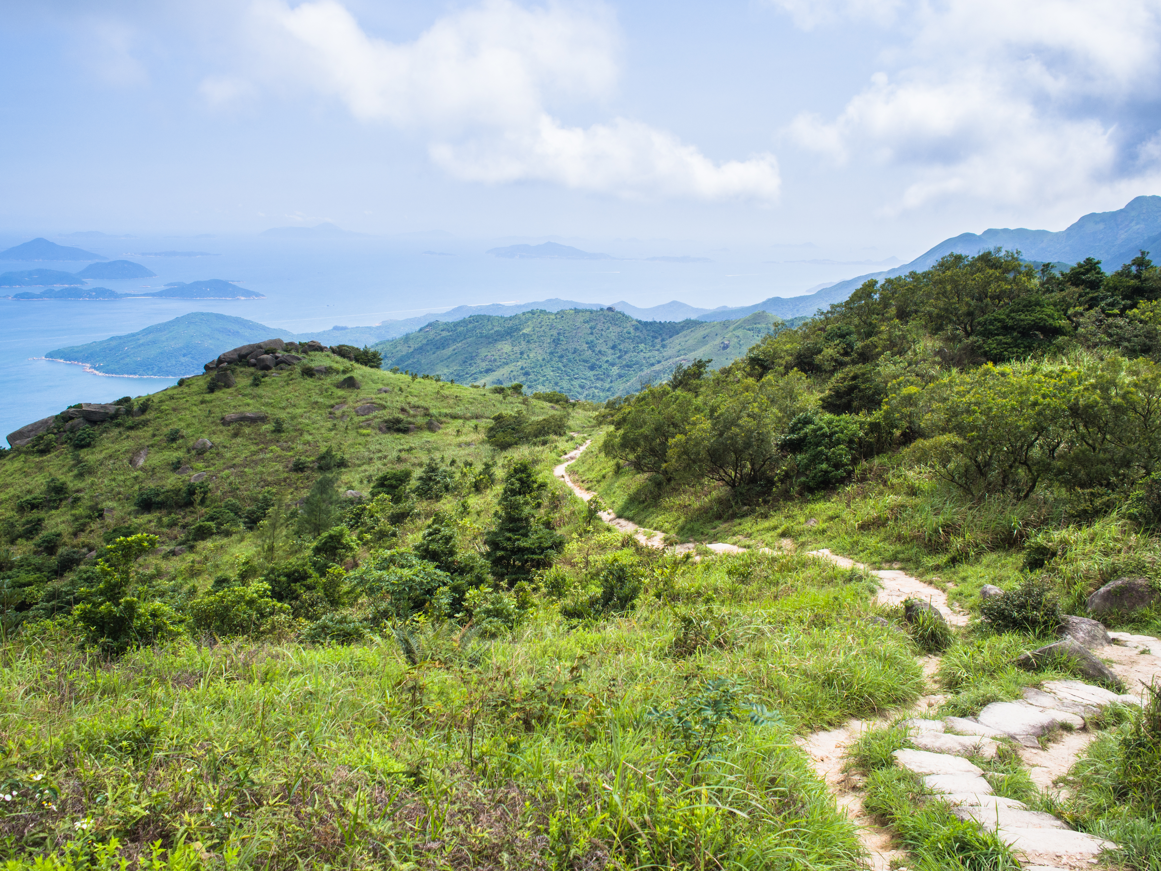
The descent offered up some of the most beautiful views ever. So glad we came up via Nam Shan and could enjoy the views while going down. Here are some of my favourite shots.

View from Sunset Peak before descent
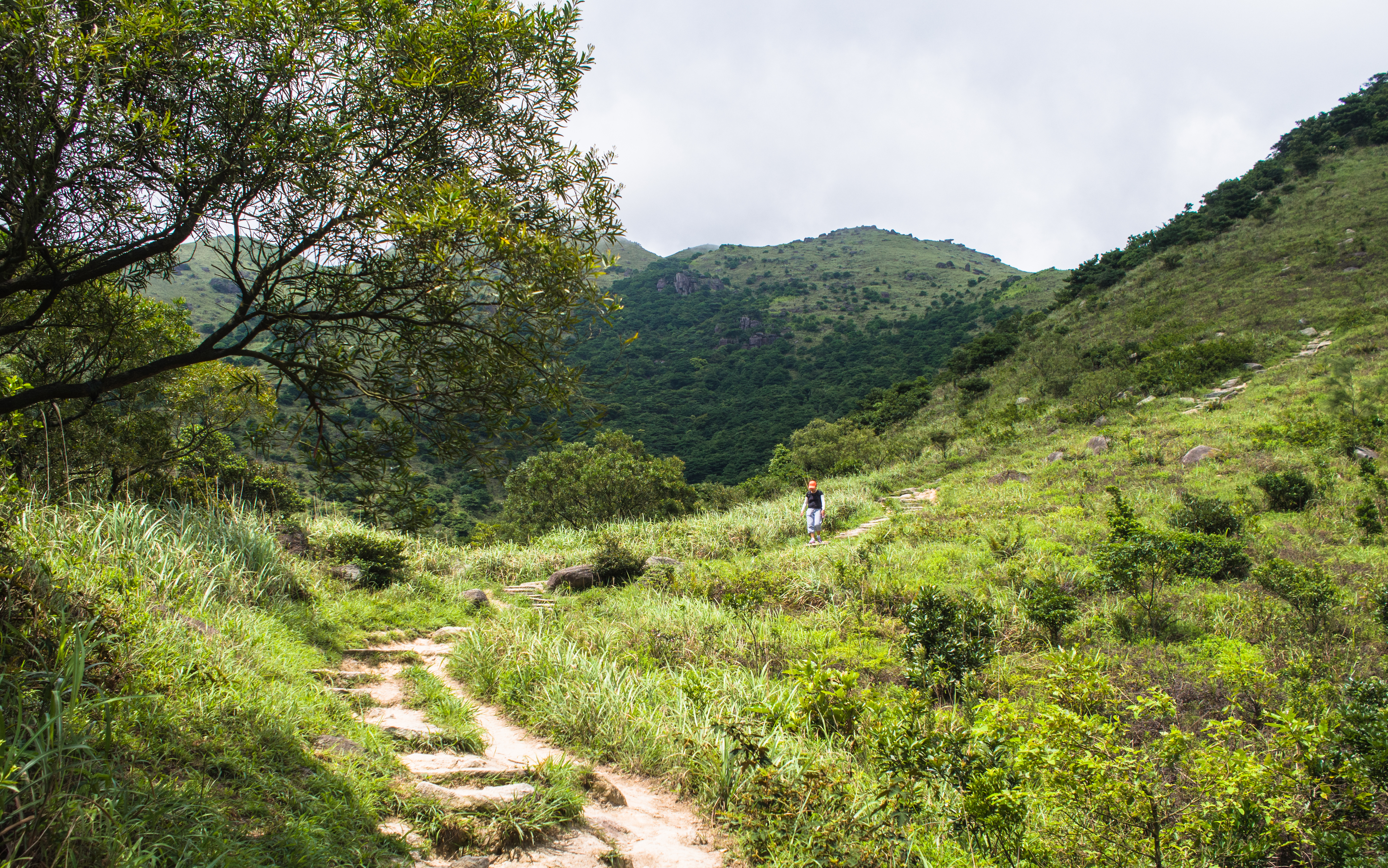
Start of descent
Down, down and down
Pressing on

Passing through the hills
Taking a breather
Along the way, Lantau Peak sashayed into view. From our trail, we could make out the trail going up and up. But the summit was shrouded in mist. Very glad we didn’t choose Lantau Peak. It looked quite forbidding. Not sure we would have enjoyed it as much as Sunset Peak.
Lantau Peak Trail
Hikers coming up via Pak Kung Au
Getting nearer to the end
Almost there
We reached Check Point 18 and Tung Chung Road (東涌道 East Diversion Road) about 5 hours from when we started, then took bus #11 to Tai-O (大澳 Big Bay). Tai-O was super crowded with local and foreign tourists. On other days, iI might have revelled in the merry-making. But having just came down from a beautiful tranquil trek, it was jarring to the senses.
Luckily, we managed to find refuge in a cafe-B&B that served very good beer: Espace Elastique B&B. Along the same stretch, there were 1 or 2 more cafes.

Taking notes

Best before 11.11.14: Not taking any chances!
We were tired but felt satisfied and accomplished. No more hikes tomorrow. it’s shopping time!
(The shopping started right after we reached Tung Chung Station. 😀 )
Categories: Hiking, Northeast Asia
